MyTopo
Delectable Mountain Vermont US Topo Map
Couldn't load pickup availability
Also explore the Delectable Mountain Forest Service Topo of this same quad for updated USFS data
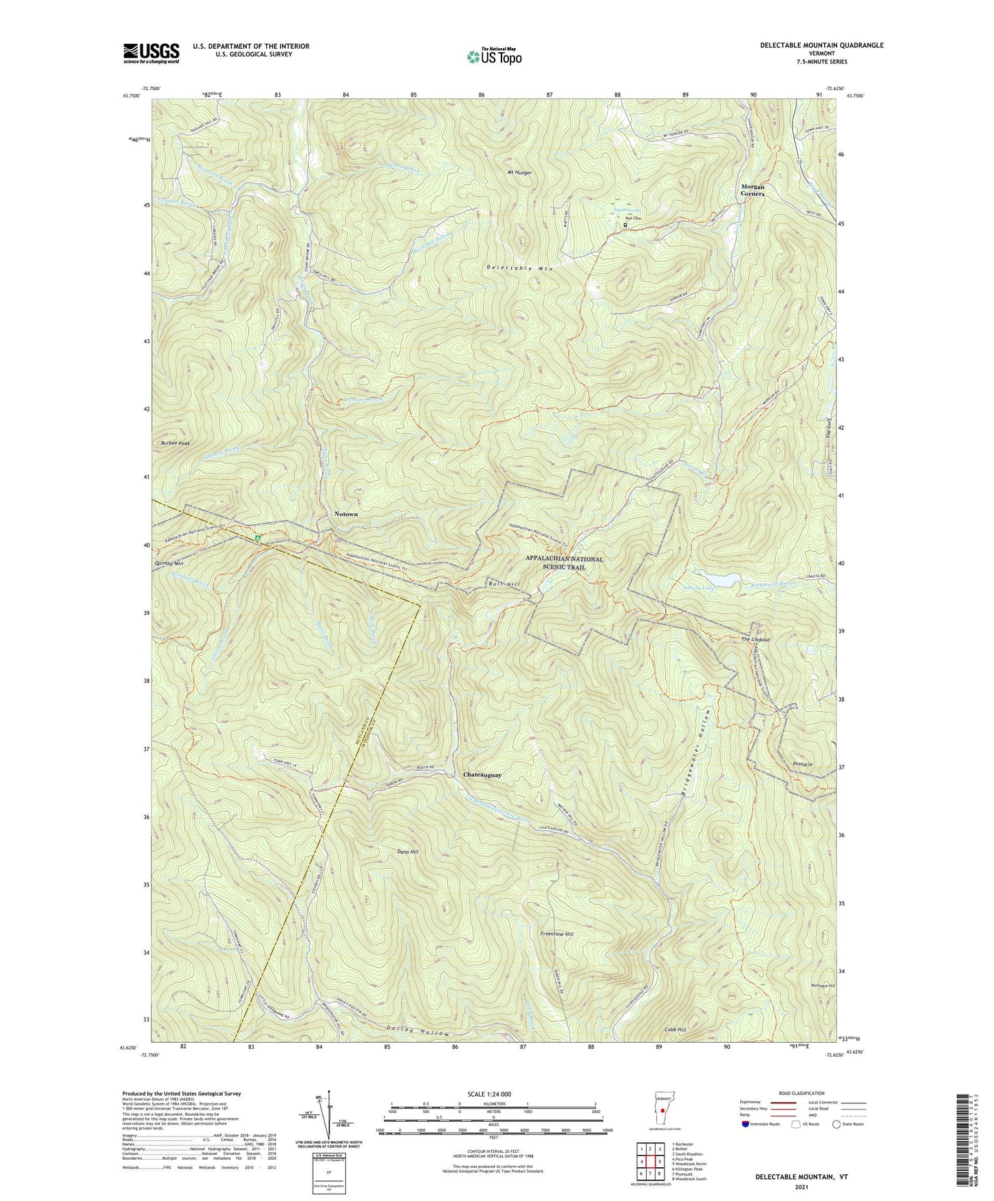
2024 topographic map quadrangle Delectable Mountain in the state of Vermont. Scale: 1:24000. Based on the newly updated USGS 7.5' US Topo map series, this map is in the following counties: Windsor, Rutland. The map contains contour data, water features, and other items you are used to seeing on USGS maps, but also has updated roads and other features. This is the next generation of topographic maps. Printed on high-quality waterproof paper with UV fade-resistant inks.
Quads adjacent to this one:
West: Pico Peak
Northwest: Rochester
North: Bethel
Northeast: South Royalton
East: Woodstock North
Southeast: Woodstock South
South: Plymouth
Southwest: Killington Peak
This map covers the same area as the classic USGS quad with code o43072f6.
Contains the following named places: Barnard Town Forest, Barnard Trail, Basin Brook, Boutwell Brook, Bridgewater Hollow, Broughton Brook, Bull Hill, Burbee Peak, Chateauguay, Cobb Hill, Dalton Brook, Dana Hill, Davis Hill Brook, Delectable Mountain, Dimick Brook, Fletcher Brook, Freestone Hill, Johnson Brook, Lakota Lake, Lakota Lake Dam, Mink Brook, Montague Hill, Morgan Corners, Mount Hunger, Notown, Nye Cemetery, Nyes Swamp, Perkins Brook, Pinnacle, Taggart Brook, The Gulf, The Lookout, Town of Bridgewater, Windfall Brook