MyTopo
Saint Albans Bay Vermont US Topo Map
Couldn't load pickup availability
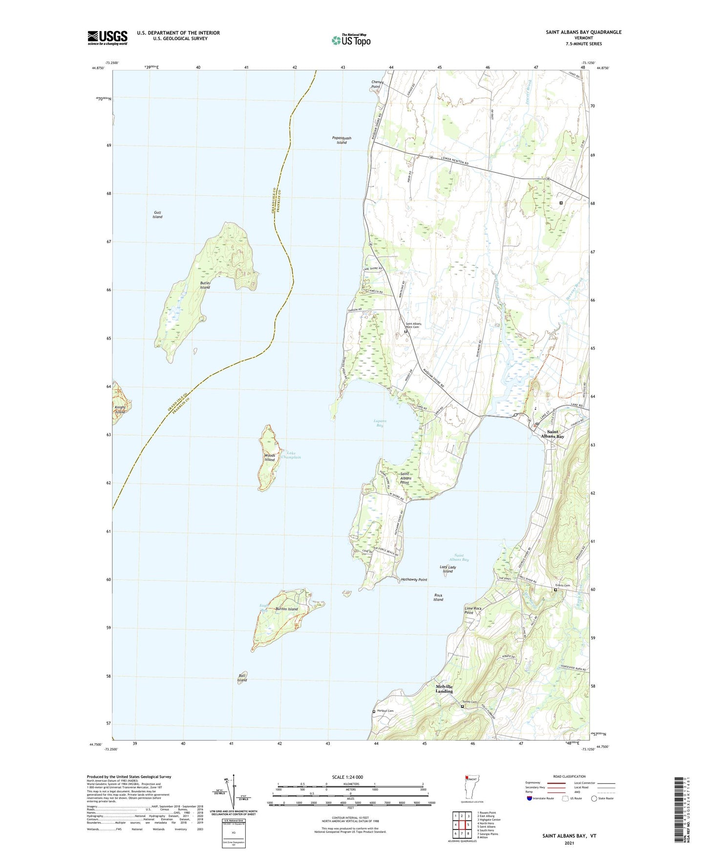
2021 topographic map quadrangle Saint Albans Bay in the state of Vermont. Scale: 1:24000. Based on the newly updated USGS 7.5' US Topo map series, this map is in the following counties: Franklin, Grand Isle. The map contains contour data, water features, and other items you are used to seeing on USGS maps, but also has updated roads and other features. This is the next generation of topographic maps. Printed on high-quality waterproof paper with UV fade-resistant inks.
Quads adjacent to this one:
West: North Hero
Northwest: Rouses Point
North: East Alburg
Northeast: Highgate Center
East: Saint Albans
Southeast: Milton
South: Georgia Plains
Southwest: South Hero
Contains the following named places: Ball Island, Burtland Farms, Burton Island, Burton Island State Park, Burton Island State Park Nature Center, Butler Island, Cheney Point, Eagle Bay, Evarts Cemetery, Gull Island, Hathaway Point, Hurlbut Cemetery, Island Farm Nature Trail, Jewett Brook, Kamp Kill Kare, Killkare State Park, Knight Island State Park, Lapans Bay, Lazy Lady Island, Lime Rock Point, Melville Landing, Mill River, North Shore Trail, Northwest State Correctional Facility - Swanton, Popasquash Island, Rock Island, Rugg Brook, Saint Albans Bay, Saint Albans Bay Post Office, Saint Albans Bay State Park, Saint Albans Point, Saint Albans Point Cemetery, Southern Tip Trail, Stevens Brook, Torrey Cemetery, Town of Saint Albans, West Shore Trail, Woods Island, Woods Island State Park, ZIP Code: 05481