MyTopo
Snake Mountain Vermont US Topo Map
Couldn't load pickup availability
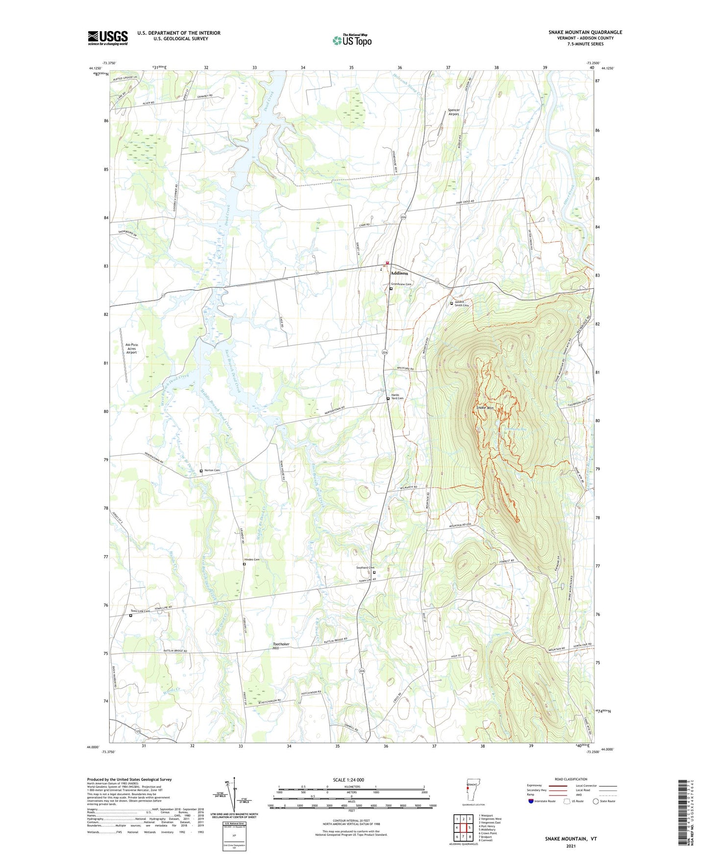
2021 topographic map quadrangle Snake Mountain in the state of Vermont. Scale: 1:24000. Based on the newly updated USGS 7.5' US Topo map series, this map is in the following counties: Addison. The map contains contour data, water features, and other items you are used to seeing on USGS maps, but also has updated roads and other features. This is the next generation of topographic maps. Printed on high-quality waterproof paper with UV fade-resistant inks.
Quads adjacent to this one:
West: Port Henry
Northwest: Westport
North: Vergennes West
Northeast: Vergennes East
East: Middlebury
Southeast: Cornwall
South: Bridport
Southwest: Crown Point
Contains the following named places: Addison, Addison Baptist Church, Addison Central School, Addison Volunteer Fire Department, Advent - Smith Cemetery, Ass-Pirin Acres Airport, Briggs Dairy Farm, Brilyea East Dam, Brilyea West Dam, Childs School, Cranberry Bog, Crane School, Creek's Edge Farm, Dead Creek Wildlife Management Area, Dubois Farm, East Branch Dead Creek, Farrell Dam, Grandview Cemetery, Grandview Grange, Hanks Yard Cemetery, Harwood Farm, Hawthorn School, Hindes Cemetery, Jerome Dam, Middle Branch Dead Creek, Nor Dic Farm, Norton Cemetery, Nortontown School, Palmer Corner, Pratt School, Smith School, Snake Mountain, Southard Cemetery, Spencer Airport, Tetrault Dam, Town Line Cemetery, Town of Addison, West Branch Dead Creek, Willmarth School, Wright Cemetery, ZIP Code: 05491