MyTopo
Spectacle Pond Vermont US Topo Map
Couldn't load pickup availability
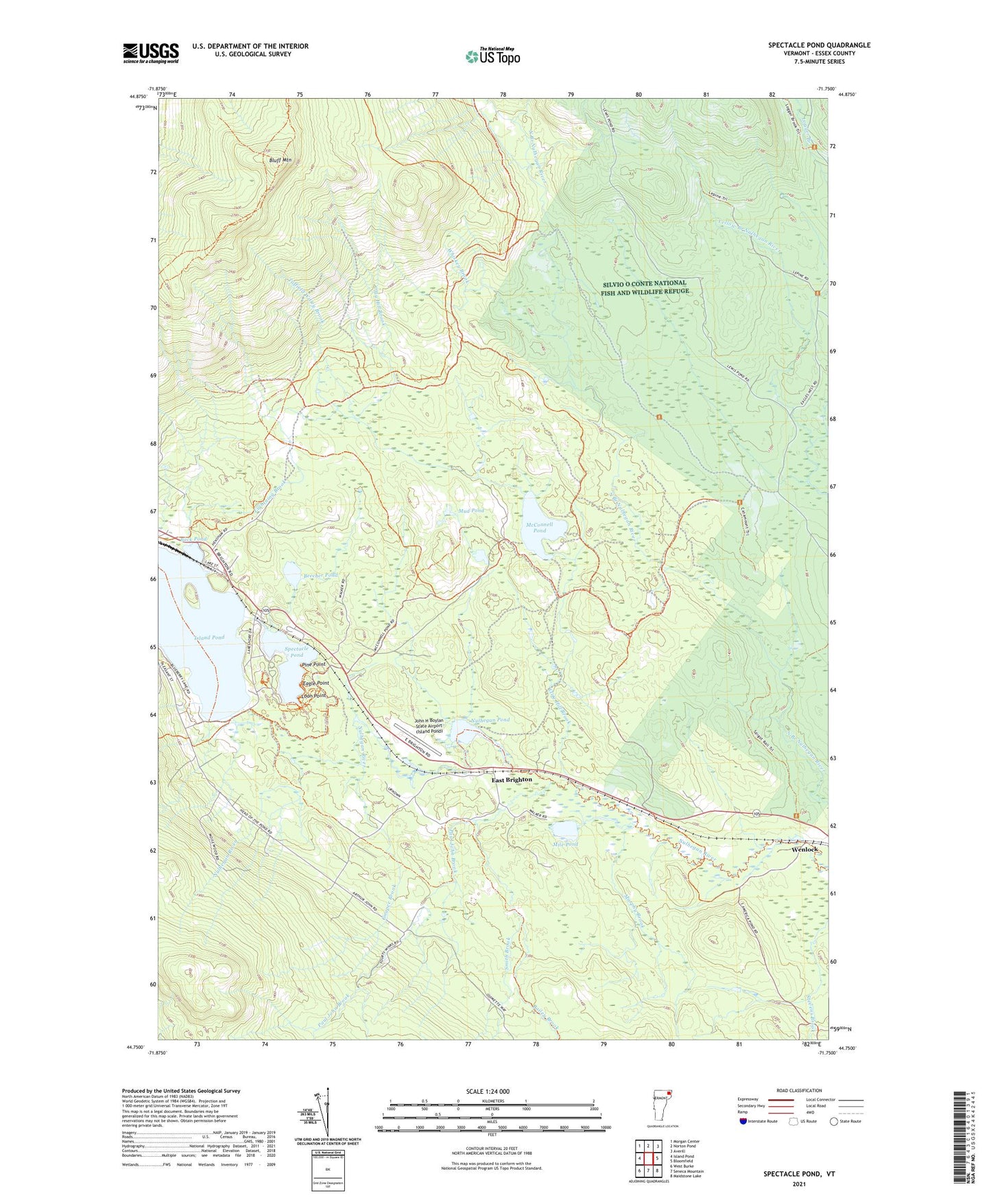
2021 topographic map quadrangle Spectacle Pond in the state of Vermont. Scale: 1:24000. Based on the newly updated USGS 7.5' US Topo map series, this map is in the following counties: Essex. The map contains contour data, water features, and other items you are used to seeing on USGS maps, but also has updated roads and other features. This is the next generation of topographic maps. Printed on high-quality waterproof paper with UV fade-resistant inks.
Quads adjacent to this one:
West: Island Pond
Northwest: Morgan Center
North: Norton Pond
Northeast: Averill
East: Bloomfield
South: Seneca Mountain
Southwest: West Burke
Contains the following named places: Back Pond, Bailey Brook, Beecher Pond, Bluff Mountain, Brighton Municipal Forest, Brighton State Park, Clay Hill Brook, Don Eagle Museum, Eagle Point, East Brighton, Goupee Brook, Island Pond, John H Boylan State Airport (Island Pond), Lightning Brook, Loggers Loop Trail, Loon Point, Main Trail, McConnell Pond, Mile Pond, Mud Pond, Murphy Brook, Nulhegan Pond, Paul John Brook, Pine Point, Red Pine Trail, Shore Trail, Smith Brook, Spectacle Pond, Tim Carroll Brook, Town of Brighton, Tuffield Willey Brook, Wenlock, Wenlock Crossing Heliport, Whiskey Brook, ZIP Code: 05846