MyTopo
Morgan Center Vermont US Topo Map
Couldn't load pickup availability
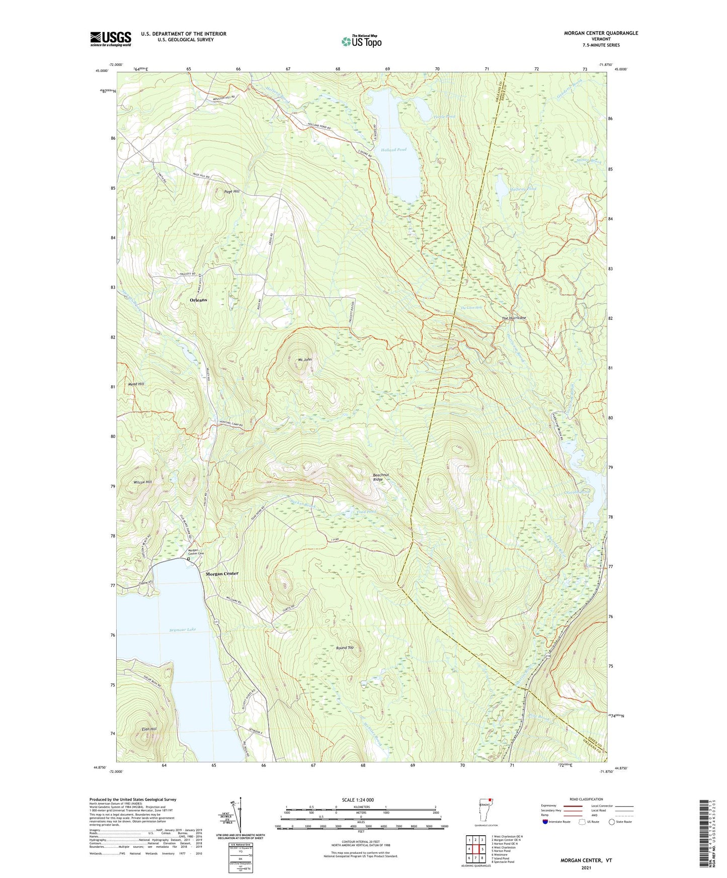
2024 topographic map quadrangle Morgan Center in the state of Vermont. Scale: 1:24000. Based on the newly updated USGS 7.5' US Topo map series, this map is in the following counties: Orleans, Essex. The map contains contour data, water features, and other items you are used to seeing on USGS maps, but also has updated roads and other features. This is the next generation of topographic maps. Printed on high-quality waterproof paper with UV fade-resistant inks.
Quads adjacent to this one:
West: West Charleston
Northwest: West Charleston OE N
North: Morgan Center OE N
Northeast: Norton Pond OE N
East: Norton Pond
Southeast: Spectacle Pond
South: Island Pond
Southwest: Westmore
This map covers the same area as the classic USGS quad with code o44071h8.
Contains the following named places: Beechnut Ridge, Bill Sladyk State Wildlife Management Area, Coaticook Brook, Elan Hill, Halfway Pond, Holland Pond, Hurricane Brook, Mead Hill, Morgan Center, Morgan Center Cemetery, Mount John, Page Hill, Pine Brook, Round Top, Seymour Lake, Sucker Brook, Summit, The Hurricane, The Loon Hole, Toad Pond, Town of Holland, Town of Morgan, Turtle Pond, Warner's Grant, Wilcox Hill, ZIP Codes: 05830, 05853