MyTopo
Island Pond Vermont US Topo Map
Couldn't load pickup availability
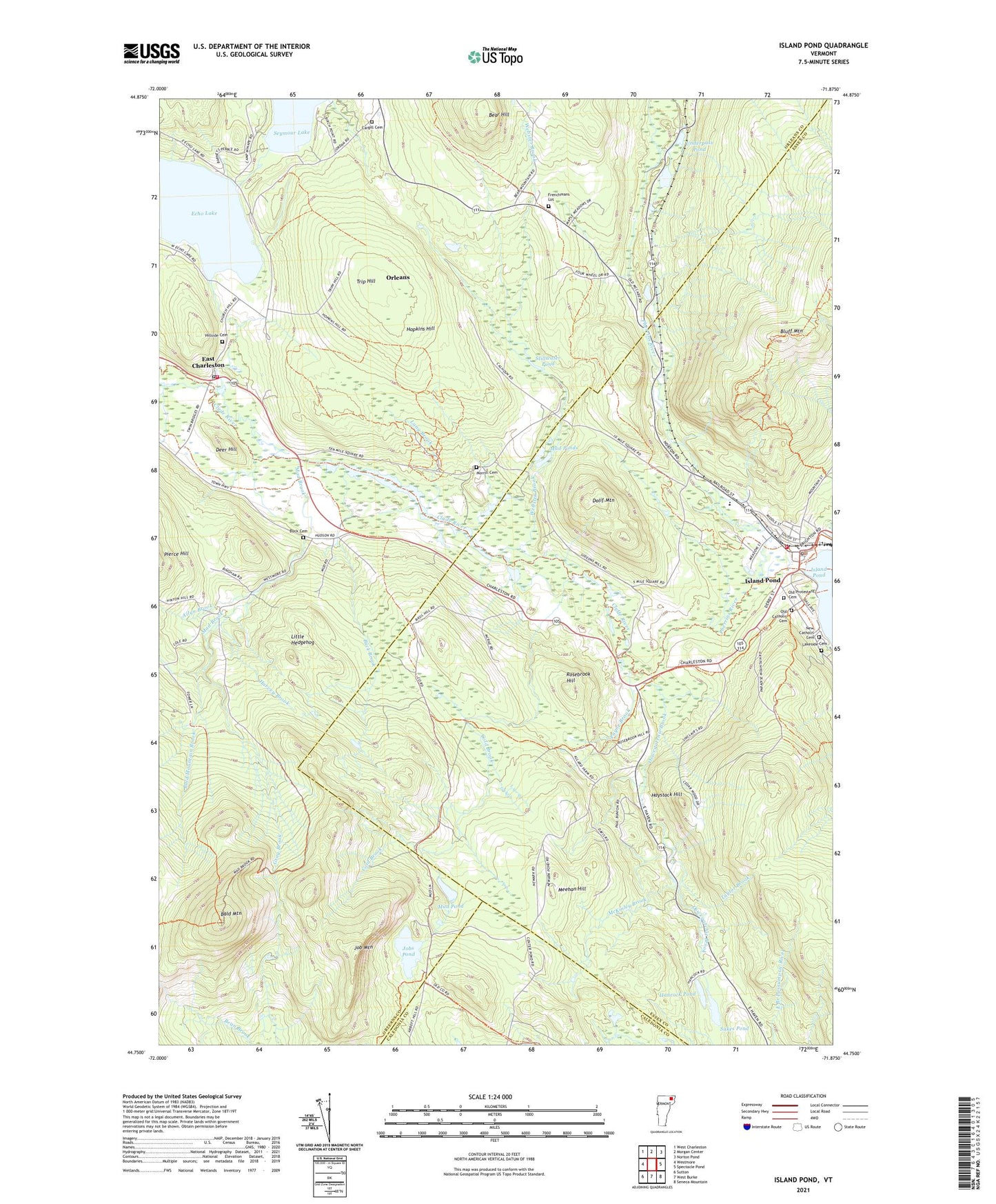
2024 topographic map quadrangle Island Pond in the state of Vermont. Scale: 1:24000. Based on the newly updated USGS 7.5' US Topo map series, this map is in the following counties: Orleans, Essex, Caledonia. The map contains contour data, water features, and other items you are used to seeing on USGS maps, but also has updated roads and other features. This is the next generation of topographic maps. Printed on high-quality waterproof paper with UV fade-resistant inks.
Quads adjacent to this one:
West: Westmore
Northwest: West Charleston
North: Morgan Center
Northeast: Norton Pond
East: Spectacle Pond
Southeast: Seneca Mountain
South: West Burke
Southwest: Sutton
This map covers the same area as the classic USGS quad with code o44071g8.
Contains the following named places: Allyn Brook, Bald Mountain, Bald Mountain Brook, Bear Hill, Brighton Elementary School, Brighton Fire Department, Brigton Baptist Church, Buck Brook, Buck Cemetery, Buck School, Camp Winape, Cargill Cemetery, Charleston Volunteer Fire Department, Christ Episcopal Church, Cold Brook, Deer Hill, Derby Line Rescue Squad, Dolif Mountain, East Charleston, East Charleston Post Office, Echo Lake, Echo Lake Dam, Frenchmans Lot, Gray Brook, Hancock Pond, Harvey Brook, Haystack Hill, Hillside Cemetery, Hopkins Hill, Island Pond, Island Pond Census Designated Place, Island Pond Fire Station, Island Pond Historic District, Island Pond Post Office, Job Mountain, Jobs Pond, Lakeside Cemetery, Lang Brook, Little Hedgehog, Mad Brook, McKinley Brook, Meehan Hill, Morrill Cemetery, Mud Pond, Mud Ponds, New Catholic Cemetery, Old Buck School, Old Catholic Cemetery, Old Protestant Cemetery, Oswegatchie Brook, Payne Brook, Pherrins River, Rosebrook Hill, Seymour Lake Dam, Stillwater Pond, Sukes Pond, Taylor Brook, The Church of Jesus Christ of Latter Day Saints, Trip Hill, Underpass Pond, Webster Brook, ZIP Code: 05833