MyTopo
Averill Vermont US Topo Map
Couldn't load pickup availability
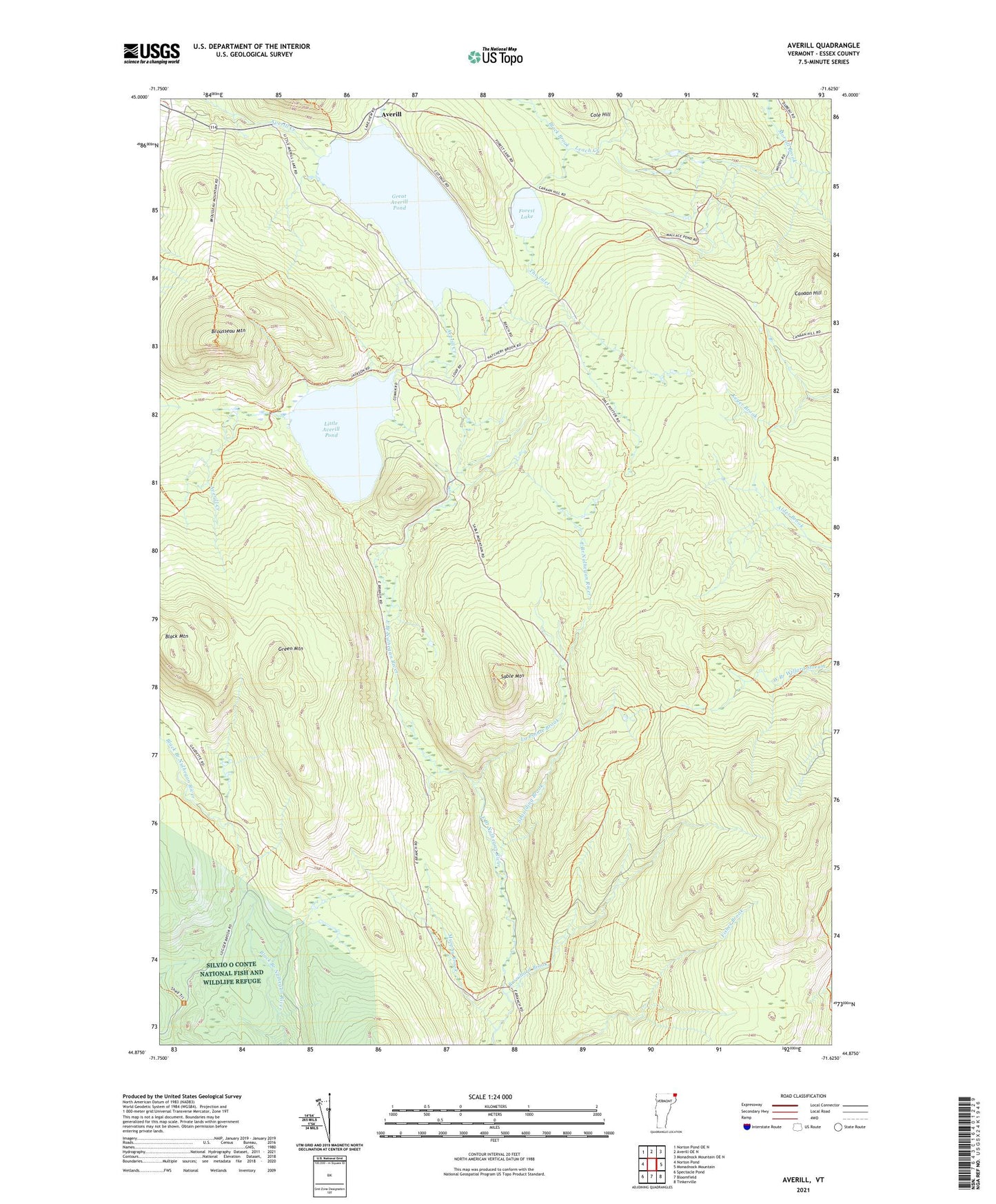
2024 topographic map quadrangle Averill in the state of Vermont. Scale: 1:24000. Based on the newly updated USGS 7.5' US Topo map series, this map is in the following counties: Essex. The map contains contour data, water features, and other items you are used to seeing on USGS maps, but also has updated roads and other features. This is the next generation of topographic maps. Printed on high-quality waterproof paper with UV fade-resistant inks.
Quads adjacent to this one:
West: Norton Pond
Northwest: Norton Pond OE N
North: Averill OE N
East: Monadnock Mountain
Southeast: Tinkerville
South: Bloomfield
Southwest: Spectacle Pond
This map covers the same area as the classic USGS quad with code o44071h6.
Contains the following named places: Averill, Black Brook, Black Mountain, Brouillard Brook, Brousseau Mountain, Camp Number Eighteen, Camp Number Eleven, Camp Number Fourteen, Camp Number Nineteen, Camp Number Sixteen, Camp Number Thirteen, Camp Number Twelve, Camp Number Twenty, Camp Number Twentyone, Canaan Hill, Cold Spring Camp, Cole Hill, Conway Dam, Dam Number Five, Dam Number Four, Dam Number Six, Forest Lake, Great Averill Pond, Great Averill Pond Dam, Green Mountain, La Pointe Brook, Little Averill Dam, Little Averill Lake, Little Averill Pond, Murphy Brook, Sable Mountain, Spaulding Brook, The Inlet, Town of Averill, WKNW-FM (Canaan), ZIP Code: 05901