
MyTopo
Stannard Vermont US Topo Map
Couldn't load pickup availability
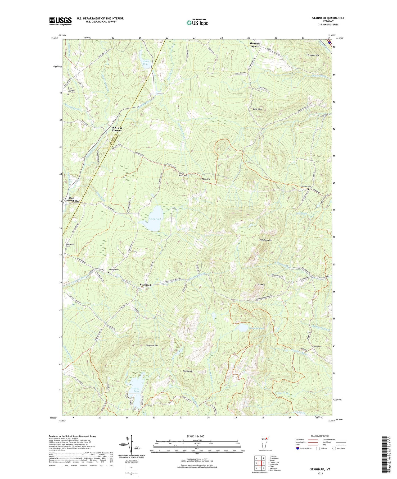
2021 topographic map quadrangle Stannard in the state of Vermont. Scale: 1:24000. Based on the newly updated USGS 7.5' US Topo map series, this map is in the following counties: Caledonia, Orleans. The map contains contour data, water features, and other items you are used to seeing on USGS maps, but also has updated roads and other features. This is the next generation of topographic maps. Printed on high-quality waterproof paper with UV fade-resistant inks.
Quads adjacent to this one:
West: Caspian Lake
Northwest: Craftsbury
North: Crystal Lake
Northeast: Sutton
East: Lyndonville
Southeast: Saint Johnsbury
South: Joes Pond
Southwest: Cabot
Contains the following named places: Batchelder Cemetery, Coles Pond, Coles Pond Dam, Dunn Mountain, Esdon Brook, Fairbanks Mills, Ferguson Hill, Flagg Brook, Flagg Pond, Green Mountain Monastery, Horne Cemetery, Horse Pond, Ide Mountain, Morrison Brook, Mud Pond Brook, Page Brook, Paine Brook, Patch Hill, Ramsey Cemetery, Round Mountain, Sawmill Brook, Sheffield Square, Sherburne School, South Maid Hill, Stannard, Stannard Cemetery, Stannard Mountain, Stannard Pond, Stream Mill Brook, The Four Corners, Town of Stannard, Town of Wheelock, Wheelock Mountain, ZIP Code: 05842


