MyTopo
Cabot Vermont US Topo Map
Couldn't load pickup availability
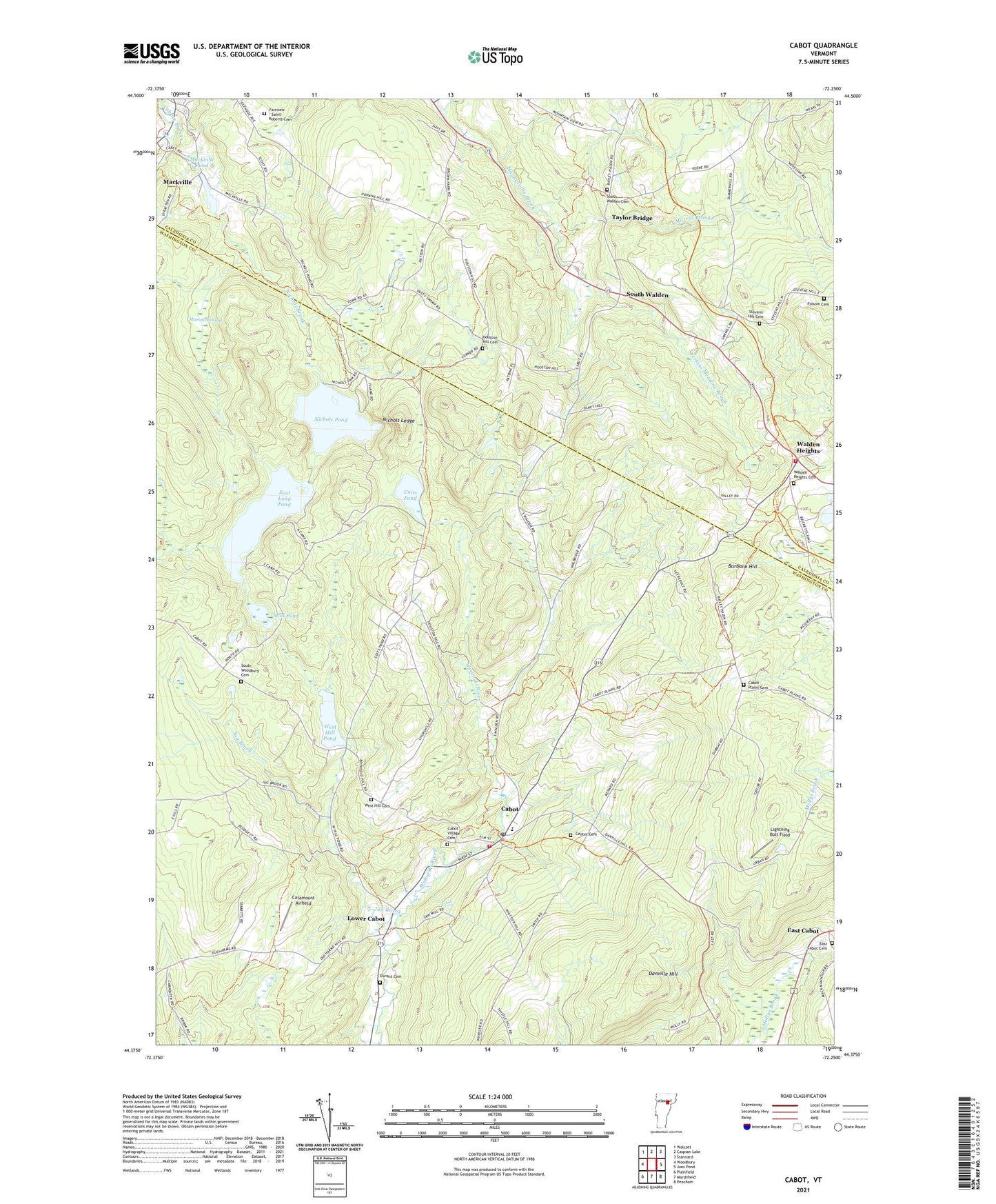
2024 topographic map quadrangle Cabot in the state of Vermont. Scale: 1:24000. Based on the newly updated USGS 7.5' US Topo map series, this map is in the following counties: Washington, Caledonia. The map contains contour data, water features, and other items you are used to seeing on USGS maps, but also has updated roads and other features. This is the next generation of topographic maps. Printed on high-quality waterproof paper with UV fade-resistant inks.
Quads adjacent to this one:
West: Woodbury
Northwest: Wolcott
North: Caspian Lake
Northeast: Stannard
East: Joes Pond
Southeast: Peacham
South: Marshfield
Southwest: Plainfield
This map covers the same area as the classic USGS quad with code o44072d3.
Contains the following named places: Burbank Hill, Cabot, Cabot Census Designated Place, Cabot Emergency Ambulance, Cabot Plains Cemetery, Cabot Post Office, Cabot School, Cabot Village Cemetery, Cabot Volunteer Fire Department, Catamount Airfield, Center Cemetery, Coits Pond, Danville Hill, Dunstable Farm, Durant Cemetery, East Cabot, East Cabot Cemetery, East Long Pond, East Long Pond Dam, Fairview - Saint Roberts Cemetery, Folsom Cemetery, Houston Hill Cemetery, Houston Hill School, Idle Hours Campground, Jug Brook, Lightning Bolt Field, Lower Cabot, Mackville, Mackville Dam, Mackville Pond, Martell Swamp, Morrill Brook, Mud Pond, Nichols Brook, Nichols Ledge, Nichols Pond, Nichols Pond Dam, Perkins Meadow Brook, Smith Corner, South Walden, South Walden Cemetery, South Woodbury Cemetery, Steam Mill Brook Wildlife Management Area, Stevens Hill Cemetery, Taylor Bridge, Town of Cabot, United Church of Cabot, Village of Cabot, Walden Fire Department, Walden Heights, Walden Heights Cemetery, Walden Station, West Hill Cemetery, West Hill Pond, West Hill Pond Dam, Westhill Cemetery, ZIP Code: 05647