MyTopo
Sutton Vermont US Topo Map
Couldn't load pickup availability
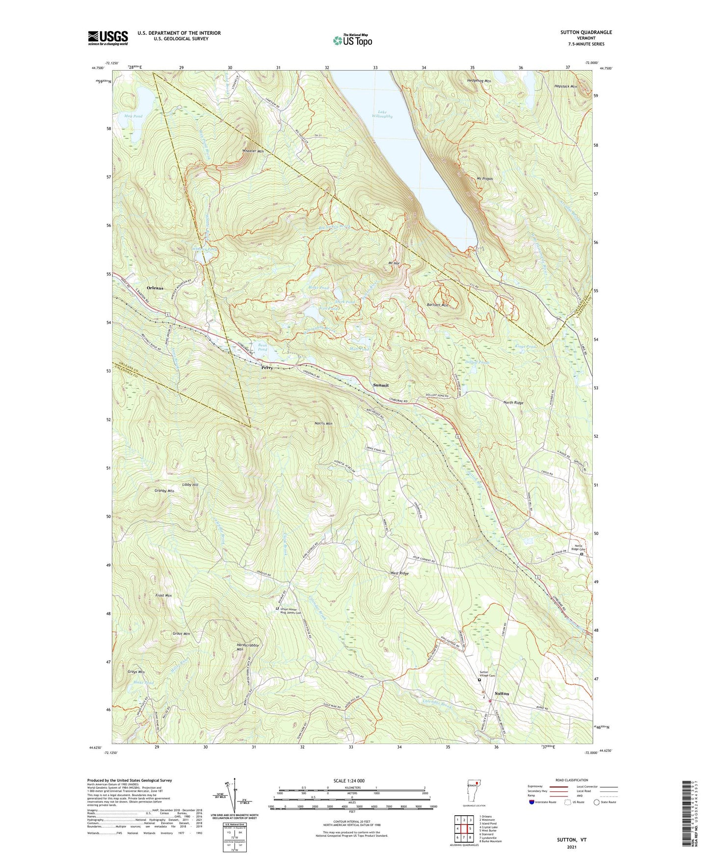
2021 topographic map quadrangle Sutton in the state of Vermont. Scale: 1:24000. Based on the newly updated USGS 7.5' US Topo map series, this map is in the following counties: Caledonia, Orleans. The map contains contour data, water features, and other items you are used to seeing on USGS maps, but also has updated roads and other features. This is the next generation of topographic maps. Printed on high-quality waterproof paper with UV fade-resistant inks.
Quads adjacent to this one:
West: Crystal Lake
Northwest: Orleans
North: Westmore
Northeast: Island Pond
East: West Burke
Southeast: Burke Mountain
South: Lyndonville
Southwest: Stannard
Contains the following named places: Annis Brook, Arcadia Brook, Bartlett Mountain, Bean Pond, Big Valley Brook, Blake Pond, Calendar Brook State Wildlife Management Area, Clark Brook, Dolloff Ponds, Duck Pond, Frost Mountain, Granby Mountain, Grays Mountain, Grout Mountain, Hardscrabble Mountain, Haystack Mountain, Hedgehog Mountain, Herbert Hawkes Hiking Trail, Highland School, King George School, Kings Pond, Libby Hill, Marl Pond, May Pond, May Pond Dam, Mount Hor, Mount Pisgah, Mount Pisgah Trail, Mud Pond, Norris Mountain, North Ridge, North Ridge Cemetery, Perry, Richies Run, Sheffield Municipal Forest, South Shore Hiking Trail, Summit, Sunmit, Sutton, Sutton Census Designated Place, Sutton Fire Department, Sutton Free Public Library, Sutton Station, Sutton Village Cemetery, Sutton Village School, Town of Sutton, Union House - King James Cemetery, Vail Pond, West Ridge, Wheeler Brook, Wheeler Mountain, Wheeler Pond, White Caps Campground, Willoughby, Willoughby School, Willoughby State Forest, ZIP Codes: 05866, 05867