MyTopo
Westmore Vermont US Topo Map
Couldn't load pickup availability
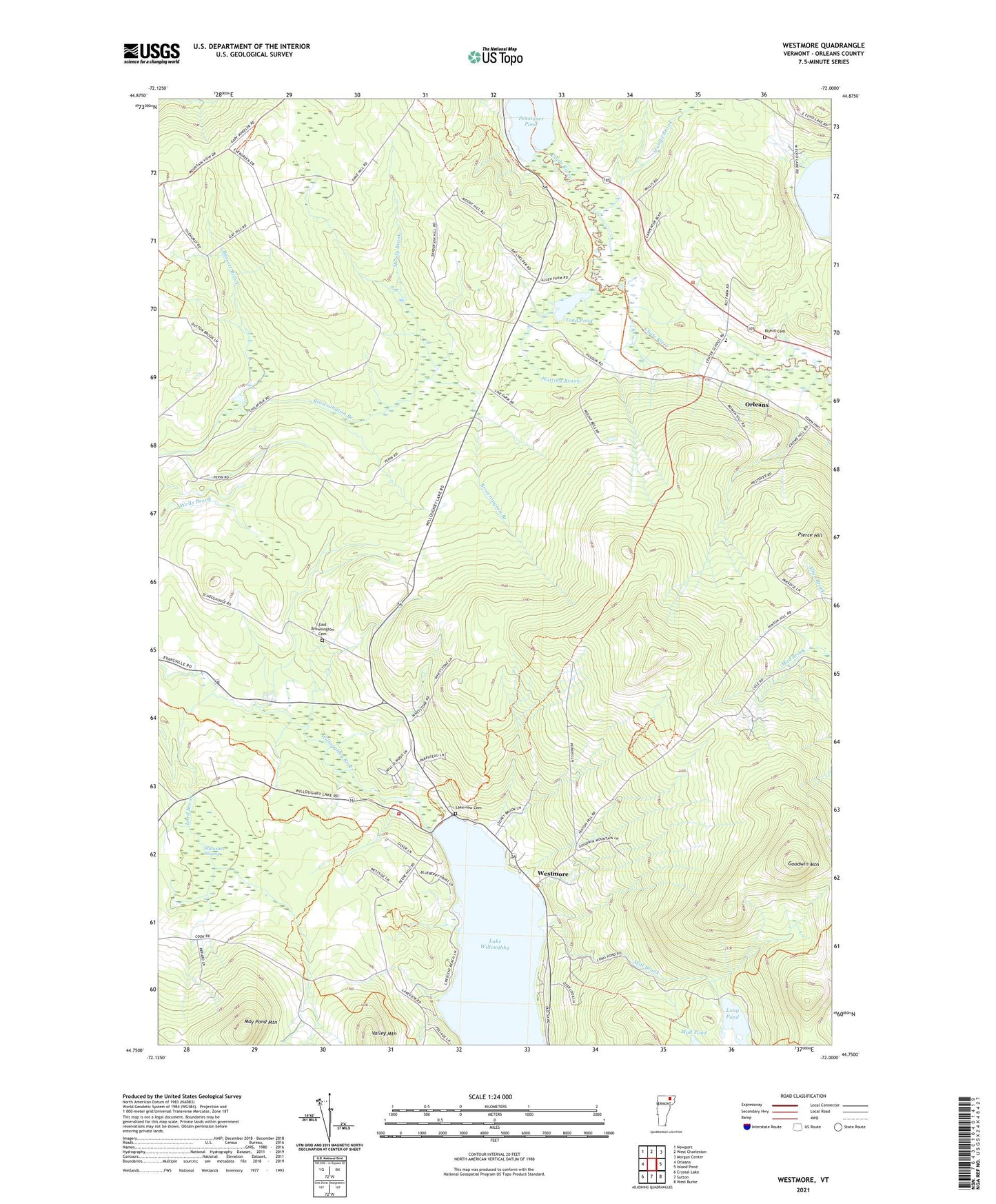
2024 topographic map quadrangle Westmore in the state of Vermont. Scale: 1:24000. Based on the newly updated USGS 7.5' US Topo map series, this map is in the following counties: Orleans. The map contains contour data, water features, and other items you are used to seeing on USGS maps, but also has updated roads and other features. This is the next generation of topographic maps. Printed on high-quality waterproof paper with UV fade-resistant inks.
Quads adjacent to this one:
West: Orleans
Northwest: Newport
North: West Charleston
Northeast: Morgan Center
East: Island Pond
Southeast: West Burke
South: Sutton
Southwest: Crystal Lake
This map covers the same area as the classic USGS quad with code o44072g1.
Contains the following named places: Bassett Brook, Blyhill Cemetery, Charleston Elementary School, East Brownington, East Brownington Cemetery, East Brownington School, East Cemetery, Fisk School, Goodwin Mountain, Hinton School, Lake View School, Lake Willoughby, Lakeview Cemetery, Long Pond, Lord Brook, Lubber Lake, May Pond Mountain, Mill Brook, Moody Brook, Nutting Brook, Pensioner Pond, Pierce Hill, Powers School, Songadeewin Camp, Stillwater Swamp, Stumpf Brook, Toad Pond, Town of Brownington, Town of Charleston, Town of Westmore, Valley Mountain, West Charleston Dam, Westmore, Westmore Fire and Rescue, Will-O-Wood Campground, ZIP Codes: 05860, 05872