MyTopo
Washington Vermont US Topo Map
Couldn't load pickup availability
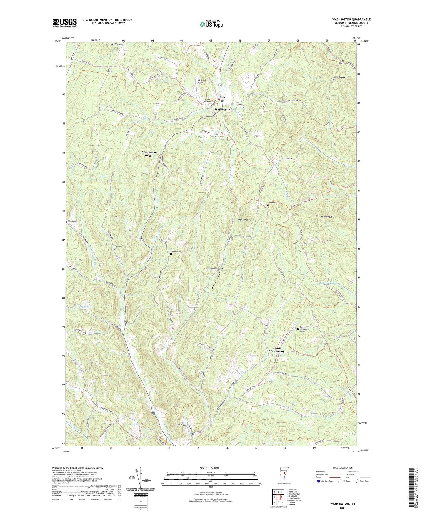
2024 topographic map quadrangle Washington in the state of Vermont. Scale: 1:24000. Based on the newly updated USGS 7.5' US Topo map series, this map is in the following counties: Orange. The map contains contour data, water features, and other items you are used to seeing on USGS maps, but also has updated roads and other features. This is the next generation of topographic maps. Printed on high-quality waterproof paper with UV fade-resistant inks.
Quads adjacent to this one:
West: Brookfield
Northwest: Barre West
North: Barre East
Northeast: Knox Mountain
East: West Topsham
Southeast: Vershire
South: Chelsea
Southwest: Randolph Center
This map covers the same area as the classic USGS quad with code o44072a4.
Contains the following named places: Bohonon Cemetery, Boyce Hill, Camp Sky Acres, Carriers Skypark, Caswell Cemetery, Cheney Cemetery, Clough Cemetery, Devils Den, Fish Cemetery, Flint Cemetery, Hart Hollow, Jones Pond, Kennedy Corners, Lyme Emery Hill, Maple Hill Cemetery, Michigan Hill, Mount Pleasant, Orange County, Riders Corners, South Washington, South Washington Cemetery, The Notch, Town of Washington, Washington, Washington Baptist Church, Washington First Aid Stabilization Team Squad, Washington Heights, Washington Post Office, Washington State Forest, Washington Town Forest, Washington Village School, Washington Volunteer Fire Department, Washington Wildlife Management Area, ZIP Code: 05675