MyTopo
Knox Mountain Vermont US Topo Map
Couldn't load pickup availability
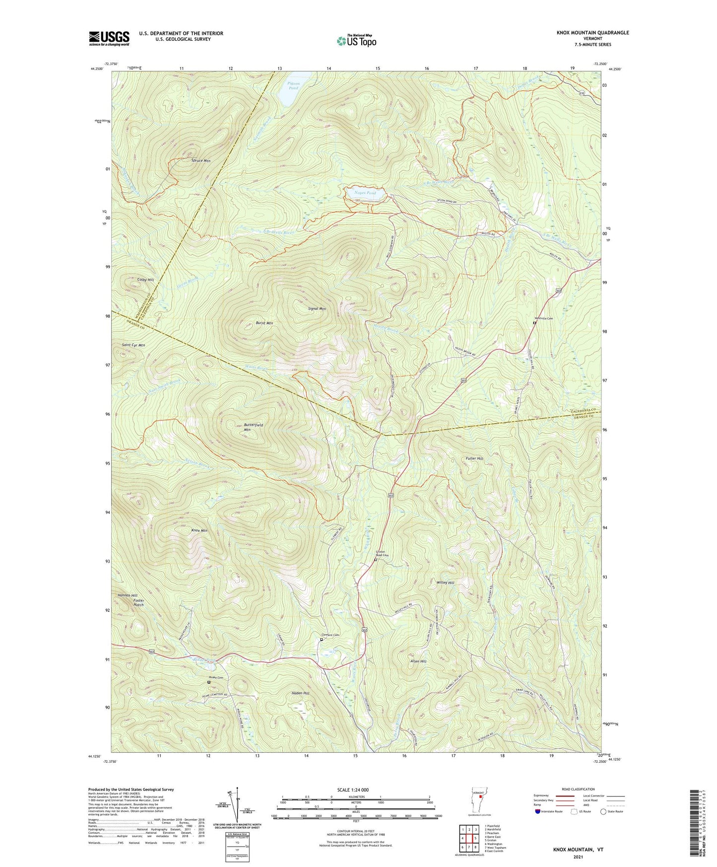
2024 topographic map quadrangle Knox Mountain in the state of Vermont. Scale: 1:24000. Based on the newly updated USGS 7.5' US Topo map series, this map is in the following counties: Orange, Caledonia, Washington. The map contains contour data, water features, and other items you are used to seeing on USGS maps, but also has updated roads and other features. This is the next generation of topographic maps. Printed on high-quality waterproof paper with UV fade-resistant inks.
Quads adjacent to this one:
West: Barre East
Northwest: Plainfield
North: Marshfield
Northeast: Peacham
East: Groton
Southeast: East Corinth
South: West Topsham
Southwest: Washington
This map covers the same area as the classic USGS quad with code o44072b3.
Contains the following named places: Allen Hill, Burnt Mountain, Butterfield Mountain, Clement Cemetery, Colby Hill, Foster Notch, Fuller Hill, Groton Road Cemetery, Groton State Forest, Haden Hill, Hannah Hill, Health Brook, Knox Mountain, L R Jones State Forest, Noyes Pond, Noyes Pond Dam, Peake Cemetery, Perry Brook, Pigeon Pond, Riddel Pond, Saint Cyr Mountain, Seyon Ranch, Signal Mountain, Spruce Mountain, Town of Groton, Town of Orange, Westville Cemetery, Willey Hill, William Scott Memorial Monument, ZIP Codes: 05046, 05649