MyTopo
Wells Vermont US Topo Map
Couldn't load pickup availability
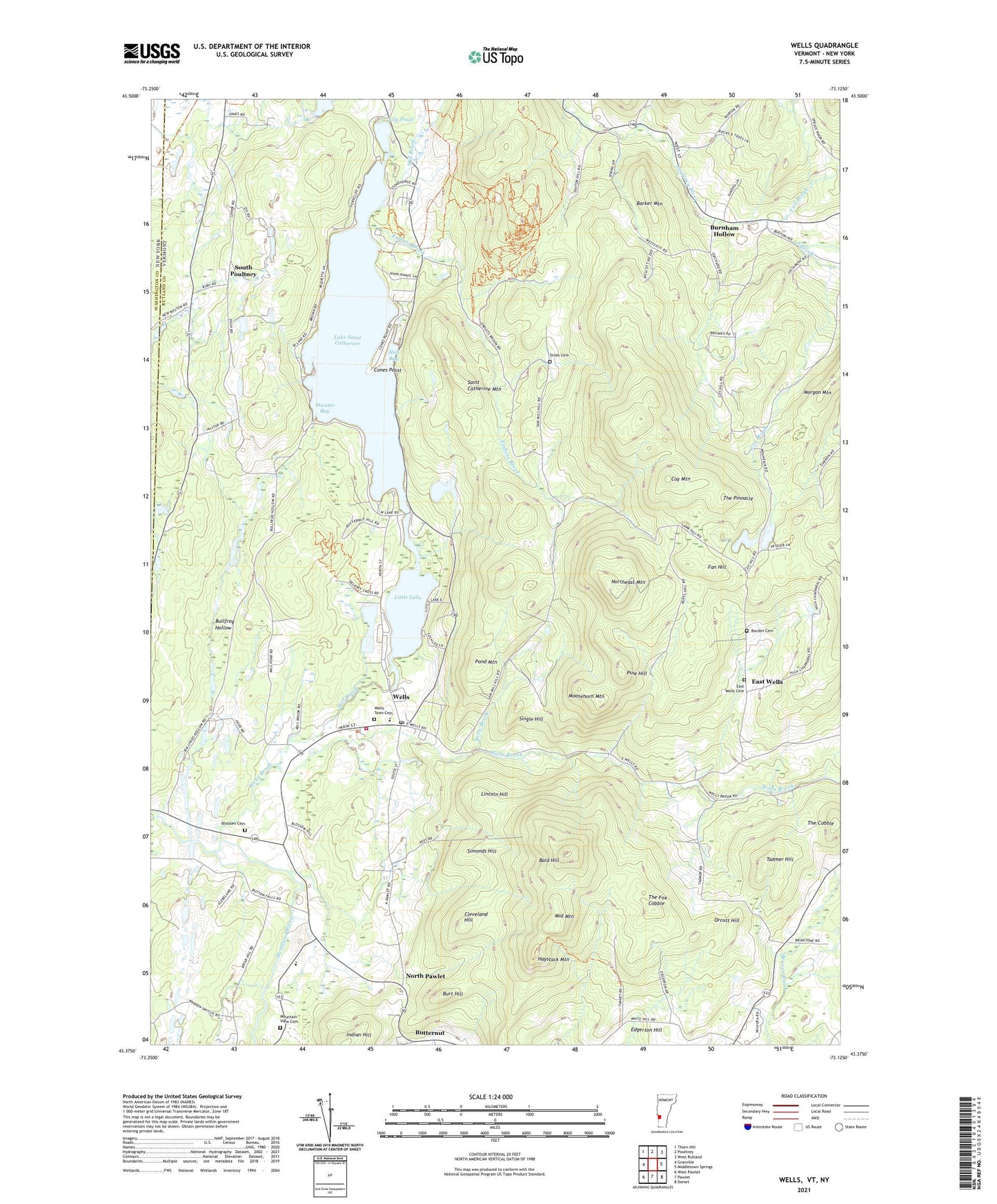
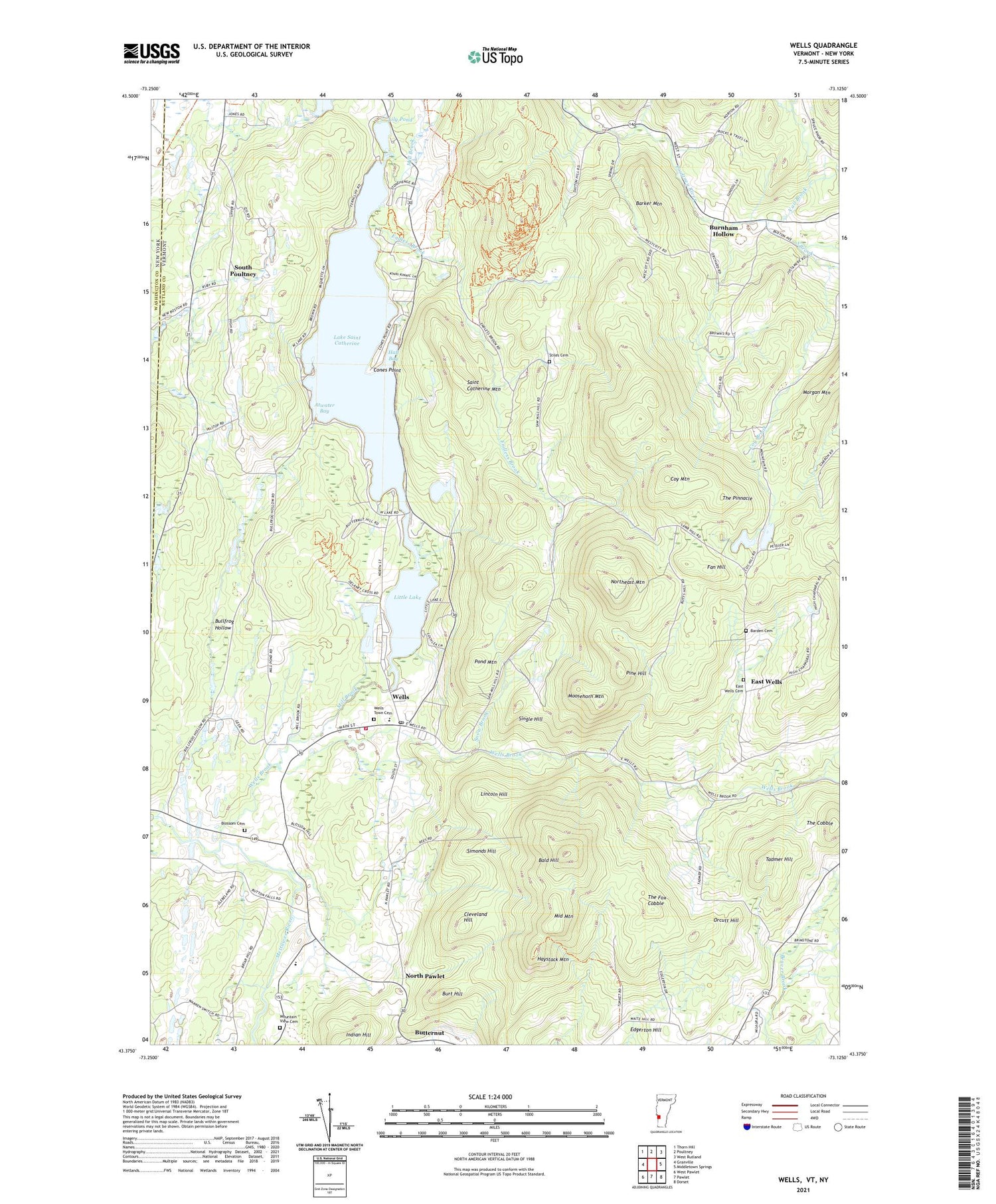
2021 topographic map quadrangle Wells in the state of Vermont. Scale: 1:24000. Based on the newly updated USGS 7.5' US Topo map series, this map is in the following counties: Rutland, Washington. The map contains contour data, water features, and other items you are used to seeing on USGS maps, but also has updated roads and other features. This is the next generation of topographic maps. Printed on high-quality waterproof paper with UV fade-resistant inks.
Quads adjacent to this one:
West: Granville
Northwest: Thorn Hill
North: Poultney
Northeast: West Rutland
East: Middletown Springs
Southeast: Dorset
South: Pawlet
Contains the following named places: Atwater Bay, Bald Hill, Barden Cemetery, Barker Mountain, Blossom Cemetery, Blossoms Corners, Boczek Marsh Wildlife Management Area, Brimstone Corners, Bullfrog Hollow, Burnham Hollow, Burt Hill, Butternut, Camp Kinni Kinnic, Cleveland Hill, Cones Point, Coy Brook, Coy Mountain, East Wells, East Wells Cemetery, Edgerton Hill, Endless Brook, Fan Hill, Hall Bay, Haystack Mountain, Indian Hill, Lake Saint Catherine, Lake Saint Catherine Golf Course, Lake Saint Catherine State Park, Lily Pond, Lincoln Hill, Little Lake, Little Pond Dam, Melcher Dam, Mettawee Community School, Middle Mountain, Mill Brook, Moosehorn Mountain, Mountain View Cemetery, North Pawlet, Northeast Developers Dam, Northeast Mountain, Orcutt Hill, Pine Hill, Pond Mountain, Saint Catherine Mountain, Schiff Dam, Schmidt Dam, Simonds Hill, Single Hill, Snow Brook, South Brook, South Poultney, Stiles Cemetery, Tadmer Hill, The Cobble, The Fox Cobble, The Pinnacle, Town of Middletown Springs, Town of Wells, Vail Brook, Wells, Wells Brook, Wells Census Designated Place, Wells Post Office, Wells Town Cemetery, Wells Village School, Wells Volunteer Fire Department, ZIP Code: 05774