MyTopo
Poultney Vermont US Topo Map
Couldn't load pickup availability
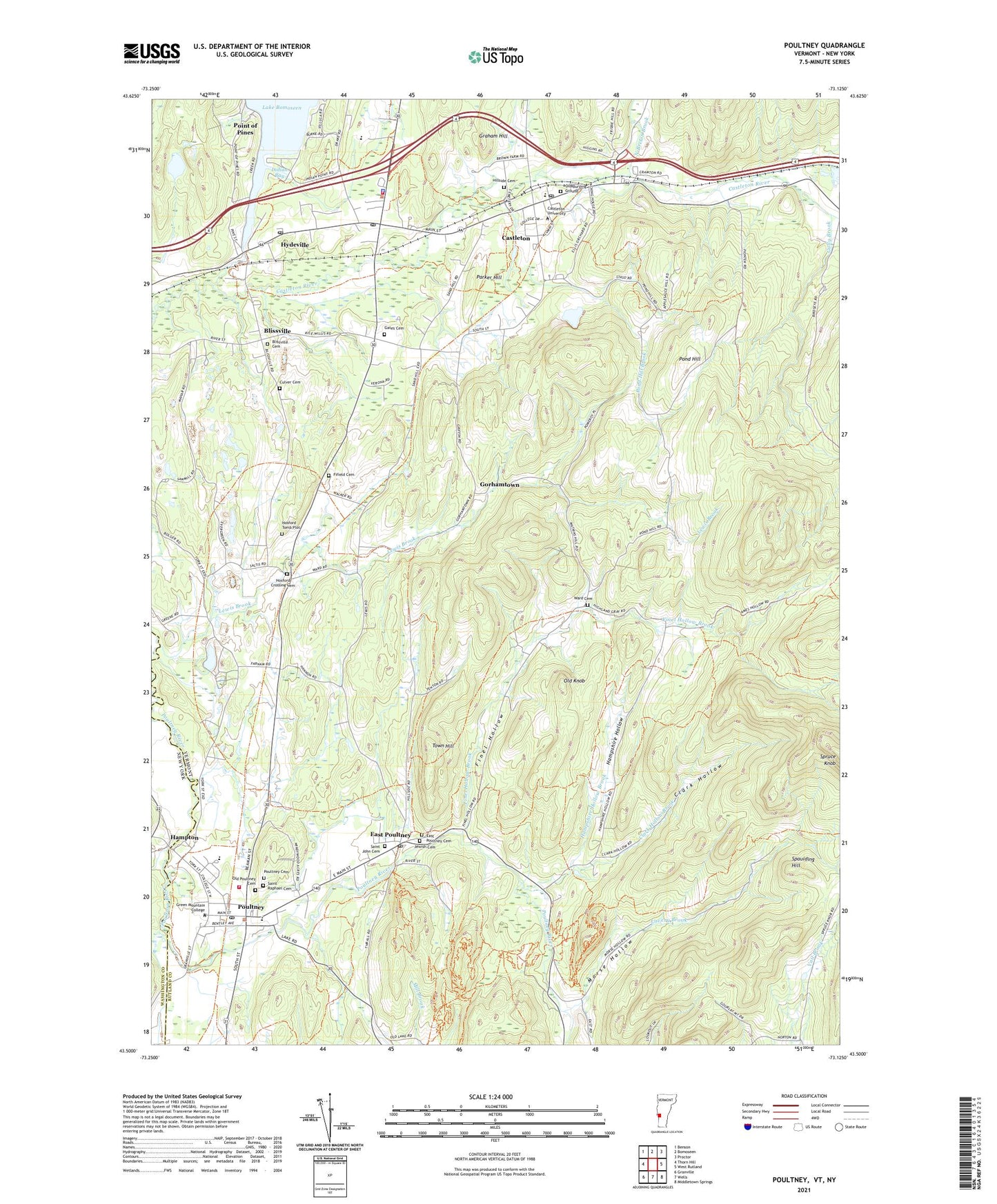
2024 topographic map quadrangle Poultney in the state of Vermont. Scale: 1:24000. Based on the newly updated USGS 7.5' US Topo map series, this map is in the following counties: Rutland, Washington. The map contains contour data, water features, and other items you are used to seeing on USGS maps, but also has updated roads and other features. This is the next generation of topographic maps. Printed on high-quality waterproof paper with UV fade-resistant inks.
Quads adjacent to this one:
West: Thorn Hill
Northwest: Benson
North: Bomoseen
Northeast: Proctor
East: West Rutland
Southeast: Middletown Springs
South: Wells
Southwest: Granville
This map covers the same area as the classic USGS quad with code o43073e2.
Contains the following named places: Ames Memorial Hall, Blissville, Blissville Cemetery, Blueberry Hill Wildlife Management Area, Bomoseen Post Office, Calvin Coolidge Library, Castleton, Castleton Census Designated Place, Castleton Corners, Castleton Fire Department, Castleton Four Corners Census Designated Place, Castleton Hubbardton Elementary School, Castleton Police Department, Castleton Post Office, Castleton Town Hall, Castleton University, Castleton Village Historic District, Castleton Village School, Clark Hollow, Clark Hollow Brook, Culver Cemetery, East Poultney, East Poultney Cemetery, East Poultney Census Designated Place, East Poultney Historic District, East Poultney Post Office, Federated Church, Fifield Cemetery, Finel Hollow, Finel Hollow Brook, Gates Cemetery, Gorhamtown, Graham Hill, Green Mountain College, Gully Brook, Hampshire Hollow, Hampshire Hollow Brook, Hillside Cemetery, Hosford Crossing Cemetery, Hosford Tomb Plot, Hydeville, Hydeville Post Office, Hydeville School, Indian Bay, Jewish Cemetery, Lake Bomossen Dam, Lavery Brook, Lewis Brook, Morse Hollow, North Breton Brook, Old Baptist Church, Old Burying Ground, Old Knob, Old Poultney Cemetery, Parker Hill, Point of Pines, Pond Hill, Pond Hill Brook, Poultney, Poultney Cemetery, Poultney Elementary School, Poultney Fire Department, Poultney High School, Poultney Main Street Historic District, Poultney Post Office, Poultney Rescue Squad, Poultney Town Hall, Poultney United Methodist Church, Rutland County Grammar School, Rutland Southwest Essential Early Education Program, Saint John Cemetery, Saint John Episcopal Church, Saint Raphael Cemetery, Spaulding Hill, Town Hill, Town of Poultney, Village of Poultney, Ward Cemetery, WIUV-FM (Castleton), WVNR-AM (Poultney), ZIP Code: 05764