MyTopo
West Rutland Vermont US Topo Map
Couldn't load pickup availability
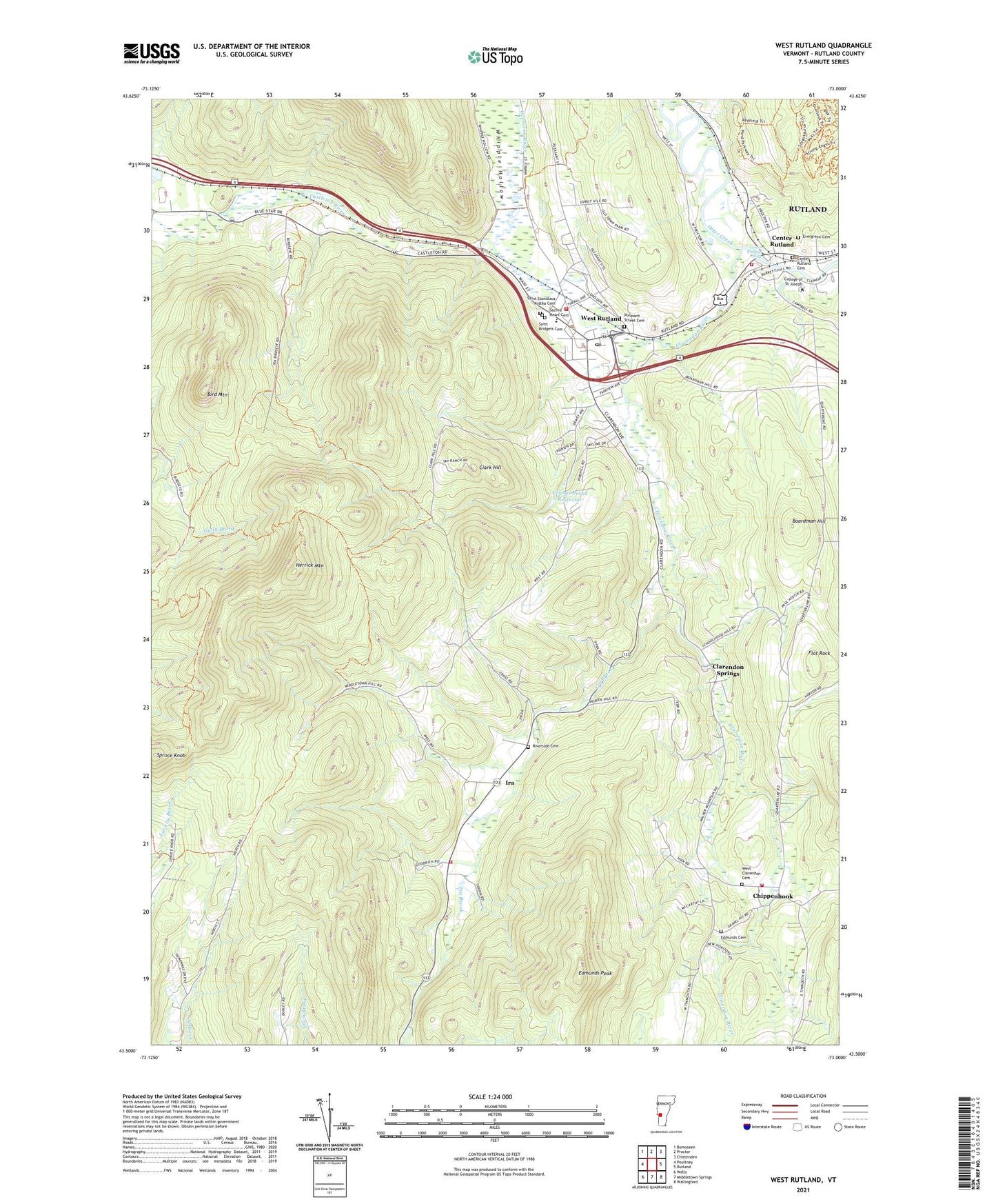
2024 topographic map quadrangle West Rutland in the state of Vermont. Scale: 1:24000. Based on the newly updated USGS 7.5' US Topo map series, this map is in the following counties: Rutland. The map contains contour data, water features, and other items you are used to seeing on USGS maps, but also has updated roads and other features. This is the next generation of topographic maps. Printed on high-quality waterproof paper with UV fade-resistant inks.
Quads adjacent to this one:
West: Poultney
Northwest: Bomoseen
North: Proctor
Northeast: Chittenden
East: Rutland
Southeast: Wallingford
South: Middletown Springs
Southwest: Wells
This map covers the same area as the classic USGS quad with code o43073e1.
Contains the following named places: Bird Mountain, Bird Mountain Wildlife Management Area, Boardman Hill, Center Rutland, Center Rutland Cemetery, Center Rutland Dam, Center Rutland Falls, Center Rutland Fire Department, Chippenhook, Clarendon River, Clarendon Springs, Clarendon Volunteer Fire Association Station 2, Clark Hill, College of Saint Joseph, Durgy Hill Heights, Edmunds Cemetery, Edmunds Peak, Evergreen Cemetery, Flat Rock, Herrick Mountain, Ira, Ira Baptist Church, Ira Brook, Ira Town Hall, Ira Volunteer Fire Department, Marble Street Historic District, Old Center Rutland School, Pleasant Street Cemetery, Riverside Cemetery, Rutland County, Sacred Heart Cemetery, Saint Bridgets Cemetery, Saint Joseph College Library, Saint Joseph Novitiate, Saint Stanislaus Kostka Catholic Church, Saint Stanislaus Kostka Cemetery, Saint Stanislaus Kostka School, Spruce Knob, Town of Ira, Town of West Rutland, United Church of West Rutland, West Clarendon Cemetery, West Rutland, West Rutland Census Designated Place, West Rutland Fire Department, West Rutland Municipal Forest, West Rutland Post Office, West Rutland School, West Rutland Town Hall, Whipple Hollow, WHWB-AM (Rutland), WHWB-FM (Rutland), WRUT-FM (West Rutland), Youngs Brook Dam, Youngs Brook Reservoir, ZIP Code: 05777