MyTopo
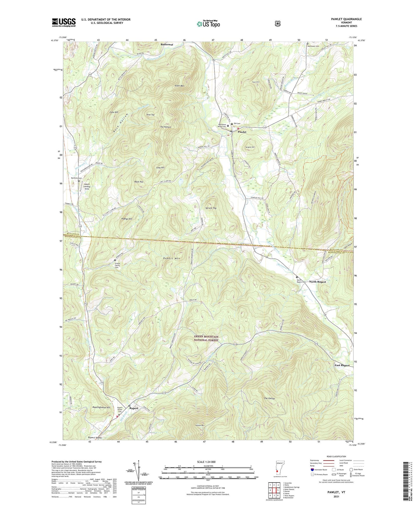
Pawlet Vermont US Topo Map
Couldn't load pickup availability
Also explore the Pawlet Forest Service Topo of this same quad for updated USFS data
2024 topographic map quadrangle Pawlet in the state of Vermont. Scale: 1:24000. Based on the newly updated USGS 7.5' US Topo map series, this map is in the following counties: Rutland, Bennington. The map contains contour data, water features, and other items you are used to seeing on USGS maps, but also has updated roads and other features. This is the next generation of topographic maps. Printed on high-quality waterproof paper with UV fade-resistant inks.
Quads adjacent to this one:
Northwest: Granville
North: Wells
Northeast: Middletown Springs
East: Dorset
Southeast: Manchester
South: West Rupert
Southwest: Salem
This map covers the same area as the classic USGS quad with code o43073c2.
Contains the following named places: Antone Mountain, Bardwell Cemetery, Beaver Brook, Cole Hill, Dry Brook, East Rupert, Flower Brook, Graves Family Cemetery, Herrick Brook, Highgo Hill, Hulett Landing Strip, Long Hill, Mach Personal Strip, Meetinghouse Hill, Mettawee Valley Cemetery, North Rupert, North Rupert Cemetery, Northeast Cemetery, Old Cemetery, Pawlet, Pawlet Census Designated Place, Pawlet Community Church, Pawlet Post Office, Pawlet Public Library, Pawlet Town Hall, Pawlet Village School, Pawlet Volunteer Fire Department, Pine Top, Rock Hill, Rupert, Rupert Mountain, Rupert Post Office, Rupert Street Cemetery, Rupert Town Forest, Rupert Village School, Rupert Volunteer Fire Department, Rush Hollow, Sargent Hill, Scott Mountain, Spruce Top, Sykes Hollow, The Gallop, The Pattern, Town Hill, Town of Pawlet, Town of Rupert, West Pawlet Census Designated Place, WMNV-FM (Rupert), ZIP Codes: 05761, 05775, 05776