MyTopo
West Pawlet Vermont US Topo Map
Couldn't load pickup availability
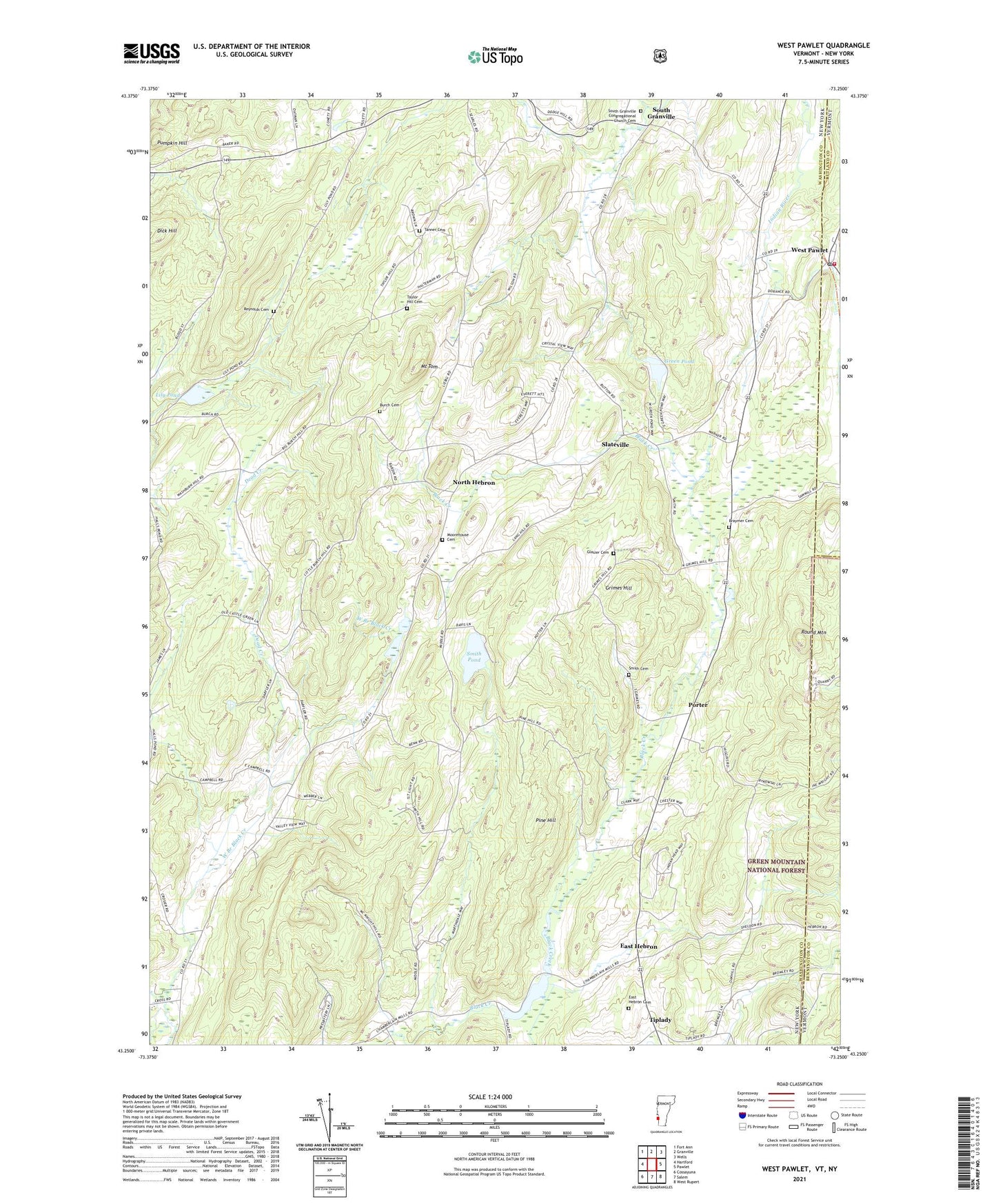
2021 topographic map quadrangle West Pawlet in the states of New York, Vermont. Scale: 1:24000. Based on the newly updated USGS 7.5' US Topo map series, this map is in the following counties: Bennington, Washington, Rutland. The map contains contour data, water features, and other items you are used to seeing on USGS maps, but also has updated roads and other features. This is the next generation of topographic maps. Printed on high-quality waterproof paper with UV fade-resistant inks.
Quads adjacent to this one:
West: Hartford
Northwest: Fort Ann
North: Granville
Northeast: Wells
East: Pawlet
Southeast: West Rupert
South: Salem
Southwest: Cossayuna
Contains the following named places: Birch Hill Farm, Braymer Cemetery, Braymer School, Burch Cemetery, Castle Green, Chamberlin Mills, Dead Creek, Dick Hill, East Hebron, East Hebron Cemetery, Glasier Cemetery, Green Pond, Grimes Hill, Hebron Church, Lily Pond, Moorehouse Cemetery, Mount Tom, North Hebron, Pine Hill, Porter, Pumpkin Hill, Reynolds Cemetery, Round Mountain, School Number 11, School Number 4, School Number 5, School Number 8, Slateville, Smith Cemetery, Smith Pond, South Granville, South Granville Congregational Church, South Granville Congregational Church Cemetery, Tanner Cemetery, Taylor Hill Cemetery, Tiplady, Town of Hebron, West Pawlet, West Pawlet Post Office, West Pawlet School, West Pawlet United Church, West Pawlet Volunteer Fire Department, ZIP Code: 12832