MyTopo
Fort Ann New York US Topo Map
Couldn't load pickup availability
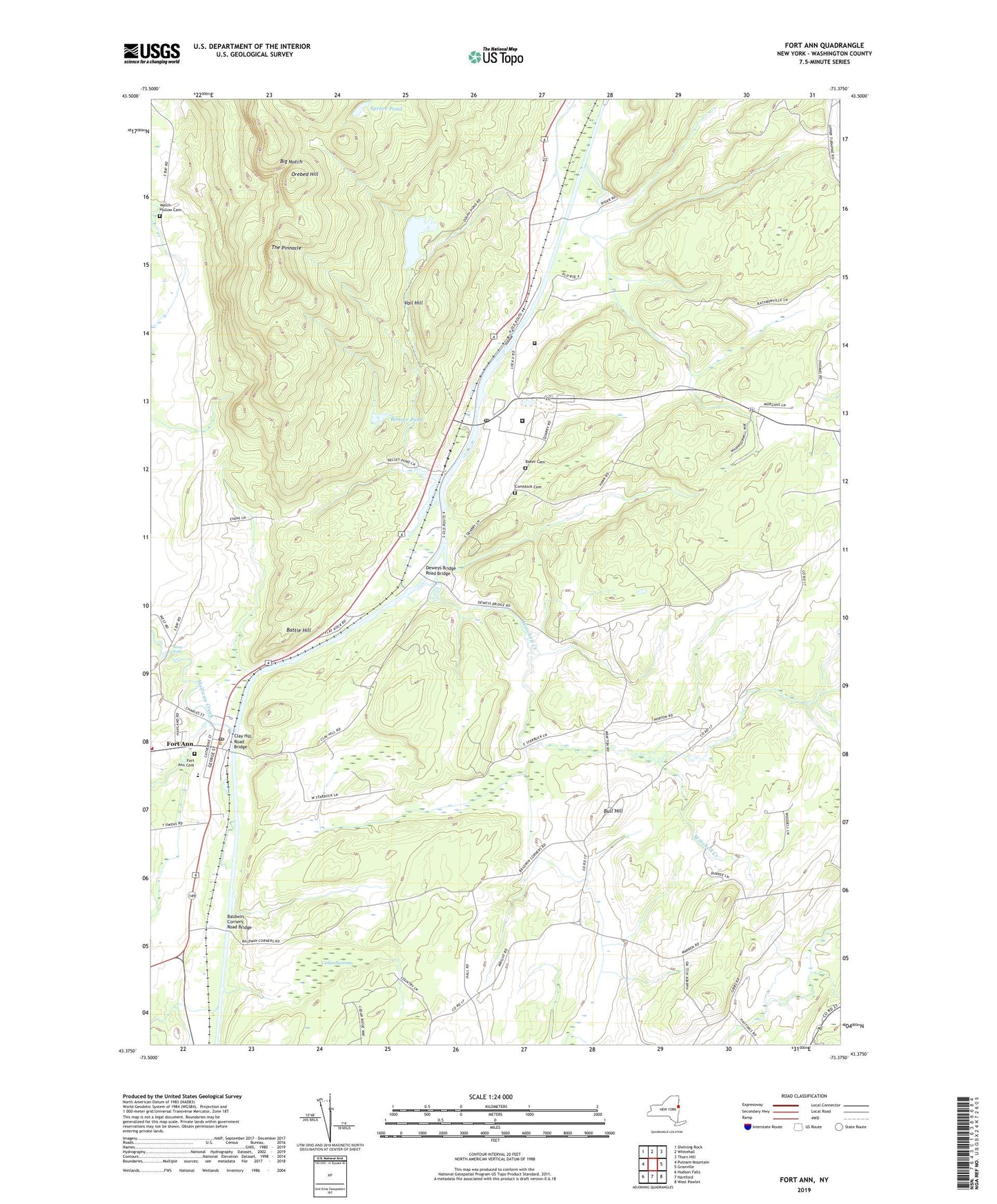
2023 topographic map quadrangle Fort Ann in the state of New York. Scale: 1:24000. Based on the newly updated USGS 7.5' US Topo map series, this map is in the following counties: Washington. The map contains contour data, water features, and other items you are used to seeing on USGS maps, but also has updated roads and other features. This is the next generation of topographic maps. Printed on high-quality waterproof paper with UV fade-resistant inks.
Quads adjacent to this one:
West: Putnam Mountain
Northwest: Shelving Rock
North: Whitehall
Northeast: Thorn Hill
East: Granville
South: Hartford
Southwest: Hudson Falls
This map covers the same area as the classic USGS quad with code o43073d4.
Contains the following named places: B and C Farms, Baker Cemetery, Baldwin Corner, Baldwin Corners Road Bridge, Battle Hill, Beaver Pond, Big Notch, Brookefield Farm, Bull Hill, Cedar Swamp, Champlain Canal, Clay Hill Road Bridge, Comstock, Comstock Cemetery, Comstock Post Office, Deweys Bridge Quarry, Deweys Bridge Road Bridge, Dolph Pond, Fort Ann, Fort Ann Cemetery, Fort Ann Central School, Fort Ann Post Office, Fort Ann Quarry, Fort Ann Volunteer Fire Company, Great Meadow Correctional Facility, Green Thumb Nursery, Halfway Brook, Hartford Quarry, Holstein Heaven Farm, Kane Falls, Milton Farms, Orebed Hill, Rathbunville School, Saint Ann's Catholic Church, School Number 13, Spruce Pond, The Pinnacle, United Protestant Church, Vail Hill, Village of Fort Ann, Washington Correctional Facility, Welch Hollow Cemetery, Whitehall Drive-In, Winchell Creek, WNYV-FM (Whitehall), ZIP Code: 12821