MyTopo
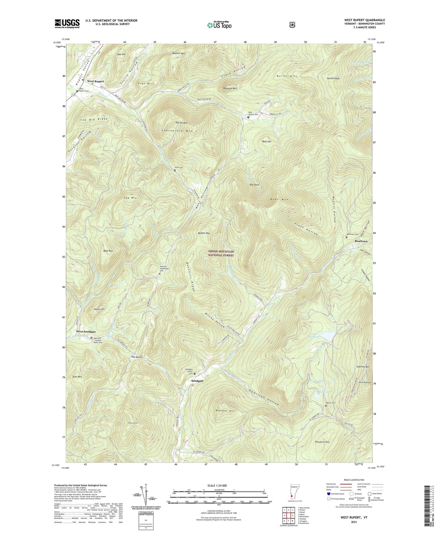
West Rupert Vermont US Topo Map
Couldn't load pickup availability
Also explore the West Rupert Forest Service Topo of this same quad for updated USFS data
2024 topographic map quadrangle West Rupert in the state of Vermont. Scale: 1:24000. Based on the newly updated USGS 7.5' US Topo map series, this map is in the following counties: Bennington. The map contains contour data, water features, and other items you are used to seeing on USGS maps, but also has updated roads and other features. This is the next generation of topographic maps. Printed on high-quality waterproof paper with UV fade-resistant inks.
Quads adjacent to this one:
West: Salem
North: Pawlet
Northeast: Dorset
East: Manchester
Southeast: Sunderland
South: Arlington
Southwest: Shushan
This map covers the same area as the classic USGS quad with code o43073b2.
Contains the following named places: Baker Brook, Bald Mountain, Barbos Lake, Barbos Lake Dam, Bass Hill, Bear Mountain, Beartown, Beartown Cemetery, Bennetts Ridge, Brown Brook, Burnt Hill, Clark Hollow, Corbett Hollow, Devils Glen Brook, Disciples of Christ Church, Egg Mountain, Flat Hill, Frost Hollow, Hamilton Hollow, Haystack Mountain, Hooper Brook Dam, Hopper Brook, Hopper Brook Dam, Hopper Pond, Kate Hollow, Kent Hollow, Kent Hollow Cemetery, Lake Madeleine, Lake Madeleine Dam, Little Equinox, Little Haystack Mountain, Masters Mountain, Mears Hollow, Mill Brook, Minister Hill, Moffitt Hollow, Moffitt Mountain, Norton Brook, Oak Hill, Oven Brook, Pendock Hill, Pruddy Brook, Rupert State Forest, Sandgate, Sandgate Brook, Sandgate Center Cemetery, Sandgate Methodist Church, Sandgate Town Hall, Scott Cemetery, Shatterack Mountain, Sherman Homestead Cemetery, Spruce Peak, Spruce Swamp, Swearing Hill, Tate Mountain, The Big Ridge, The Notch, The Oven, The Ox Bow, Tidd Hollow, Town of Sandgate, Walnut Hill, West End - Camdon Valley Cemetery, West Rupert, West Rupert Cemetery, West Rupert Post Office, West Sandgate, Wilcox Cemetery, Wilcox Hollow, Youlin Hollow