MyTopo
Westminster West Vermont US Topo Map
Couldn't load pickup availability
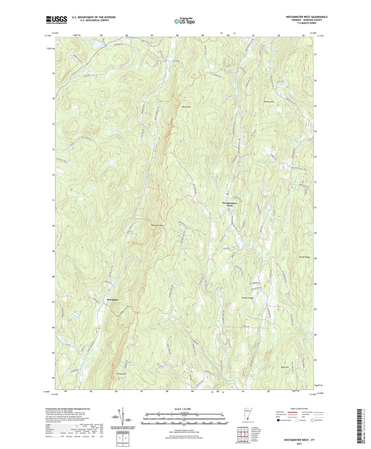
2021 topographic map quadrangle Westminster West in the state of Vermont. Scale: 1:24000. Based on the newly updated USGS 7.5' US Topo map series, this map is in the following counties: Windham. The map contains contour data, water features, and other items you are used to seeing on USGS maps, but also has updated roads and other features. This is the next generation of topographic maps. Printed on high-quality waterproof paper with UV fade-resistant inks.
Quads adjacent to this one:
West: Townshend
Northwest: Windham
North: Saxtons River
East: Walpole
Southeast: Spofford
South: Putney
Southwest: Newfane
Contains the following named places: Athens Brook, Athens Pond, Bear Hill, Bemis Hill, Brookline, Brookline Elementary School, Hartley Hill, Hickory Ridge, Putney Grammar School, Putney Mountain, Rocky Ridge, Round School, Town of Athens, Town of Brookline, Town of Westminster, Westminster Volunteer Fire and Rescue, Westminster West, Westminster West School, Windmill Mountain, ZIP Code: 05346