MyTopo
Windham Vermont US Topo Map
Couldn't load pickup availability
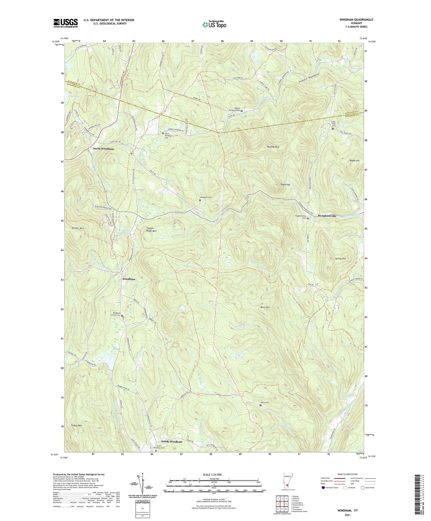
2024 topographic map quadrangle Windham in the state of Vermont. Scale: 1:24000. Based on the newly updated USGS 7.5' US Topo map series, this map is in the following counties: Windham, Windsor. The map contains contour data, water features, and other items you are used to seeing on USGS maps, but also has updated roads and other features. This is the next generation of topographic maps. Printed on high-quality waterproof paper with UV fade-resistant inks.
Quads adjacent to this one:
West: Londonderry
Northwest: Weston
North: Andover
Northeast: Chester
East: Saxtons River
Southeast: Westminster West
South: Townshend
Southwest: Jamaica
Contains the following named places: Blake Hill, Burbee Pond Dam, Burbees Mill, Burbees Pond, Burt Hill, Cobb - West Cemetery, Grafton State Forest, Houghtonville, Houghtonville Cemetery, Howe Brook, Lawrence Four Corners, North Windham, North Windham Airport, North Windham Cemetery, Popple Dungeon Cemetery, Roundy Mountain, South Windham, South Windham Cemetery, South Windham Village Historic District, Spring Hill, Stiles Brook, Stiles Cemetery, Sugarloaf, Tater Hill Golf Course, Tater Hill Ski Center, Timber Ridge Mountain, Town of Windham, Turkey Mountain, Williams River State Forest, Willie Brook, Windham, Windham Center Cemetery, Windham Congregational Church, Windham Elementary School, Windham Village Historic District, Windham Volunteer Fire and Rescue Company, Woodburn Cemetery, ZIP Codes: 05146, 05359