MyTopo
Barley Virginia US Topo Map
Couldn't load pickup availability
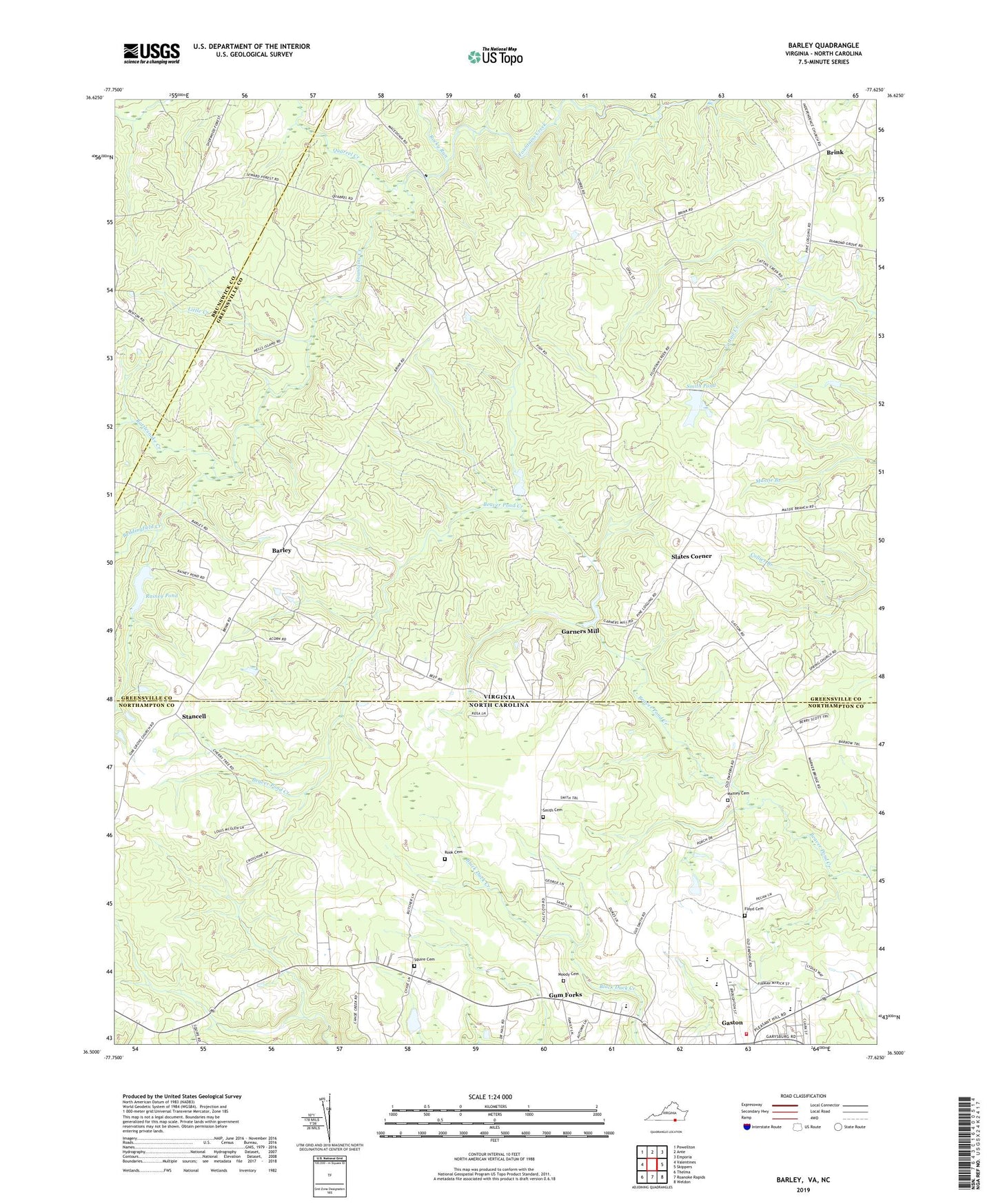
2022 topographic map quadrangle Barley in the states of Virginia, North Carolina. Scale: 1:24000. Based on the newly updated USGS 7.5' US Topo map series, this map is in the following counties: Greensville, Northampton, Brunswick. The map contains contour data, water features, and other items you are used to seeing on USGS maps, but also has updated roads and other features. This is the next generation of topographic maps. Printed on high-quality waterproof paper with UV fade-resistant inks.
Quads adjacent to this one:
West: Valentines
Northwest: Powellton
North: Ante
Northeast: Emporia
East: Skippers
Southeast: Weldon
South: Roanoke Rapids
Southwest: Thelma
This map covers the same area as the classic USGS quad with code o36077e6.
Contains the following named places: Barley, Beddingfield Creek, Bethany Church, Brink, District 2, Ebenezer Church, Floyd Cemetery, Fontaine Creek Church, Forrest Hill Church, Garners Dam, Garners Mill, Garners Millpond, Gaston, Gaston Fire Department, Gum Forks, Hicksford District, Jerusalem Church, Little Creek, Macedonia Church, Massey Cemetery, Moody Cemetery, Oak Grove Church, Paris Store, Quarrel Creek, Rainey Dam, Rainey Pond, Rattlesnake Creek, Rocky Run, Rook Cemetery, Royland School, Shiloh Church, Slates Corner, Smith Cemetery, Smith Pond, Smiths Dam, Squire Cemetery, Squire School, Stancell, Township of Gaston, ZIP Code: 27832