MyTopo
Beulahville Virginia US Topo Map
Couldn't load pickup availability
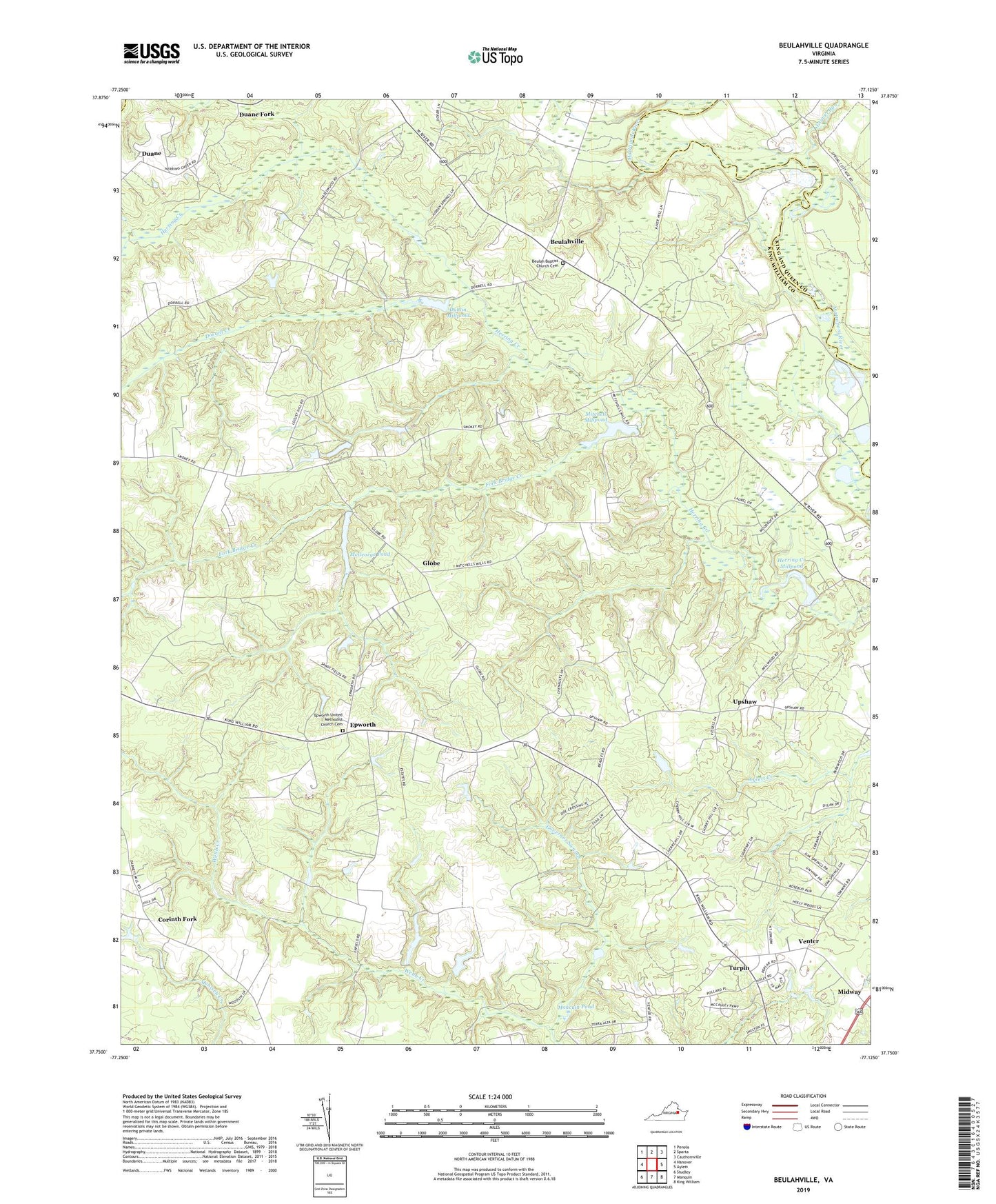
2019 topographic map quadrangle Beulahville in the state of Virginia. Scale: 1:24000. Based on the newly updated USGS 7.5' US Topo map series, this map is in the following counties: King William, King and Queen, Caroline. The map contains contour data, water features, and other items you are used to seeing on USGS maps, but also has updated roads and other features. This is the next generation of topographic maps. Printed on high-quality waterproof paper with UV fade-resistant inks.
Quads adjacent to this one:
West: Hanover
Northwest: Penola
North: Sparta
Northeast: Cauthornville
East: Aylett
Southeast: King William
South: Manquin
Southwest: Studley
Contains the following named places: Beulah Baptist Church Cemetery, Beulah Church, Beulahville, Beulahville School, Campbells Fork, Corinth Church, Corinth Fork, Dorrell Creek, Duane, Duane Fork, Dublin Millpond, Dublin Millpond Dam, Epworth, Epworth United Methodist Church Cemetery, Fork Bridge Creek, Globe, Governor Swamp, Gravel Run, Gutherie Dam, Gutherie Pond, Hall Dam, Herring Creek Mill, Herring Creek Millpond, Herring Creek Millpond Dam, Kellys Dam, Mangohick District, McGeorge Pond, Midway, Mitchell Mill, Mitchell Millpond, Mitchell Millpond Dam, Moncuin Pond, Mount Sinai Church, Pollards Corner, Providence Church, Saint Pauls Church, Turpin, Upshaw, Venter, Venter School, ZIP Code: 23009