MyTopo
Sparta Virginia US Topo Map
Couldn't load pickup availability
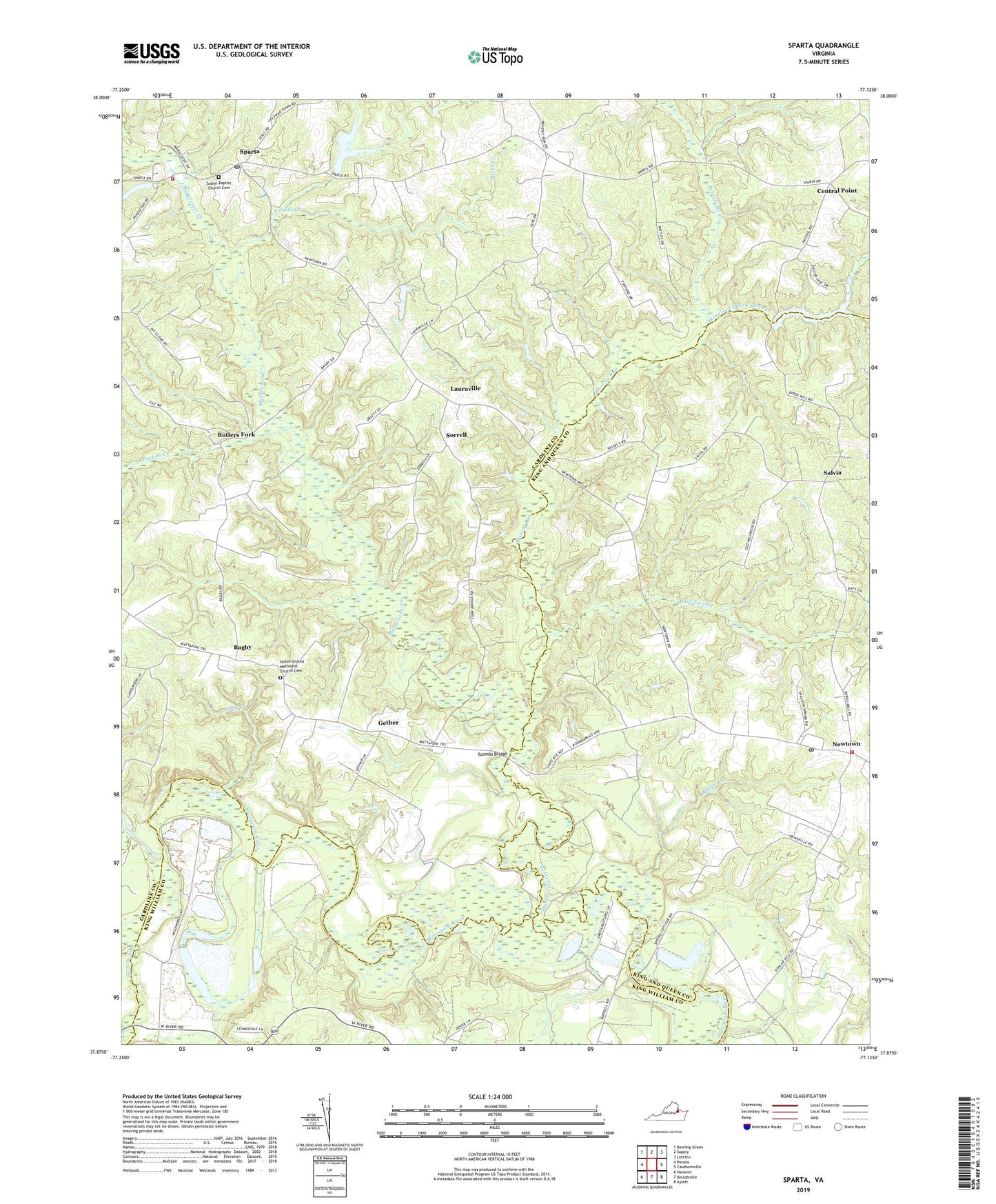
2022 topographic map quadrangle Sparta in the state of Virginia. Scale: 1:24000. Based on the newly updated USGS 7.5' US Topo map series, this map is in the following counties: Caroline, King and Queen, King William. The map contains contour data, water features, and other items you are used to seeing on USGS maps, but also has updated roads and other features. This is the next generation of topographic maps. Printed on high-quality waterproof paper with UV fade-resistant inks.
Quads adjacent to this one:
West: Penola
Northwest: Bowling Green
North: Supply
Northeast: Loretto
East: Cauthornville
Southeast: Aylett
South: Beulahville
Southwest: Hanover
This map covers the same area as the classic USGS quad with code o37077h2.
Contains the following named places: Alps, Bagby, Beale, Beverly, Beverly Run, Boiler Run, Boot Swamp, Bowling Green District, Broadus Corner, Butlers Fork, Byrds Mill Dam, Byrds Millpond, Caroline County Fire and Rescue / Sparta Volunteer Fire Department Company 4, Central Point, Cook Swamp, Doctors Creek, Gether, Hays Farm Dam, Jacks Creek, Jerusalem Church, Jerusalem School, Jiles Dam, Jiles Millpond, King and Queen Swamp, Lauraville, Long Creek, Malden Creek, Maracossic Creek, Newtown, Newtown Historic District, Newtown Post Office, Root Swamp, Saint Stephens Church, Salem Baptist Church Cemetery, Salem Church, Salvia, Shiloh Church, Shiloh United Methodist Church Cemetery, Sorrell, Sparta, Sparta Post Office, Thelma Pitts Dam, Toombs Bridge, Upper King and Queen Volunteer Fire Department, ZIP Code: 23126