MyTopo
Penola Virginia US Topo Map
Couldn't load pickup availability
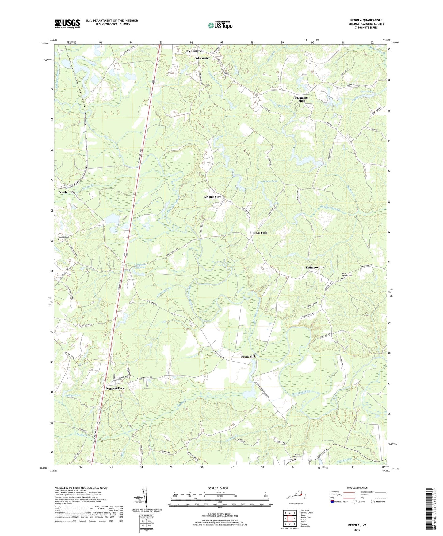
2022 topographic map quadrangle Penola in the state of Virginia. Scale: 1:24000. Based on the newly updated USGS 7.5' US Topo map series, this map is in the following counties: Caroline. The map contains contour data, water features, and other items you are used to seeing on USGS maps, but also has updated roads and other features. This is the next generation of topographic maps. Printed on high-quality waterproof paper with UV fade-resistant inks.
Quads adjacent to this one:
West: Ruther Glen
Northwest: Woodford
North: Bowling Green
Northeast: Supply
East: Sparta
Southeast: Beulahville
South: Hanover
Southwest: Ashland
This map covers the same area as the classic USGS quad with code o37077h3.
Contains the following named places: Camp Parater, Campbells Corner, Campbells Dam, Campbells Millpond, Chenaults Shop, Cobbins Creek, Collins Dam, Collins Pond, DeJarnette, Doggetts Fork, File, File School, Goose Pond, Greens Pond, Holy Trinity Church, Kemp Corner, Kidds Fork, Lake Holly, Lake Holly Dam, Margaret Pitts Dam, Mill Creek, Mount Herman Cemetery, Mount Hermon Church, Mount Salem Church, Mount Salem School, Mount Tabor Church, Mount Vernon Cemetery, Mount Vernon Church, No Mans Corner, Oak Corner, Pendleton School, Penola, Phillips Pond, Pitts Pond, Polecat Creek, Providence Church, Reedy Creek, Reedy Mill, Reedy Mill Dam, Reedy Millpond, Rosehill Cemetery, Saint James Church, Saint James School, Shumansville, Shumanville School, Tanyard Swamp, Union Swamp, Wrights Fork