MyTopo
Walkers Virginia US Topo Map
Couldn't load pickup availability
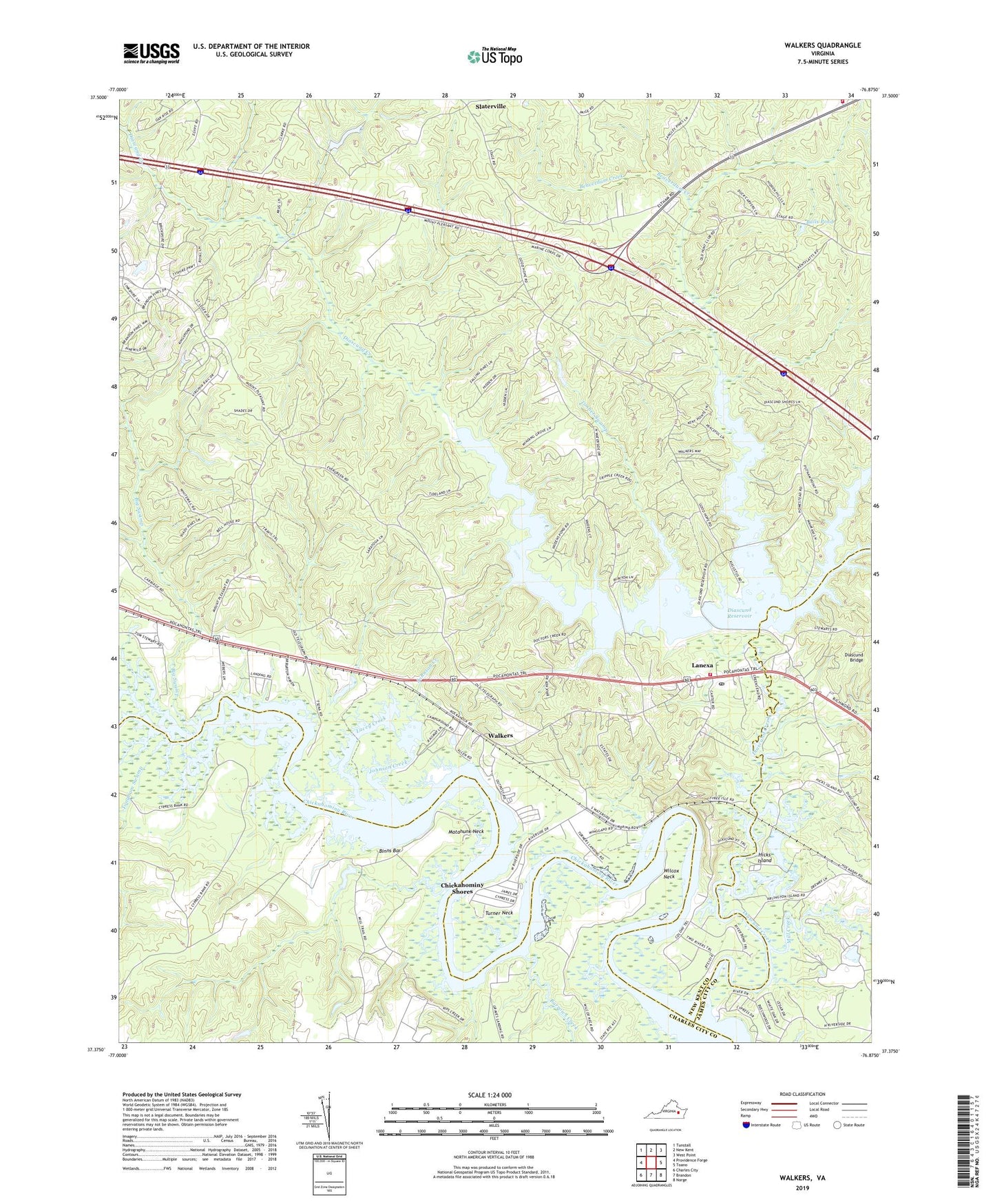
2022 topographic map quadrangle Walkers in the state of Virginia. Scale: 1:24000. Based on the newly updated USGS 7.5' US Topo map series, this map is in the following counties: New Kent, Charles City, James City. The map contains contour data, water features, and other items you are used to seeing on USGS maps, but also has updated roads and other features. This is the next generation of topographic maps. Printed on high-quality waterproof paper with UV fade-resistant inks.
Quads adjacent to this one:
West: Providence Forge
Northwest: Tunstall
North: New Kent
Northeast: West Point
East: Toano
Southeast: Norge
South: Brandon
Southwest: Charles City
This map covers the same area as the classic USGS quad with code o37076d8.
Contains the following named places: Balls Pond, Barnes Swamp, Barrows Creek, Beaverdam Creek, Big Swamp, Binns Bar, Chickahominy Lake, Chickahominy Outpost, Chickahominy Shores, Colonial Golf Club, Colonial Harbor Marina, Cypress Bank Landing, Diascund Bridge, Diascund Creek, Diascund Creek Reservoir, Diascund Dam, District 5, Eastern Chickahominy Tribal Designated Statistical Area, Ebenezer Church, Fish Hole Landing, Golf Club at Brickshire, Good Hope Church, Goodhope School, Graves Landing, Hicks Island, Johnson Creek, Lacey Creek, Lanexa, Lanexa Post Office, Liberty Church, Matahunk Neck, Mill Creek, Mount Pleasant Church, New Kent Fire - Rescue Station 3 / Weir Creek Volunteer Emergency Services, New Kent Fire - Rescue Station 4 / Lanexa Volunteer Fire and Emergency Medical Services, Osborn Landing, Rock-A-Hock, Slaterville, Timber Swamp, Tonyham Swamp, Tradition Golf Club at Royal New Kent, Tsena Commoko Church, Turner Neck, Vaidens Pond, Wahrani Swamp, Walkers, WDCK-FM (Williamsburg), Wilcox Neck, Windsor Shades, ZIP Code: 23089