MyTopo
Chilhowie Virginia US Topo Map
Couldn't load pickup availability
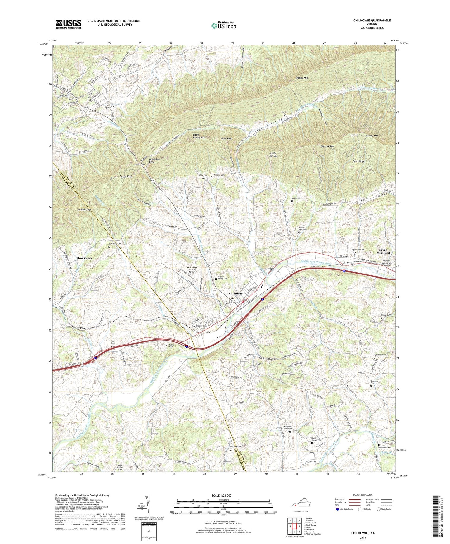
2019 topographic map quadrangle Chilhowie in the state of Virginia. Scale: 1:24000. Based on the newly updated USGS 7.5' US Topo map series, this map is in the following counties: Smyth, Washington. The map contains contour data, water features, and other items you are used to seeing on USGS maps, but also has updated roads and other features. This is the next generation of topographic maps. Printed on high-quality waterproof paper with UV fade-resistant inks.
Quads adjacent to this one:
West: Glade Spring
Northwest: Saltville
North: Broadford
Northeast: Chatham Hill
East: Marion
Southeast: Whitetop Mountain
South: Konnarock
Southwest: Damascus
Contains the following named places: Aspenvale Cemetery, Beatie Cemetery, Bettys Knob, Big Low Gap, Bishop Branch, Brindle Hollow, Campbells Chapel, Carlock Church, Carlock Creek, Chilhowie, Chilhowie Christian Church, Chilhowie District, Chilhowie Elementary School, Chilhowie Fire Department, Chilhowie High School, Chilhowie Middle School, Chilhowie Police Department, Chilhowie Post Office, Chilhowie Rescue Squad, Chilhowie Town Hall, Cleghorn Valley, Cleghorn Valley Church, Cleghorn Valley Creek, Cleghorn Valley School, Copenhaver Cemetery, Farris Cemetery, Flatwood School, Fleet, Gallahorn School, Goat Knob, Gollehon Cemetery, Greever Branch, Greever Cemetery, Horseshoe Bend, Huff Airport, Hutton Creek, Jamison Gap, Jones Cemetery, Kell Cemetery, Little Brushy Mountain, Little Low Gap, Lyons Gap, McClure Cemetery, McCready Cemetery, McKees Store, Meek Cemetery, Middle Fork Cemetery, Middle Fork Church, Mountain View Cemetery, Mountain View Church, Parker Branch, Peak Cemetery, Phipps Cemetery, Pioneer Memorial Bridge, Pleasant Heights, Plum Creek, Riverside, Riverside Baptist Church, Riverside Cemetery, Saint Clair Bottom, Saint Clair Bottom Primitive Baptist Church, Saint Clair Creek, Saint James Cemetery, Saint James Church, Sand Ridge, Seven Mile Ford, Seven Mile Ford Census Designated Place, Shular Hollow, Stone Coal Hollow, Sugar Grove Church, Sugar Grove School, Sulphur Spring Cemetery, Sulphur Spring Church, Sulphur Spring Creek, Sulphur Springs Heights, Tate Chapel, Tattle Branch, Town of Chilhowie, Washington Springs, Washington Springs Church, White Oak Stand Airport, Williams Cemetery, WXMY-AM (Saltville)