MyTopo
Damascus Virginia US Topo Map
Couldn't load pickup availability
Also explore the Damascus Forest Service Topo of this same quad for updated USFS data
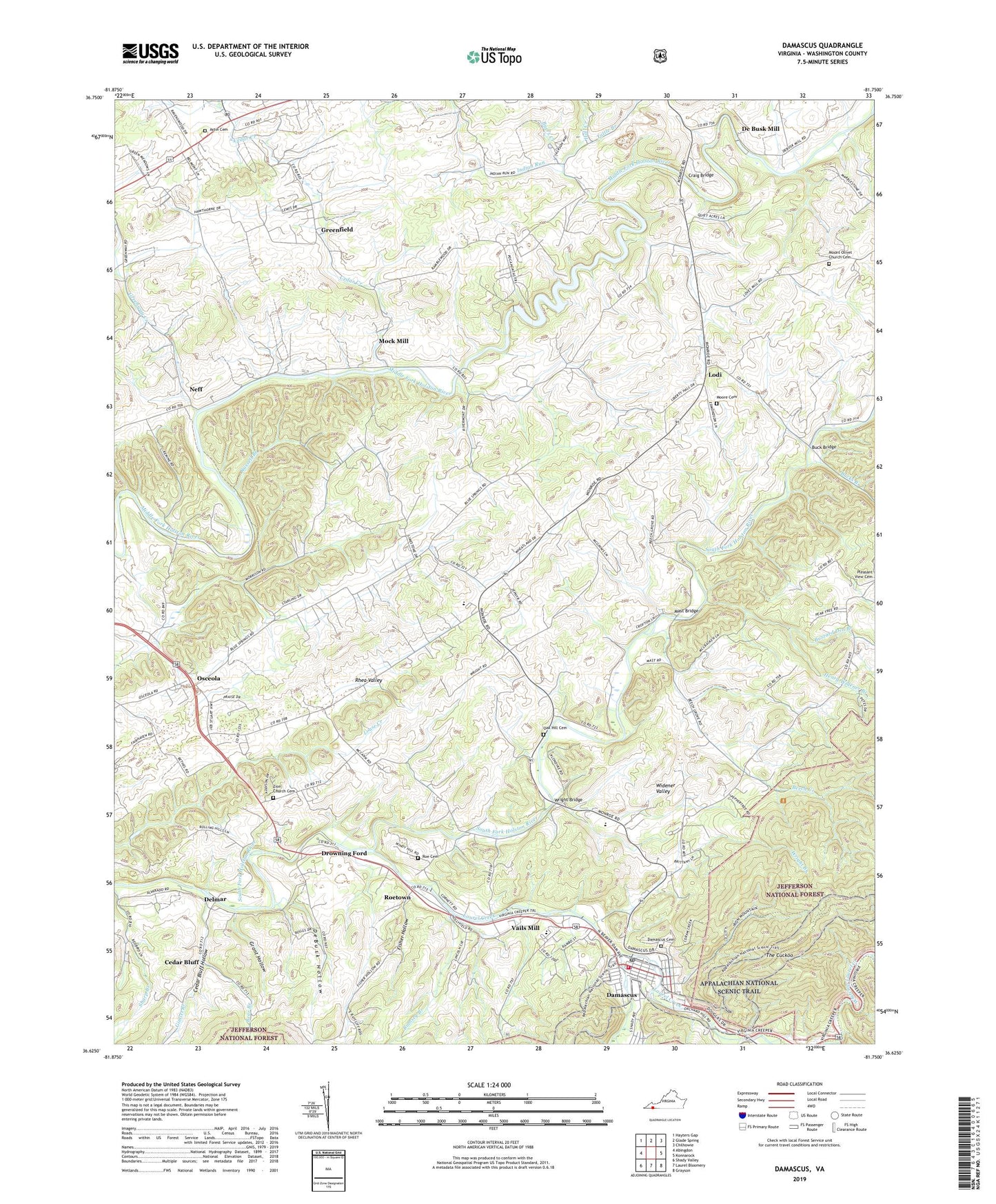
2022 topographic map quadrangle Damascus in the state of Virginia. Scale: 1:24000. Based on the newly updated USGS 7.5' US Topo map series, this map is in the following counties: Washington. The map contains contour data, water features, and other items you are used to seeing on USGS maps, but also has updated roads and other features. This is the next generation of topographic maps. Printed on high-quality waterproof paper with UV fade-resistant inks.
Quads adjacent to this one:
West: Abingdon
Northwest: Hayters Gap
North: Glade Spring
Northeast: Chilhowie
East: Konnarock
Southeast: Grayson
South: Laurel Bloomery
Southwest: Shady Valley
This map covers the same area as the classic USGS quad with code o36081f7.
Contains the following named places: Astin Cemetery, Bear Branch, Beaverdam Creek, Beech Creek, Beech Grove School, Buck Bridge, Bucks Branch, Buzzard Den Branch, Byers Creek, Camp Pocahontas, Cedar Bluff, Cedar Bluff Hollow, Cedar Bluff United Methodist Church, Cedar Creek, Chestnut Ridge, Clark Mountain Trail, Craig Bridge, Damascus, Damascus Cemetery, Damascus Fire Department, Damascus Middle School, Damascus Post Office, Damascus Town Police Department, Damascus Volunteer Rescue Squad, De Busk Mill, DeBusk Hollow, Delmar, Drowning Ford, East Fork Cedar Creek, Ebbing Spring Church, Edmondson Dam, Fisher Hollow, Gimlet Branch, Grant Hollow, Greenfield, Greenway Creek, Groseclose Corner, Hall Creek, Henry Widener Branch, High Point Elementary School, Holston High School, Honey Locust Branch, Indian Run, Indoor Farms Greenhouses, Ketchum Branch, Ketron Corner, Laurel School, Liberty Hall School, Lodi, Luther Chapel, Mast Bridge, Middle Fork Holston River, Mock Mill, Moore Cemetery, Mount Olivet Church, Mount Olivet Church Cemetery, Neff, New Zion School, Oak Hill Cemetery, Osceola, Pleasant View Church, Ramsey Branch, Rhea Valley, Rhea Valley Elementary School, Rock Spring Church, Roe Cemetery, Roetown, Russell Branch, Snodgrass, Tattle Branch, Taylor District, The Cuckoo, Town of Damascus, Vails Mill, Vestal, West Fork Cedar Creek, Wright Branch, Wright Bridge, Wright Chapel, Wright Hollow, Zion Church, Zion Church Cemetery