MyTopo
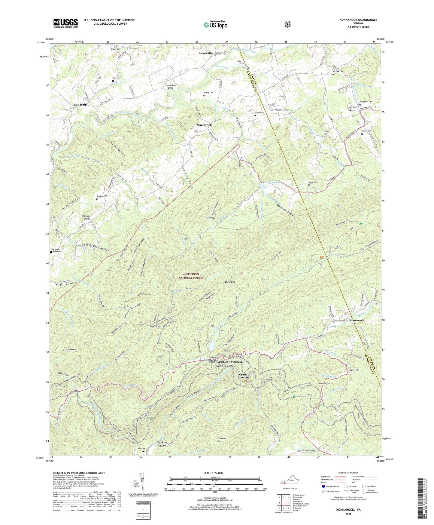
Konnarock Virginia US Topo Map
Couldn't load pickup availability
Also explore the Konnarock Forest Service Topo of this same quad for updated USFS data
2022 topographic map quadrangle Konnarock in the state of Virginia. Scale: 1:24000. Based on the newly updated USGS 7.5' US Topo map series, this map is in the following counties: Washington, Smyth. The map contains contour data, water features, and other items you are used to seeing on USGS maps, but also has updated roads and other features. This is the next generation of topographic maps. Printed on high-quality waterproof paper with UV fade-resistant inks.
Quads adjacent to this one:
West: Damascus
Northwest: Glade Spring
North: Chilhowie
Northeast: Marion
East: Whitetop Mountain
Southeast: Park
South: Grayson
Southwest: Laurel Bloomery
This map covers the same area as the classic USGS quad with code o36081f6.
Contains the following named places: Azen, Azen Church, Back Fork, Barrack School, Bear Knob, Bear Tree Fisherman Parking, Bear Tree Gap, Bear Tree Group Camp, Beartree Family Camp, Beech Mountain, Big Hill, Big Knob Ridge, Big Laurel Creek, Bishop Cemetery, Brush Creek, Burnt Cabin Creek, Burnt Cabin Hollow, Buzzard Den Branch, Buzzard Den Ridge, Byars Cemetery, Chestnut Branch, Chestnut Flats, Chestnut Mountain, Chestnut Ridge, Clark Mountain, Coe Knob, Creasy Hollow, Crecy Branch, Creek Junction, Cullop Branch, Davis Cemetery, Dry Branch, Dry Fork, Feather Camp Lookout Tower, Feathercamp Branch, Feathercamp Ridge, Frank Coe Hollow, Friendship, Grassy Hollow, Greasy Rock Hollow, Green Cove Church, Green Cove Creek, Green Cove School, Grosses Creek, Grosses Creek Church, Grosses Mountain, Hash Cemetery, Hawthorne Knob, Horseshoe Bend, Iron Mountain Trail, Iron Mountains, James Cemetery, Joe Doss Hollow, Kelly Chapel, Kelly Chapel Cemetery, Ketchum Cemetery, Konnarock, Konnarock Cemetery, Laurel Mountain, Lebanon Church, Lewis Cemetery, Little Laurel Creek, Little Mountain, Little Rock Church, Locust Ridge, Locust Ridge Branch, Lost Mountain, Loves Mill, Macedonia Cemetery, Macedonia Church, Masada, Masada Church, McClure Cemetery, Mill Creek, Murrayfield, Murrayfield Branch, Patterson Branch, Pennington Branch, Piedmont School, Piney Ridge, Pleasant Home Church, Pleasant View Cemetery, Poge Branch, Pole Bridge Branch, Rafferty Cove, Rafferty Cove Branch, Raffety Knob, River Knobs, Rush Creek, Rush Creek Church, Sandy Flats, Shaw Gap, Short Mountain, Star Hill Branch, Steep Branch, Straight Branch, Straight Mountain, Sturgill Branch, Summit Cut, Tucker Cemetery, Union Church, White Oak Branch, Widener Spring, Widener Valley, Widener Valley School, ZIP Codes: 24236, 24319