MyTopo
Saltville Virginia US Topo Map
Couldn't load pickup availability
Also explore the Saltville Forest Service Topo of this same quad for updated USFS data
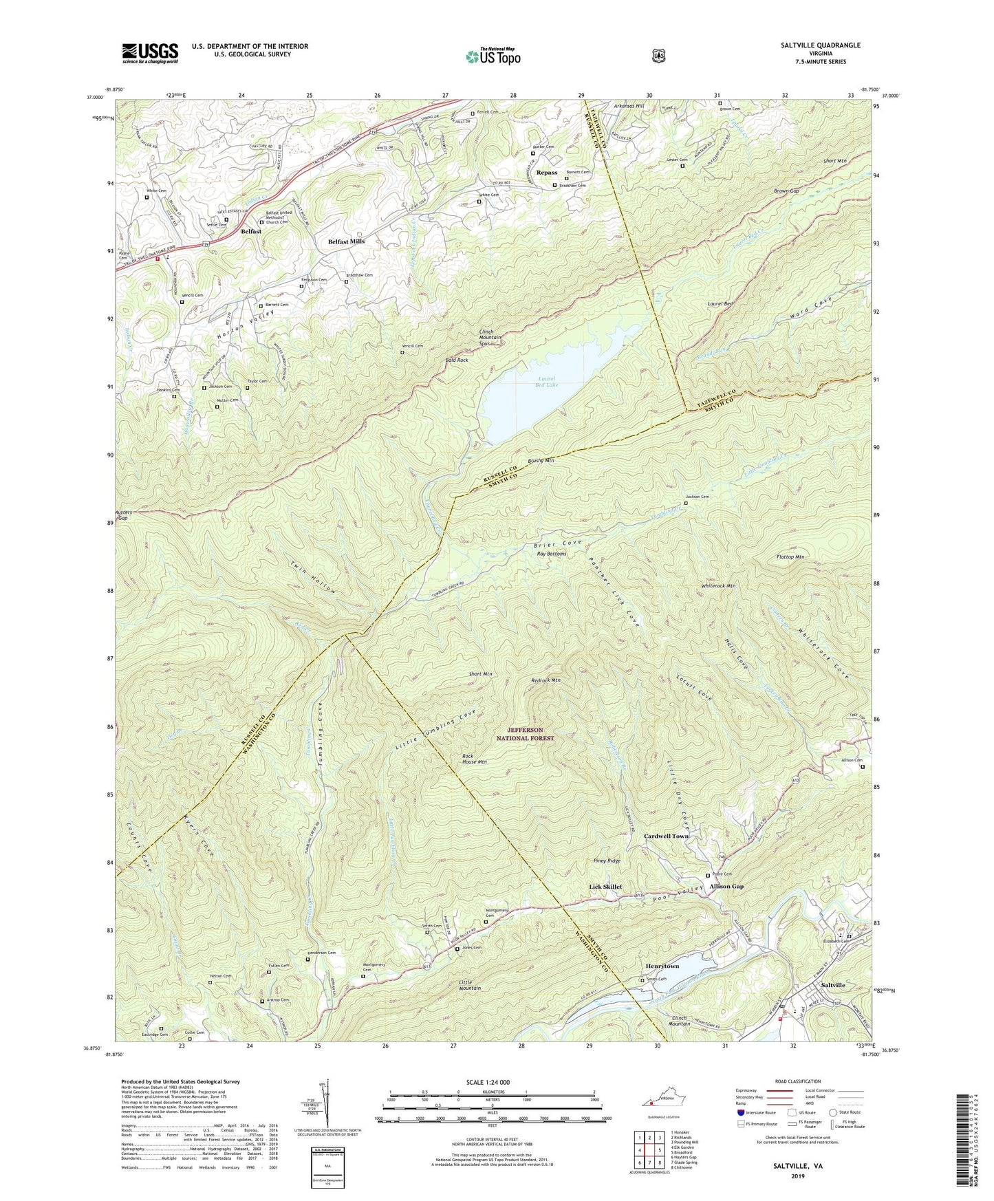
2022 topographic map quadrangle Saltville in the state of Virginia. Scale: 1:24000. Based on the newly updated USGS 7.5' US Topo map series, this map is in the following counties: Russell, Smyth, Washington, Tazewell. The map contains contour data, water features, and other items you are used to seeing on USGS maps, but also has updated roads and other features. This is the next generation of topographic maps. Printed on high-quality waterproof paper with UV fade-resistant inks.
Quads adjacent to this one:
West: Elk Garden
Northwest: Honaker
North: Richlands
Northeast: Pounding Mill
East: Broadford
Southeast: Chilhowie
South: Glade Spring
Southwest: Hayters Gap
This map covers the same area as the classic USGS quad with code o36081h7.
Contains the following named places: Aistrop Cemetery, Allison Cemetery, Allison Gap, Allison Gap Census Designated Place, Anderson Church, Arkansas Hill, Bald Rock, Barnett Cemetery, Belfast, Belfast - Rosedale Volunteer Fire Department, Belfast Elementary School, Belfast Mills, Belfast Mills Church, Belfast United Methodist Church Cemetery, Bradshaw Cemetery, Brier Cove, Broady Bottom, Brown Cemetery, Brown Gap, Cardwell Town, Clinch Mountain Spur, Clinch Mountain State Wildlife Management Area, Collie Cemetery, Counts Cove, Dry Branch, Eastridge Cemetery, Elizabeth Cemetery, Ferguson Cemetery, Ferrell Cemetery, Flattop Mountain, Fullen Cemetery, Halls Cove, Hankins Cemetery, Harmony Church, Helton Cemetery, Henderson Cemetery, Henrytown, Hogwallow Branch, Horton Valley, Jackson Cemetery, Jones Cemetery, Jones Chapel School, Kyers Cove, Laurel Bed, Laurel Bed Creek, Laurel Bed Dam, Laurel Bed Lake, Lester Cemetery, Lester School, Lick Skillet, Little Dry Cove, Little Tumbling Cove, Little Tumbling Creek, Locust Cove, Madam Russell Memorial United Methodist Church, Main Street Church of Christ, Montgomery Cemetery, Mutter Cemetery, Mutters Gap, New Bethel Church, Northwood High School, Panther Lick Cove, Piney Ridge, Poore Cemetery, Ray Bottoms, Red Creek, Redrock Camp, Redrock Mountain, Repass, Robertson Branch, Rock House Mountain, Saint Pauls Episcopal Church, Saltville, Saltville Elementary School, Saltville High School, Saltville Police Department, Saltville Post Office, Saltville Rescue Squad, Saltville Volunteer Fire Department, Settle Cemetery, Short Mountain, Smith Cemetery, Taylor Cemetery, Town of Saltville, Tumbling Cove, Tumbling Cove School, Tumbling Creek College, Twin Hollow, Vencill Cemetery, White Cemetery, White Rock, Whiterock Mountain