MyTopo
Claremont Virginia US Topo Map
Couldn't load pickup availability
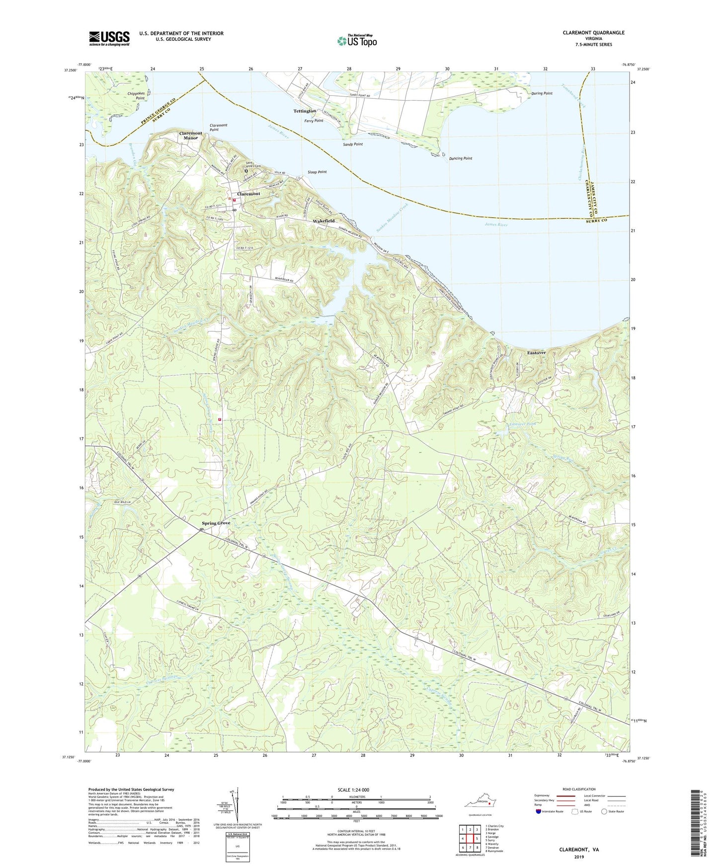
2019 topographic map quadrangle Claremont in the state of Virginia. Scale: 1:24000. Based on the newly updated USGS 7.5' US Topo map series, this map is in the following counties: Surry, Charles City, James City, Prince George. The map contains contour data, water features, and other items you are used to seeing on USGS maps, but also has updated roads and other features. This is the next generation of topographic maps. Printed on high-quality waterproof paper with UV fade-resistant inks.
Quads adjacent to this one:
West: Savedge
Northwest: Charles City
North: Brandon
Northeast: Norge
East: Surry
Southeast: Runnymede
South: Dendron
Southwest: Waverly
Contains the following named places: Brandon Gut, Burdocks Wharf, Camp Lions, Chickahominy River, Chippokes Point, Claremont, Claremont District, Claremont Manor, Claremont Point, Claremont Post Office, Claremont Public Library, Claremont Volunteer Fire Department Station 1, Claremont Volunteer Fire Department Station 2, Claremont Wharf, Claremont-Sandy Point Ferry, Dancing Point, Dancing Point Shoal Channel Range, During Point, Eastover, Eastover Dam, Eastover Pond, Educational Foundation, Ferry Point, Guilford Heights, Mercy Seat Church, Old Dominion School, Pipsico Boy Scout Reservation, Saint Anne's Cemetery, Sandy Point, Sandy Point Wharf, Sloop Point, Spring Grove, Spring Grove Post Office, Spring Grove Swamp, Sunken Meadow Beach, Sunken Meadow Creek, Sunken Meadow Dam, Sunken Meadow Pond, Swanns Point Church, Telluride School, Tettington, Tomahund Creek, Town of Claremont, Upper Chippokes Creek, Wakefield, WARO-AM (Claremont), ZIP Codes: 23881, 23899