
MyTopo
Collierstown Virginia US Topo Map
Couldn't load pickup availability
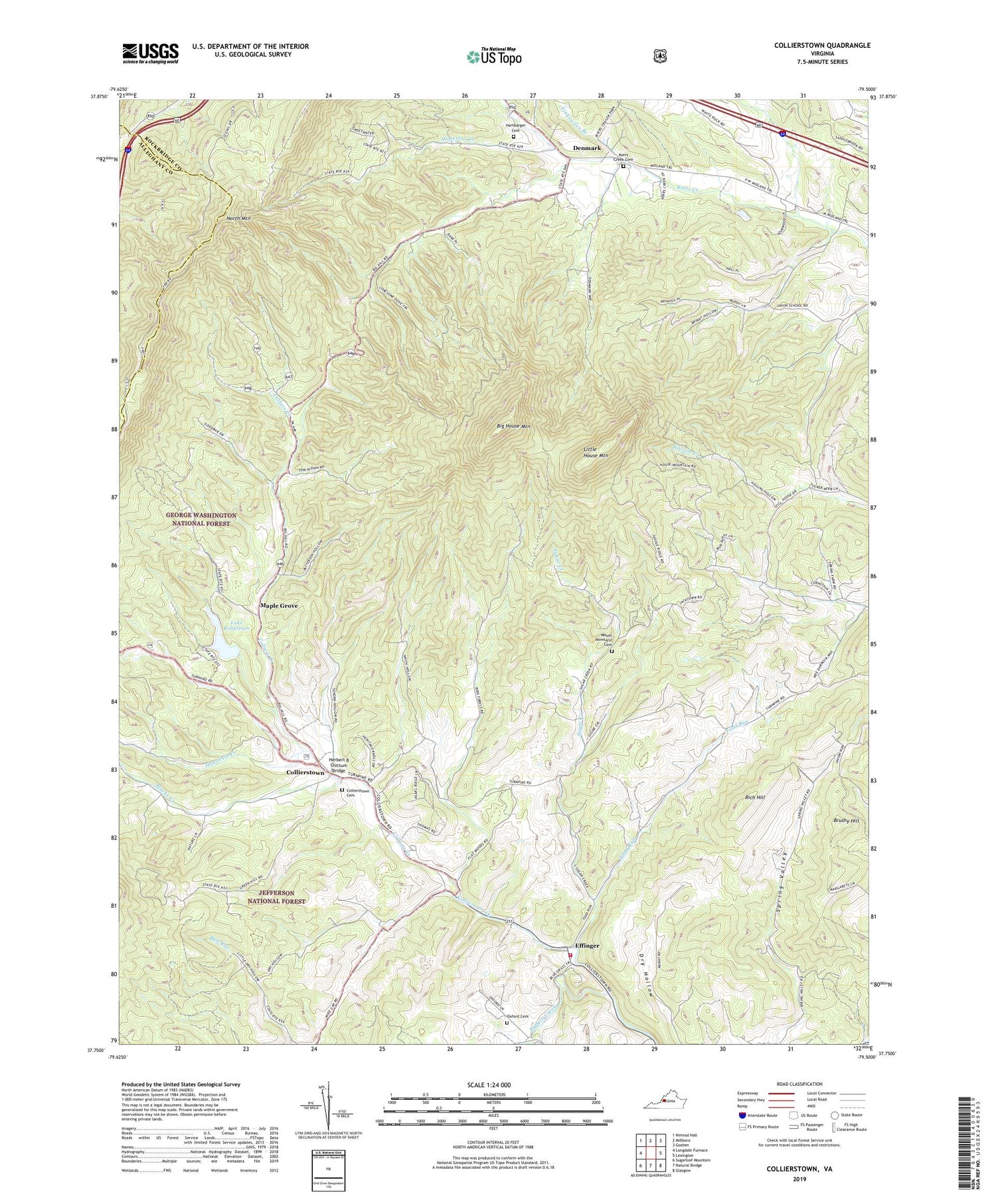
2019 topographic map quadrangle Collierstown in the state of Virginia. Scale: 1:24000. Based on the newly updated USGS 7.5' US Topo map series, this map is in the following counties: Rockbridge, Alleghany. The map contains contour data, water features, and other items you are used to seeing on USGS maps, but also has updated roads and other features. This is the next generation of topographic maps. Printed on high-quality waterproof paper with UV fade-resistant inks.
Quads adjacent to this one:
West: Longdale Furnace
Northwest: Nimrod Hall
North: Millboro
Northeast: Goshen
East: Lexington
Southeast: Glasgow
South: Natural Bridge
Southwest: Sugarloaf Mountain
Contains the following named places: Big House Mountain, Blacks Creek, Colliers Creek, Collierstown, Collierstown Cemetery, Denmark, Denmark School, Effinger, Effinger Elementary School, Effinger Volunteer Fire Department Company 1, Hartbarger Cemetery, Hayslette Creek, Herbert B Chittum Bridge, House Mountain Church, Kerrs Creek Cemetery, Kerrs Creek Church, Kerrs Creek District, Lake Robertson, Lake Robertson Recreational Area, Linkswiler Branch, Little House Mountain, Maple Grove, Mount Moreland Cemetery, Mount Moreland Church, New Hope Church, Oxford Cemetery, Oxford Church, Rich Hill, Robertson Dam, Spring Valley, Spring Valley Church, Spring Valley School, Sugar Creek, Toad Run, Top Dirve Overlook, Unexpected Church, Unexpected School, Waterloo Creek, Waterloo School, ZIP Code: 24450


