MyTopo
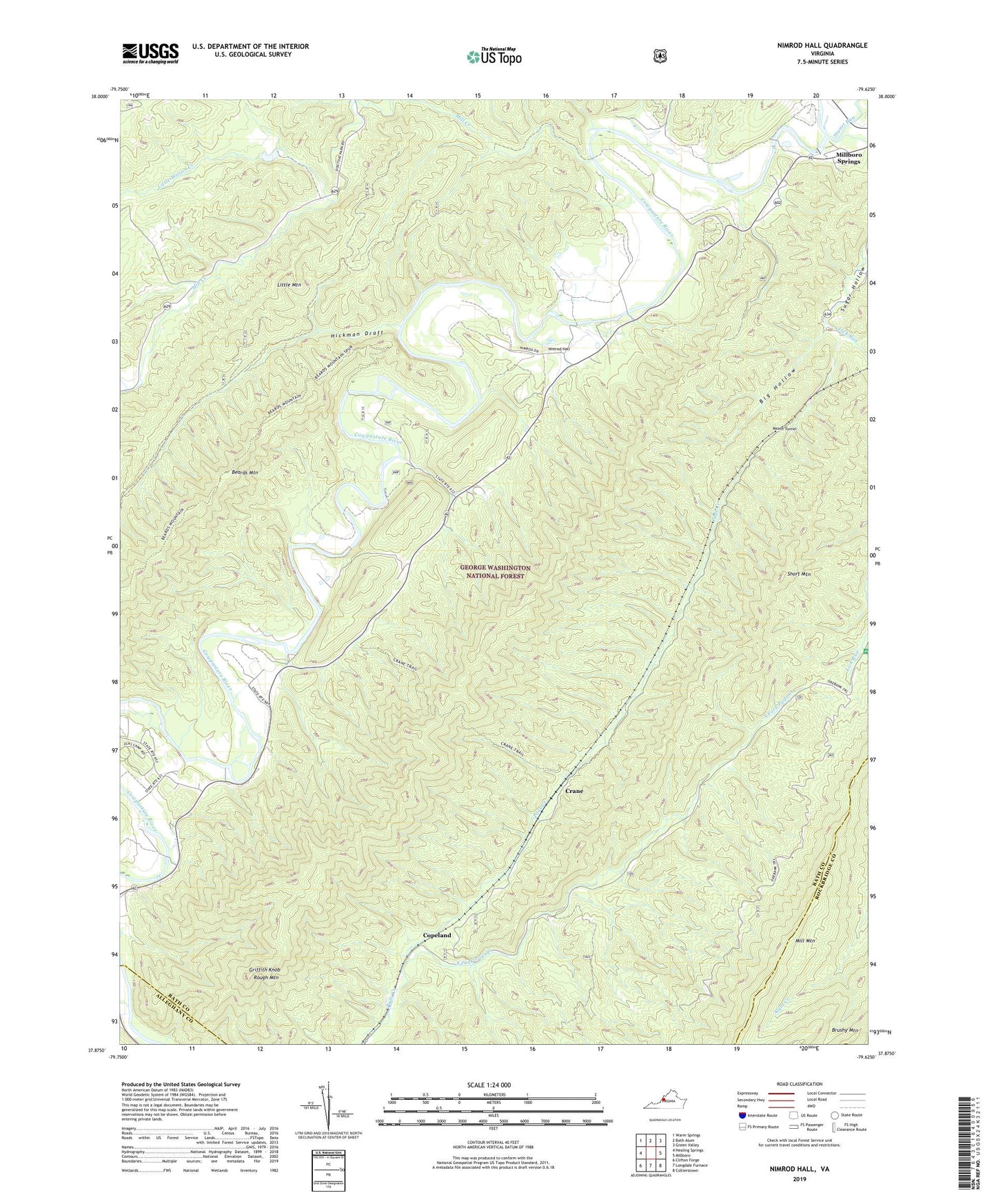
Nimrod Hall Virginia US Topo Map
Couldn't load pickup availability
Also explore the Nimrod Hall Forest Service Topo of this same quad for updated USFS data
2022 topographic map quadrangle Nimrod Hall in the state of Virginia. Scale: 1:24000. Based on the newly updated USGS 7.5' US Topo map series, this map is in the following counties: Bath, Rockbridge, Alleghany. The map contains contour data, water features, and other items you are used to seeing on USGS maps, but also has updated roads and other features. This is the next generation of topographic maps. Printed on high-quality waterproof paper with UV fade-resistant inks.
Quads adjacent to this one:
West: Healing Springs
Northwest: Warm Springs
North: Bath Alum
Northeast: Green Valley
East: Millboro
Southeast: Collierstown
South: Longdale Furnace
Southwest: Clifton Forge
This map covers the same area as the classic USGS quad with code o37079h6.
Contains the following named places: Bear Loop Hunt Club Dam, Beards Mountain Trail, Big Hollow, Boys Camp, Bubbling Spring Recreation Area, Copeland, Crane, Crane Trail, Griffith Knob, Hickman Draft, Horeb Baptist Church, Indian Hill Church, Lick Run, Limekiln Hollow, Little Mountain, Little Wilson Creek, Mason Tunnel, Mill Creek, Millboro District, Nimrod Hall, Orebank Trail, Rich Hole Trail, Roses Run, Rough Mountain, Rough Mountain Wilderness, Shop Run, Short Mountain, South Fork Pads Creek, Spring Branch, Stuart Run