MyTopo
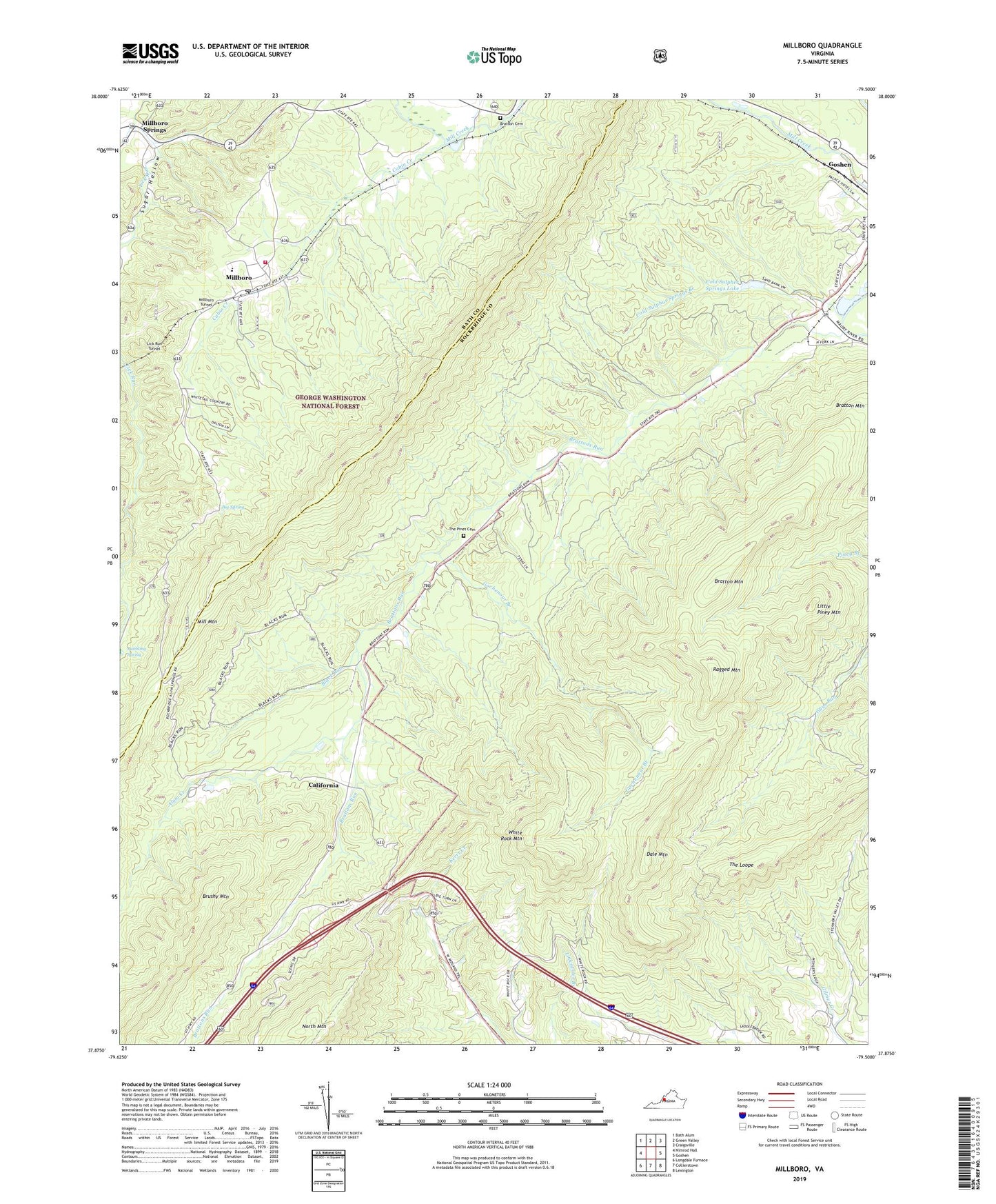
Millboro Virginia US Topo Map
Couldn't load pickup availability
Also explore the Millboro Forest Service Topo of this same quad for updated USFS data
2022 topographic map quadrangle Millboro in the state of Virginia. Scale: 1:24000. Based on the newly updated USGS 7.5' US Topo map series, this map is in the following counties: Rockbridge, Bath. The map contains contour data, water features, and other items you are used to seeing on USGS maps, but also has updated roads and other features. This is the next generation of topographic maps. Printed on high-quality waterproof paper with UV fade-resistant inks.
Quads adjacent to this one:
West: Nimrod Hall
Northwest: Bath Alum
North: Green Valley
Northeast: Craigsville
East: Goshen
Southeast: Lexington
South: Collierstown
Southwest: Longdale Furnace
This map covers the same area as the classic USGS quad with code o37079h5.
Contains the following named places: Alum Creek, Big Spring, Black Run, Bratton Cemetery, Bratton Mountain, Brattons Run, Bubbling Spring, Cabin Creek, California, California Church, Calvary Baptist Church, Camp Alkulana, Cold Sulpher Springs Dam, Cold Sulpher Springs Lake, Cold Sulphur Springs Branch, Dale Mountain, Gochenour Branch, Gochenour Hunter Access Trail, Goshen Wildlife Management Area, Lick Run Tunnel, Little Piney Mountain, Millboro, Millboro Area Rescue Squad, Millboro Census Designated Place, Millboro Elementary School, Millboro High School, Millboro Post Office, Millboro Springs, Millboro Tunnel, Millboro Volunteer Fire Association, North Mountain Trail, Ragged Mountain, Rockbridge Alum Springs, Rockbridge Alum Springs Historic District, Sugar Hollow, Sycamore Valley, Sycamore Valley Church, The Loop, The Pines Cemetery, Town of Goshen, White Rock Mountain, Wilson School