MyTopo
Concord Virginia US Topo Map
Couldn't load pickup availability
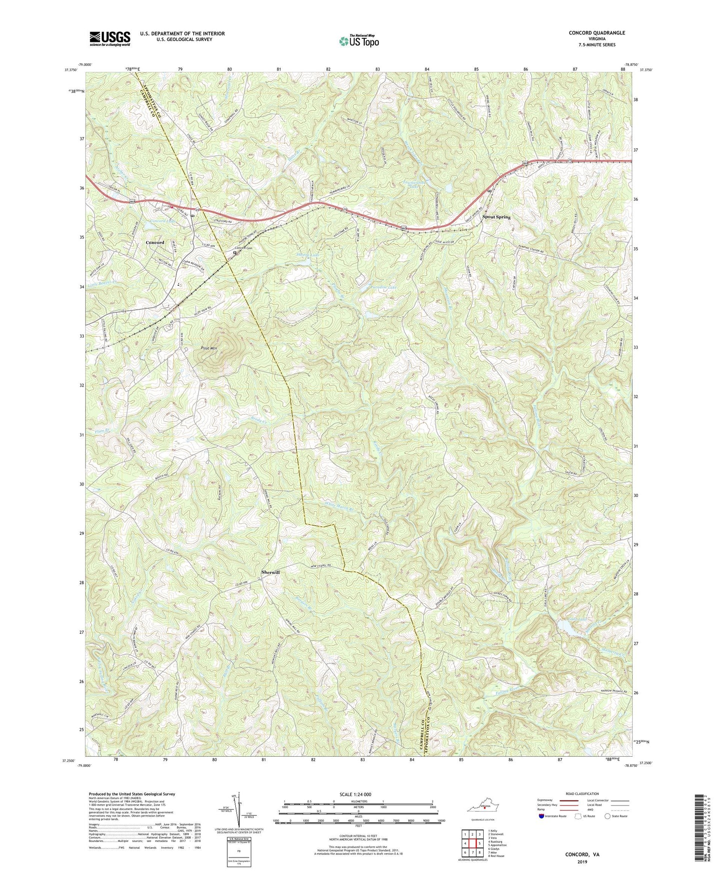
2022 topographic map quadrangle Concord in the state of Virginia. Scale: 1:24000. Based on the newly updated USGS 7.5' US Topo map series, this map is in the following counties: Appomattox, Campbell. The map contains contour data, water features, and other items you are used to seeing on USGS maps, but also has updated roads and other features. This is the next generation of topographic maps. Printed on high-quality waterproof paper with UV fade-resistant inks.
Quads adjacent to this one:
West: Rustburg
Northwest: Kelly
North: Stonewall
Northeast: Vera
East: Appomattox
Southeast: Red House
South: Mike
Southwest: Gladys
This map covers the same area as the classic USGS quad with code o37078c8.
Contains the following named places: Bethany Church, Concord, Concord Cemetery, Concord Census Designated Place, Concord Elementary School, Concord Lake, Concord Post Office, Concord Rescue Squad, Concord Volunteer Fire Department, Earlys Chapel, East Fork Falling River Number Seven Dam, Fairview Youth Camp, Fairview Youth Camp Dam, Gala Lake, Martins Creek, Moody Dam, Mount Shiloh Church, Mountain Branch, Mulberry Creek, Naked Creek, New Concord Church, Old Concord Church, Old Pilot, Paradise Lake, Peaceful Grove Baptist Church, Peaceland Farm, Phoebe Branch, Phoebe Lake, Pilot Mountain, Pilot Mountain Church, Reedy Creek, Reedy Spring Church, Salem United Methodist Church, Sherwill, Sherwill Community Center, Spout Spring, Spout Spring Post Office, Townwanda Lake, White Marsh Branch, ZIP Codes: 24538, 24593