MyTopo
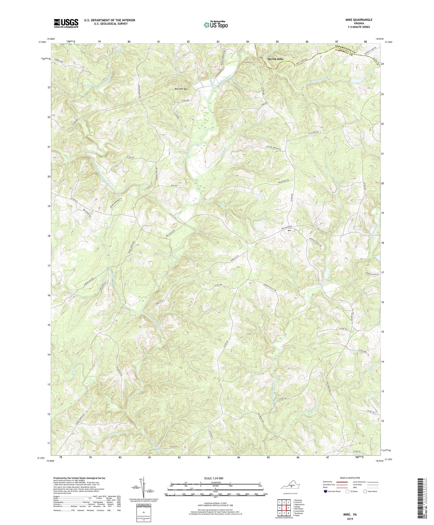
Mike Virginia US Topo Map
Couldn't load pickup availability
2022 topographic map quadrangle Mike in the state of Virginia. Scale: 1:24000. Based on the newly updated USGS 7.5' US Topo map series, this map is in the following counties: Campbell, Appomattox. The map contains contour data, water features, and other items you are used to seeing on USGS maps, but also has updated roads and other features. This is the next generation of topographic maps. Printed on high-quality waterproof paper with UV fade-resistant inks.
Quads adjacent to this one:
West: Gladys
Northwest: Rustburg
North: Concord
Northeast: Appomattox
East: Red House
Southeast: Aspen
South: Brookneal
Southwest: Long Island
This map covers the same area as the classic USGS quad with code o37078b8.
Contains the following named places: Bargers Branch, Bear Creek, Bull Branch, Entry Creek, Falling River School, Gravel Ridge, Hat Creek Church, Hat Creek School, Jacobs Creek, Jerrys Branch, Jones Dam, Jones Pond, Lawsons Creek, Little Falling River Number Three Dam, Little Falling River Number Two Dam, Long Branch, Lucks Branch, Mike, Mill Creek, Mollys Creek, Morris Church, New Bethel Church, Pulliam Branch, Rattlesnake Creek, Red Oak Mountain, Saint Lukes Church, South Fork Falling River, Spring Mills, Suck Creek, Union Hill Church