MyTopo
Conner Lake Virginia US Topo Map
Couldn't load pickup availability
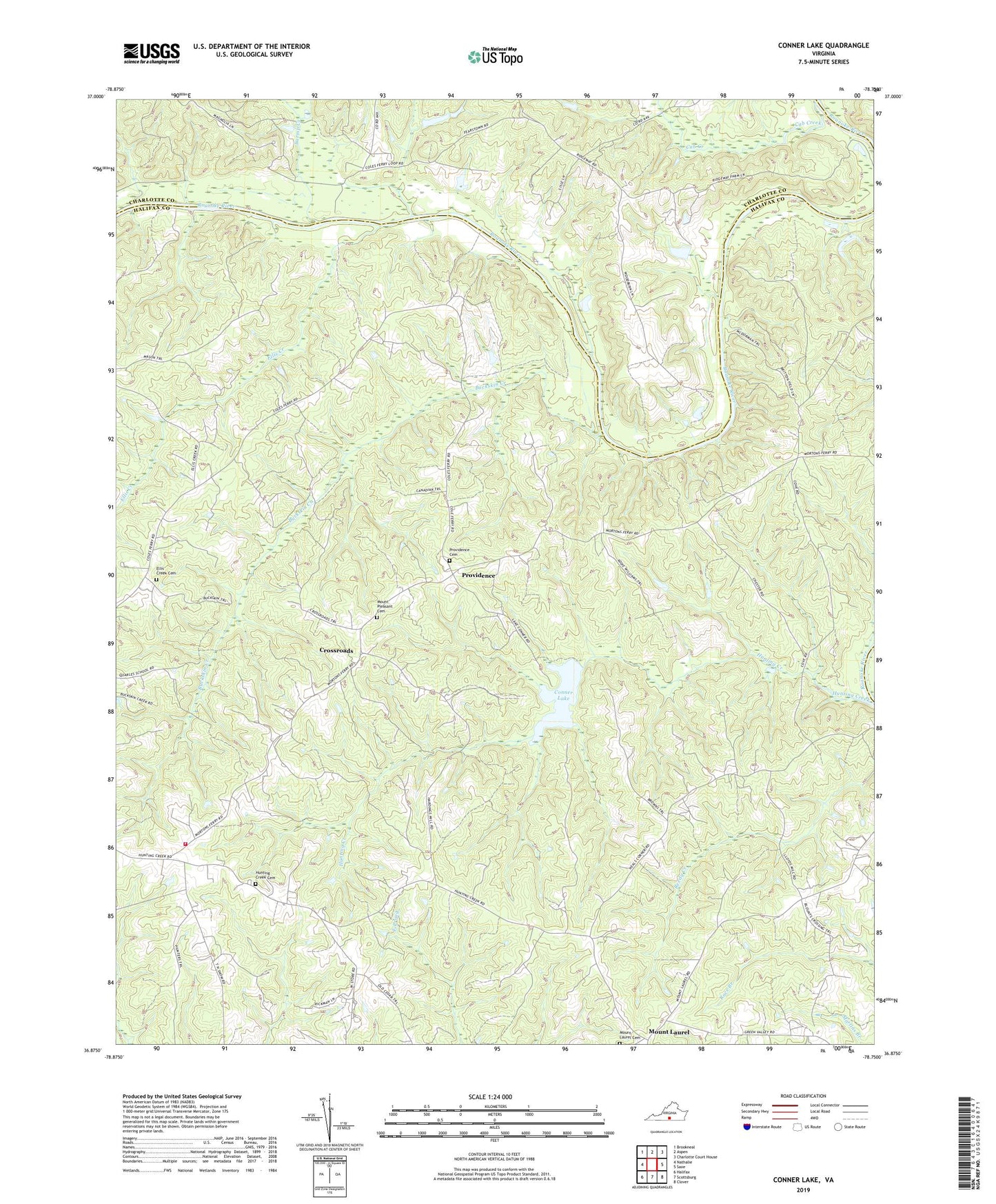
2022 topographic map quadrangle Conner Lake in the state of Virginia. Scale: 1:24000. Based on the newly updated USGS 7.5' US Topo map series, this map is in the following counties: Halifax, Charlotte. The map contains contour data, water features, and other items you are used to seeing on USGS maps, but also has updated roads and other features. This is the next generation of topographic maps. Printed on high-quality waterproof paper with UV fade-resistant inks.
Quads adjacent to this one:
West: Nathalie
Northwest: Brookneal
North: Aspen
Northeast: Charlotte Court House
East: Saxe
Southeast: Clover
South: Scottsburg
Southwest: Halifax
This map covers the same area as the classic USGS quad with code o36078h7.
Contains the following named places: Bethel Grove Church, Buckskin Creek, Carrington, Coles Ferry, Conner Lake, Conners Dam, Crossroads, Cub Creek, District 2, Ellis Creek, Ellis Creek Cemetery, Ellis Creek Church, Hunting Creek, Hunting Creek Cemetery, Hunting Creek Church, Mount Laurel, Mount Laurel Cemetery, Mount Laurel School, Mount Pleasant Cemetery, Mount Pleasant Church, Neals Corner, Old Providence Presbyterian Church, Pleasant Grove Church, Providence, Providence Cemetery, Ridgeway Church, Staunton River Church, Triangle Volunteer Fire Department, Turnip Creek, Watkins, Wests Store