MyTopo
Clover Virginia US Topo Map
Couldn't load pickup availability
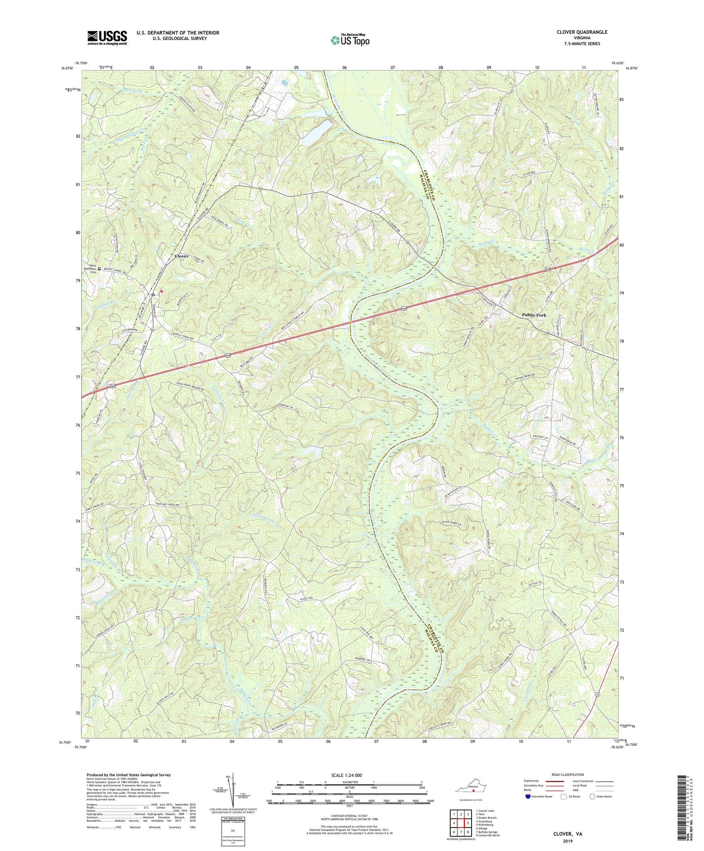
2022 topographic map quadrangle Clover in the state of Virginia. Scale: 1:24000. Based on the newly updated USGS 7.5' US Topo map series, this map is in the following counties: Halifax, Charlotte. The map contains contour data, water features, and other items you are used to seeing on USGS maps, but also has updated roads and other features. This is the next generation of topographic maps. Printed on high-quality waterproof paper with UV fade-resistant inks.
Quads adjacent to this one:
West: Scottsburg
Northwest: Conner Lake
North: Saxe
Northeast: Drakes Branch
East: Wylliesburg
Southeast: Clarksville North
South: Buffalo Springs
Southwest: Omega
This map covers the same area as the classic USGS quad with code o36078g6.
Contains the following named places: Ashcake Creek, Berles Creek, Blackcastle School, Blanks Ferry, Bruce Spring Branch, Buckhorn Creek, Buffalo Creek, Burlington Industries Dam, Clover, Clover Census Designated Place, Clover Creek, Clover Elementary School, Clover Landing, Clover Post Office, Clover Project Landing Zone Heliport, Clover Volunteer Fire Department, Dry Fork, Dunn Creek, Halifax County Academy, Hall Branch, Hazelnut Branch, Little Ashcake Creek, Martins Branch, Moseleys Ferry, Partridge Branch, Public Fork, Red Level Church, Rocky Branch Church, Saint Matthews Cemetery, Saint Matthews Church, Salem Church, Salem School, Sandy Creek, Staunton River School, Wilmoth Branch, Zion Grove Church, ZIP Code: 23964