MyTopo
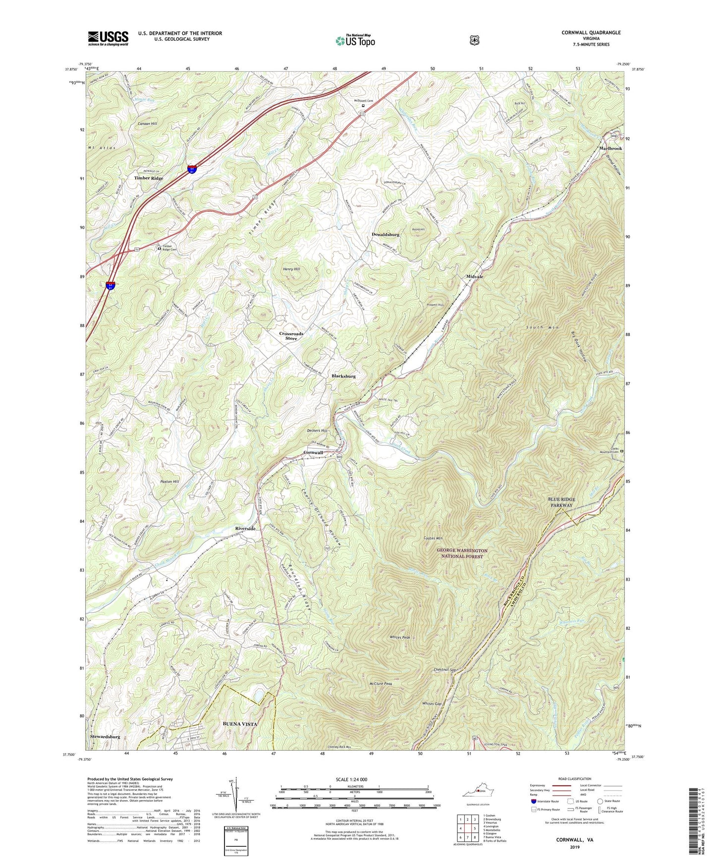
Cornwall Virginia US Topo Map
Couldn't load pickup availability
2019 topographic map quadrangle Cornwall in the state of Virginia. Scale: 1:24000. Based on the newly updated USGS 7.5' US Topo map series, this map is in the following counties: Rockbridge, Amherst, Buena Vista (city). The map contains contour data, water features, and other items you are used to seeing on USGS maps, but also has updated roads and other features. This is the next generation of topographic maps. Printed on high-quality waterproof paper with UV fade-resistant inks.
Quads adjacent to this one:
West: Lexington
Northwest: Goshen
North: Brownsburg
Northeast: Vesuvius
East: Montebello
Southeast: Forks of Buffalo
South: Buena Vista
Southwest: Glasgow
Contains the following named places: Big Dark Hollow, Blacksburg, Broad View School, Buck Hill, Canaan Hill, Cherry Orchard Hollow, Chestnut Sag, Chimney Rock Mountain, Clarks Church, Clarks Mountain Cemetery, Coates Mountain, Concord Church, Cornwall, Craig Creek, Crossroads Store, Cypress Falls, Deckers Hill, Dismal Hollow, Donaldsburg, Falling Run, Henry Hill, Irish Creek, Marl Creek, Marlbrook, Marlbrook Creek, McClure Peak, McCutchen Church, McCutcheons Chapel, McDowell Cemetery, Midvale, Mill Branch, Mount Atlas, Mountain View, Mountain View Church, Mountain View Elementary School, Mountain View School, Neriah Church, Nicholson Run, Paxton Hill, Prospect Hills, Rising Zion Church, Riverside, Riverside Church, Rock Branch, Round Hill, Roundtop Ridge, Sheep Creek, Shenandoah Valley Health Care Center, South Mountain, South River District, Spring Valley Church, Stewardsburg, Stony Run, Timber Ridge, Timber Ridge Cemetery, Timber Ridge Church, Whites Gap, Whites Gap Overlook, Whites Peak, Whites Run, Whitesides Run, WREL-FM (Buena Vista), ZIP Code: 24435