MyTopo
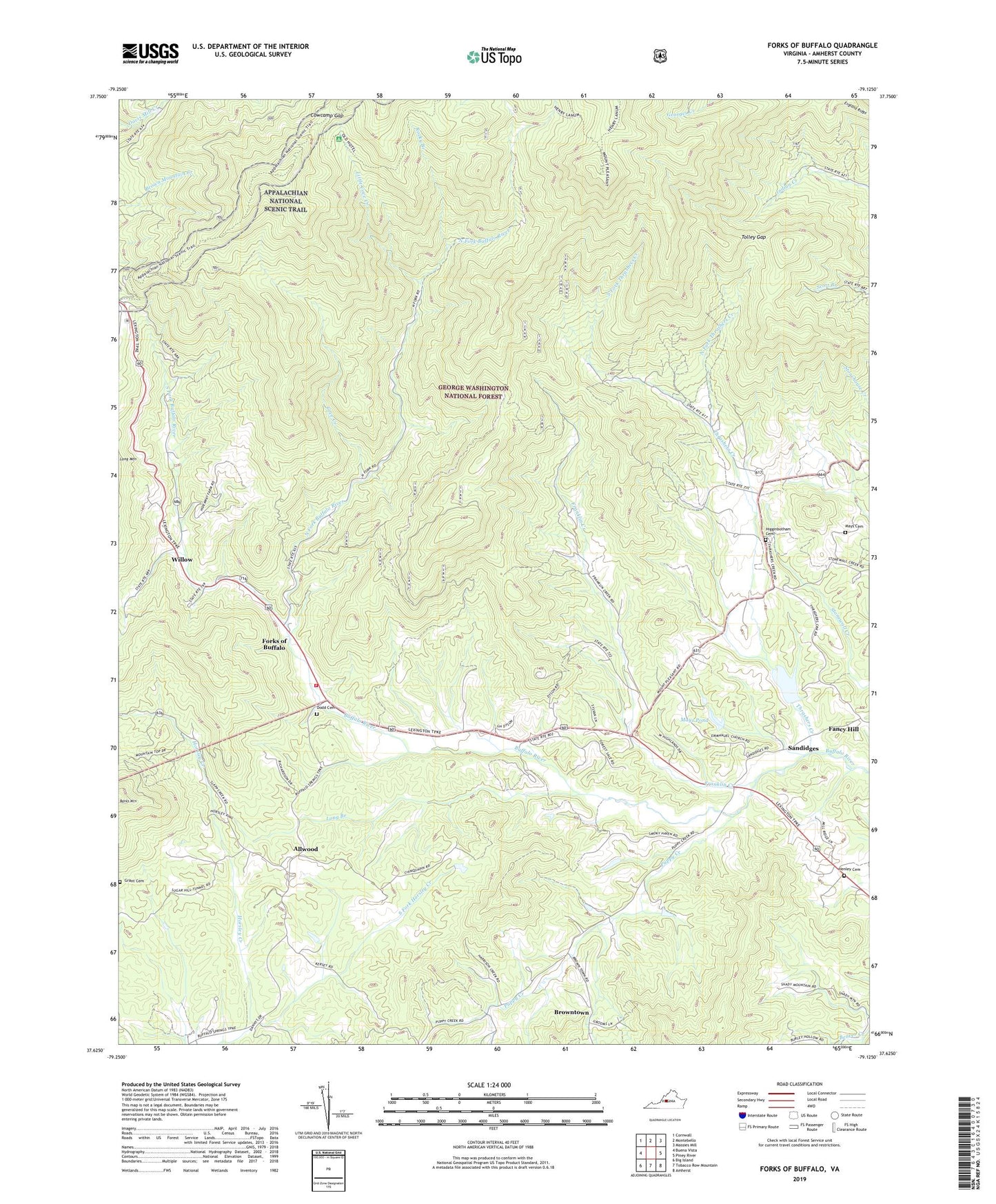
Forks of Buffalo Virginia US Topo Map
Couldn't load pickup availability
Also explore the Forks of Buffalo Forest Service Topo of this same quad for updated USFS data
2022 topographic map quadrangle Forks of Buffalo in the state of Virginia. Scale: 1:24000. Based on the newly updated USGS 7.5' US Topo map series, this map is in the following counties: Amherst. The map contains contour data, water features, and other items you are used to seeing on USGS maps, but also has updated roads and other features. This is the next generation of topographic maps. Printed on high-quality waterproof paper with UV fade-resistant inks.
Quads adjacent to this one:
West: Buena Vista
Northwest: Cornwall
North: Montebello
Northeast: Massies Mill
East: Piney River
Southeast: Amherst
South: Tobacco Row Mountain
Southwest: Big Island
This map covers the same area as the classic USGS quad with code o37079f2.
Contains the following named places: Allwood, Bald Knob, Banks Mountain, Browntown, Buck Mountain, Buffalo River Dam Number Two, Burks Mountain, Cardinal Ridge, Cedar Knob School, Chestnut Ridge, Cove Creek, Cowcamp Gap, District 2, Dodd Cemetery, Dodds Store, El Bethel Church, Emmanuel Baptist Church, Fancy Hill, Fletcher Mountain, Floyds Mountain, Fork Mountain, Forks of Buffalo, Franklin Creek, Glenn Mountain, Grant Cemetery, Henley Cemetery, Higginbotham Cemetery, Jennings Mountain, Little Cove Creek, Little Mount Pleasant, Little Rocky Mountain, Long Branch, Mays Cemetery, Mays Dam, Mays Pond, Midway Baptist Church, Mollys Mountain, Moss Rock School, Mount Horeb Church, Mount Pleasant, Mount Pleasant Church, North Fork Buffalo River, North Fork Thrashers Creek, Panther Mountain, Pedlar Volunteer Fire and Rescue, Pierce Mountain, Piney Grove Baptist Church, Piney Hill Baptist Church, Piney Mountain, Puppy Creek, Puppy Creek School, Rocky Branch, Sandidges, Scott Mountain, Shady Glenn Church, South Fork Buffalo River, South Fork Horsley Creek, South Fork Thrashers Creek, Stinnett Mountain, Sut Mountain, Thrasher Lake, Thrashers Creek, Tolley Gap, Tolley Gap Trail, Turkey Mountain, Willow