MyTopo
Brownsburg Virginia US Topo Map
Couldn't load pickup availability
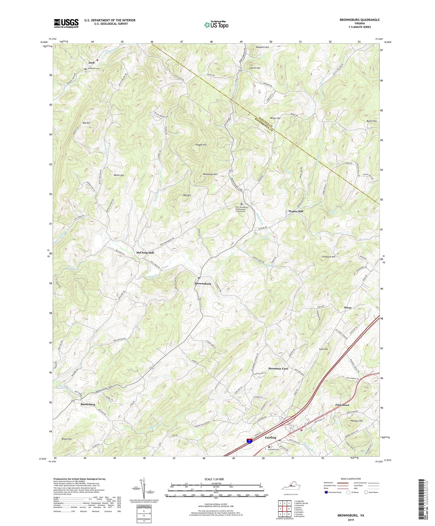
2022 topographic map quadrangle Brownsburg in the state of Virginia. Scale: 1:24000. Based on the newly updated USGS 7.5' US Topo map series, this map is in the following counties: Rockbridge, Augusta. The map contains contour data, water features, and other items you are used to seeing on USGS maps, but also has updated roads and other features. This is the next generation of topographic maps. Printed on high-quality waterproof paper with UV fade-resistant inks.
Quads adjacent to this one:
West: Goshen
Northwest: Craigsville
North: Augusta Springs
Northeast: Greenville
East: Vesuvius
Southeast: Montebello
South: Cornwall
Southwest: Lexington
This map covers the same area as the classic USGS quad with code o37079h3.
Contains the following named places: Big Hill, Brownsburg, Brownsburg Historic District, Brownsburg Post Office, Burnt Hill, Bustleburg, Cedar Creek, Davis, Decatur, Dixon Hill, Fairfield, Fairfield Cemetery, Fairfield Census Designated Place, Fairfield Elementary School, Fairfield Post Office, Fairfield Presbyterian Church, Fairfield Rescue Squad Rescue 7, Fairfield United Methodist Church, Fairfield Volunteer Rescue Squad, Gibbs Falls, Goose Creek, Hackett Hill, Immanuel Presbyterian Church, Immanuel Presbyterian Church Cemetery, Jonestown, Laurel Hill, Lawson Chapel, Lunsford Hill, Lusk Hill, McClung Mill, McElwee Chapel, McNutt, Miller Hill, Moffatts Creek, Mount Olive Church, Mountain View, Mulberry Grove, New Providence Church, New Providence Presbyterian Church Cemetery, Newport Hill, Oak Hill School, Otts Creek, Pisgah Branch, Pisgah Chapel, Pisgah Hill, Poor Creek, Rockbridge Middle School, Roundtop Hill, South River District Volunteer Fire and Rescue Company 7, Stony Run, Wades Mill, Walkers Creek Volunteer Fire Department, White Hill, Zack, ZIP Code: 24415