MyTopo
Diana Mills Virginia US Topo Map
Couldn't load pickup availability
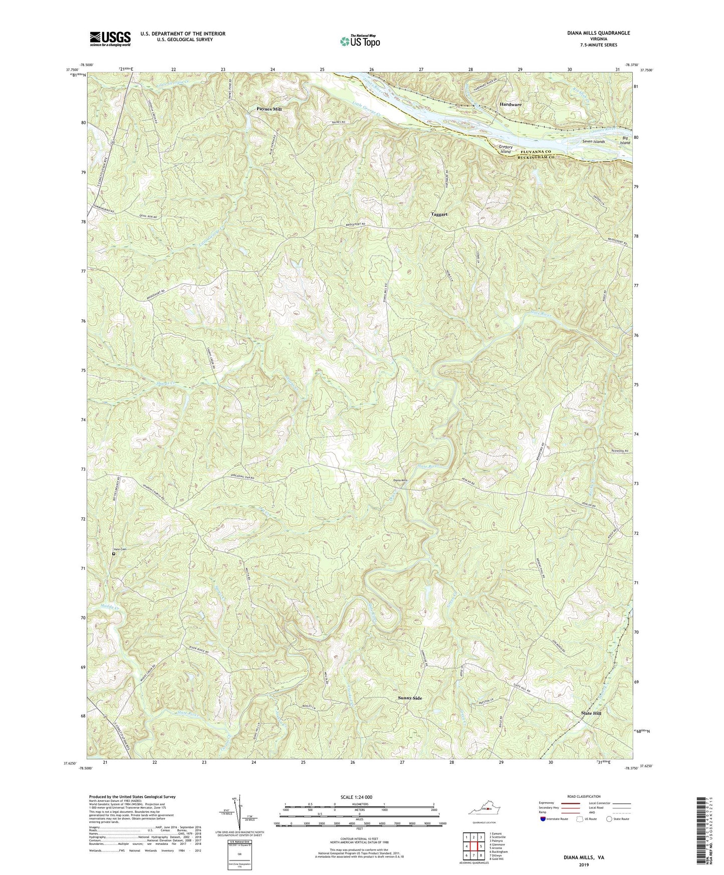
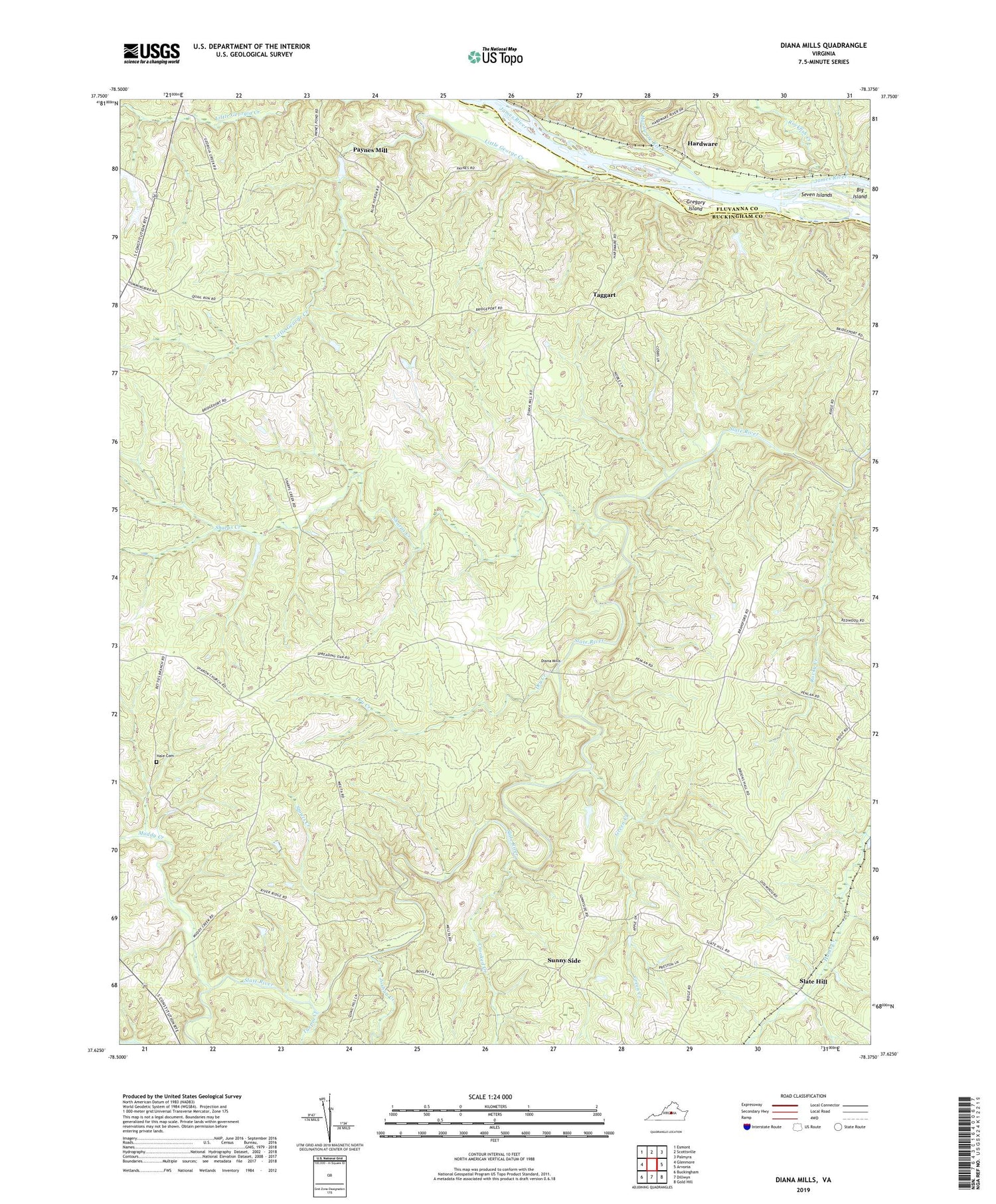
2019 topographic map quadrangle Diana Mills in the state of Virginia. Scale: 1:24000. Based on the newly updated USGS 7.5' US Topo map series, this map is in the following counties: Buckingham, Fluvanna. The map contains contour data, water features, and other items you are used to seeing on USGS maps, but also has updated roads and other features. This is the next generation of topographic maps. Printed on high-quality waterproof paper with UV fade-resistant inks.
Quads adjacent to this one:
West: Glenmore
Northwest: Esmont
North: Scottsville
Northeast: Palmyra
East: Arvonia
Southeast: Gold Hill
South: Dillwyn
Southwest: Buckingham
Contains the following named places: Crooked Creek, Diana Mills, Diana Mills Post Office, Diana Mills School, District 6, District 6 Slate River, Dry Creek, Green Creek, Gregory Island, Hale Cemetery, Hardware, Hardware River, Holman School, Joshua Creek, Little George Creek, Martin Dam, Mount Tabor Church, Mount Tabor School, Muddy Creek, Paynes Mill, Randolph School, Ridgeway Church, Rockfish Creek, Rocky Creek, Seven Islands, Sharon Church, Sharps Creek, Slate Hill, Spreading Oak Church, Stouts Creek, Sunny Side, Taggart, Turpin Creek, Union Branch Church, Union Branch School, Well Water, ZIP Code: 23004