MyTopo
Glenmore Virginia US Topo Map
Couldn't load pickup availability
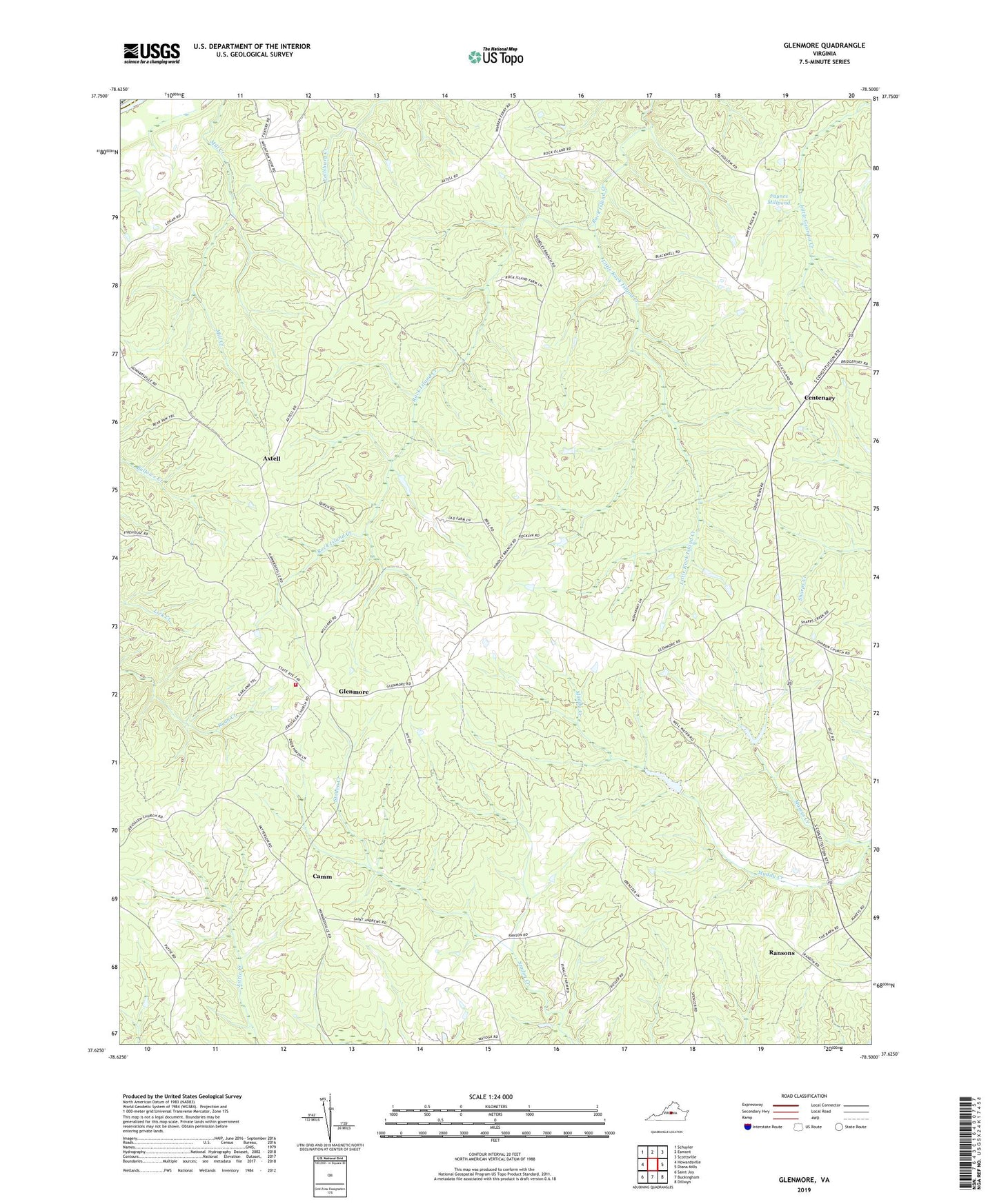
2022 topographic map quadrangle Glenmore in the state of Virginia. Scale: 1:24000. Based on the newly updated USGS 7.5' US Topo map series, this map is in the following counties: Buckingham, Albemarle. The map contains contour data, water features, and other items you are used to seeing on USGS maps, but also has updated roads and other features. This is the next generation of topographic maps. Printed on high-quality waterproof paper with UV fade-resistant inks.
Quads adjacent to this one:
West: Howardsville
Northwest: Schuyler
North: Esmont
Northeast: Scottsville
East: Diana Mills
Southeast: Dillwyn
South: Buckingham
Southwest: Saint Joy
This map covers the same area as the classic USGS quad with code o37078f5.
Contains the following named places: Alexandria Church, Axtell, Brill Dam, Buckingham County Volunteer Rescue Squad Station 18, Camm, Centenary, Ebenezer Church, Emmanuel Church, Fitzgerald Dam, Glenmore, Glenmore Post Office, Glenmore Volunteer Fire Department, Goshen Church, Little Rock Island Creek, Maxeys Creek, Muddy Creek Number One Dam, Muddy Creek Number Two Dam, Paynes Millpond, Ransons, Ridgeway School, Saint Andrews Church, Salem Church, Smith Store