MyTopo
Scottsville Virginia US Topo Map
Couldn't load pickup availability
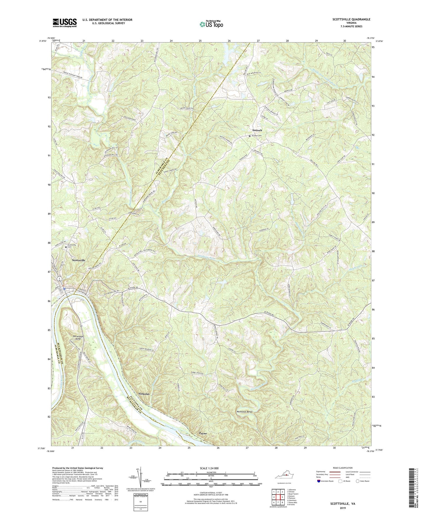
2022 topographic map quadrangle Scottsville in the state of Virginia. Scale: 1:24000. Based on the newly updated USGS 7.5' US Topo map series, this map is in the following counties: Fluvanna, Albemarle, Buckingham. The map contains contour data, water features, and other items you are used to seeing on USGS maps, but also has updated roads and other features. This is the next generation of topographic maps. Printed on high-quality waterproof paper with UV fade-resistant inks.
Quads adjacent to this one:
West: Esmont
Northwest: Alberene
North: Simeon
Northeast: Boyd Tavern
East: Palmyra
Southeast: Arvonia
South: Diana Mills
Southwest: Glenmore
This map covers the same area as the classic USGS quad with code o37078g4.
Contains the following named places: Adams Creek, Anderson Airport, Antioch, Antioch Baptist Church, Antioch Cemetery, Berea Chapel, Briery Creek, Cliffside, Cunningham District, Dry Creek, Fox Memorial Church, Hardware River State Wildlife Management Are, Horseshoe Bend, Jefferson Mill, Johnson Store, Little Georgia Creek, Mink Creek, Mink Creek Dam, Muleshoe Bend, Nicholas, Payne, Saint Johns Episcopal Church, Scottsville, Scottsville Baptist Church, Scottsville Cemetery, Scottsville Historic District, Scottsville Library, Scottsville Methodist Church, Scottsville Museum, Scottsville Police Department, Scottsville Presbyterian Church, Scottsville Town Hall, Shepherd Creek, Shores School, Stony Point, T Potts Dam Number One, T Potts Dam Number Three, T Potts Dam Number Two, Thomas Dam, Totier Creek, Town of Scottsville, Turkey Run, Union Church, Wesley Chapel, Woodside School, Woodson Creek, ZIP Code: 24590