MyTopo
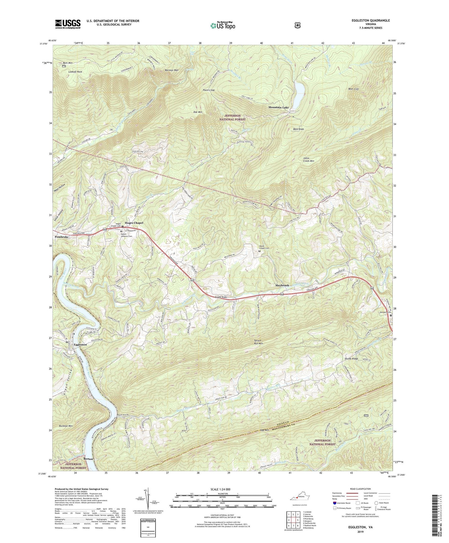
Eggleston Virginia US Topo Map
Couldn't load pickup availability
Also explore the Eggleston Forest Service Topo of this same quad for updated USFS data
2022 topographic map quadrangle Eggleston in the state of Virginia. Scale: 1:24000. Based on the newly updated USGS 7.5' US Topo map series, this map is in the following counties: Giles, Montgomery. The map contains contour data, water features, and other items you are used to seeing on USGS maps, but also has updated roads and other features. This is the next generation of topographic maps. Printed on high-quality waterproof paper with UV fade-resistant inks.
Quads adjacent to this one:
West: Pearisburg
Northwest: Lindside
North: Interior
Northeast: Waiteville
East: Newport
Southeast: Blacksburg
South: Radford North
Southwest: Staffordsville
This map covers the same area as the classic USGS quad with code o37080c5.
Contains the following named places: Bald Knob, Barneys Wall, Bear Cliff, Bear Spring Branch, Berton, Boyd Chapel, Boyds Chapel Cemetery, Butt Mountain, Butt Mountain Lookout, Cascades, Cascades Picnic Area, Chestnut Grove School, Clearbrook Fire and Rescue, Conservancy Trail, Creek Sinks, District F-01, Divide Ridge, Doe Mountain, Eastern District, Eastern Elementary - Middle School, Eggleston, Eggleston Census Designated Place, Eggleston Post Office, Gap Mountain, Goodwins Ferry, Green Valley, Hoges Chapel, Hoges Chapel Cemetery, Laurel Creek, Lookoff Rock, Lucas Memorial Church, Maybrook, Mount Lebanon Cemetery, Mount Lebanon Church, Mountain Lake, Mountain Lake Biological Station, Mountain Lake Post Office, Newport Cemetery, Norris Run School, Oakview Church, Pacers Gap, Rocky Sink School, Salt Pond Mountain, Sherry Memorial Christian Church, Sinking Creek, Spruce Run, Spruce Run Church, Spruce Run Mountain, Spruce Run School, Staytide, Upper Falls, WYDD-TV (Blacksburg), Zion Church, ZIP Code: 24136