MyTopo
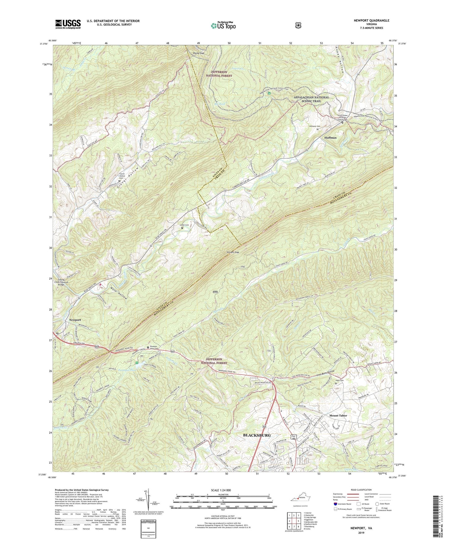
Newport Virginia US Topo Map
Couldn't load pickup availability
Also explore the Newport Forest Service Topo of this same quad for updated USFS data
2022 topographic map quadrangle Newport in the state of Virginia. Scale: 1:24000. Based on the newly updated USGS 7.5' US Topo map series, this map is in the following counties: Montgomery, Giles, Craig. The map contains contour data, water features, and other items you are used to seeing on USGS maps, but also has updated roads and other features. This is the next generation of topographic maps. Printed on high-quality waterproof paper with UV fade-resistant inks.
Quads adjacent to this one:
West: Eggleston
Northwest: Interior
North: Waiteville
Northeast: Craig Springs
East: McDonalds Mill
Southeast: Ironto
South: Blacksburg
Southwest: Radford North
This map covers the same area as the classic USGS quad with code o37080c4.
Contains the following named places: Alleghany Heights, Big Pond, Big Pond Shelter, Big Ridge, Blacksburg New School, Blacksburg Ranger Station, Brush Mountain Horse Trail, Clover Hollow, Clover Hollow Cemetery, Clover Hollow Church, Clover Hollow Mountain, Coal Bank Hollow, Countryside Estates, District G-01, Greenbrier Branch, Hale Cemetery, Happy Hollow, Huffman, Johns Creek Mountain, Julian Knob, Keister Hill, Kelly Knob, Laurel Creek, Laurel Ridge, Leffel Cemetery, Level Green Christian Church Cemetery, Level Green Church, Lugar Hill, Meadow Brook, Meadow Run, Mount Olivet Church, Mount Olivet Lutheran Church, Mount Tabor, Mount Tabor School, Mount Tabor Village, Mountain Mission, Mountain View, Mountain View Church, Newport, Newport Elementary School, Newport Post Office, Newport Recreation Area, Newport Volunteer Fire Department, Newport Volunteer Rescue Squad, Northside Park, Pandapas Pond, Piney Ridge, Pleasant View Cemetery, Poverty Creek Horse Trail, Preston Forest, Rocky Gap, Sartain Branch, Sinking Creek Covered Bridge, Slussers Chapel, Stevers Gap, Toms Creek Park, Wash Hollow, Williams Cemetery, Wolf Knob, Woodbine, ZIP Codes: 24060, 24128