MyTopo
Elliston Virginia US Topo Map
Couldn't load pickup availability
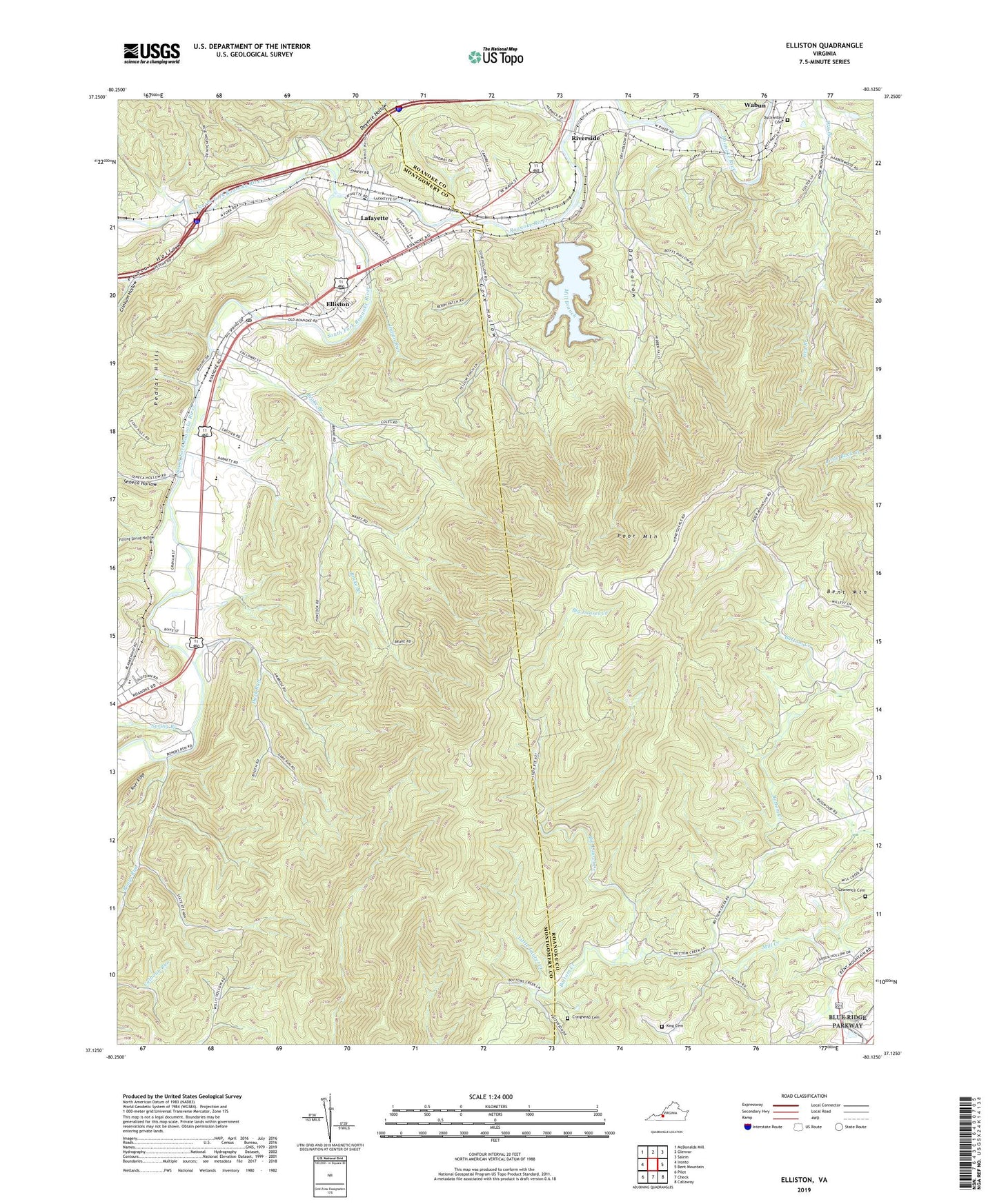
2022 topographic map quadrangle Elliston in the state of Virginia. Scale: 1:24000. Based on the newly updated USGS 7.5' US Topo map series, this map is in the following counties: Montgomery, Roanoke, Franklin. The map contains contour data, water features, and other items you are used to seeing on USGS maps, but also has updated roads and other features. This is the next generation of topographic maps. Printed on high-quality waterproof paper with UV fade-resistant inks.
Quads adjacent to this one:
West: Ironto
Northwest: McDonalds Mill
North: Glenvar
Northeast: Salem
East: Bent Mountain
Southeast: Callaway
South: Check
Southwest: Pilot
This map covers the same area as the classic USGS quad with code o37080b2.
Contains the following named places: Adney Gap, Big Laurel Creek, Big Spring Baptist Church, Bonys Run, Bonys Run Church, Bottom Creek Church, Brake Branch, Clifford D. Craig Memorial Dam, Clinkum Hollow, Cove Hollow, Craighead Cemetery, Dark Run, Deyerle Hollow, Dry Hollow, Duckwiler Cemetery, Eastern Montgomery High School, Elliston, Elliston Census Designated Place, Elliston Lafayette Elementary School, Elliston Post Office, Elliston Volunteer Fire Department, Elliston-Lafayette Census Designated Place, Falling Spring Hollow, Galilee Church, Goodwins Church, Holiness Church, Indian Run, King Cemetery, Lafayette, Lafayette Census Designated Place, Lafayette Historic District, Lawrence Cemetery, Little Hope Church, Little Laurel Creek, Madison Farm Historic District, Mill Branch, Mill Creek, North Fork Roanoke River, Pedlar Hollow, Poor Mountain, Riverside, Sawmill Hollow, Seneca Hollow, Shawsville Elementary School, Shawsville Middle School, Smith Mountain Lake Marine Fire Department, South Fork Roanoke River, Spring Branch, Spring Hollow Reservoir, Wabun, Wabun Bible Chapel, WBRA-TV (Roanoke), WDBJ-TV (Roanoke), WEFC-TV (Roanoke), WPVR-FM (Roanoke), WSLQ-FM (Roanoke), WSLS-TV (Roanoke), WVFT-TV (Roanoke), WVTF-FM (Roanoke), WXLK-FM (Roanoke), ZIP Codes: 24059, 24162


