MyTopo
Ironto Virginia US Topo Map
Couldn't load pickup availability
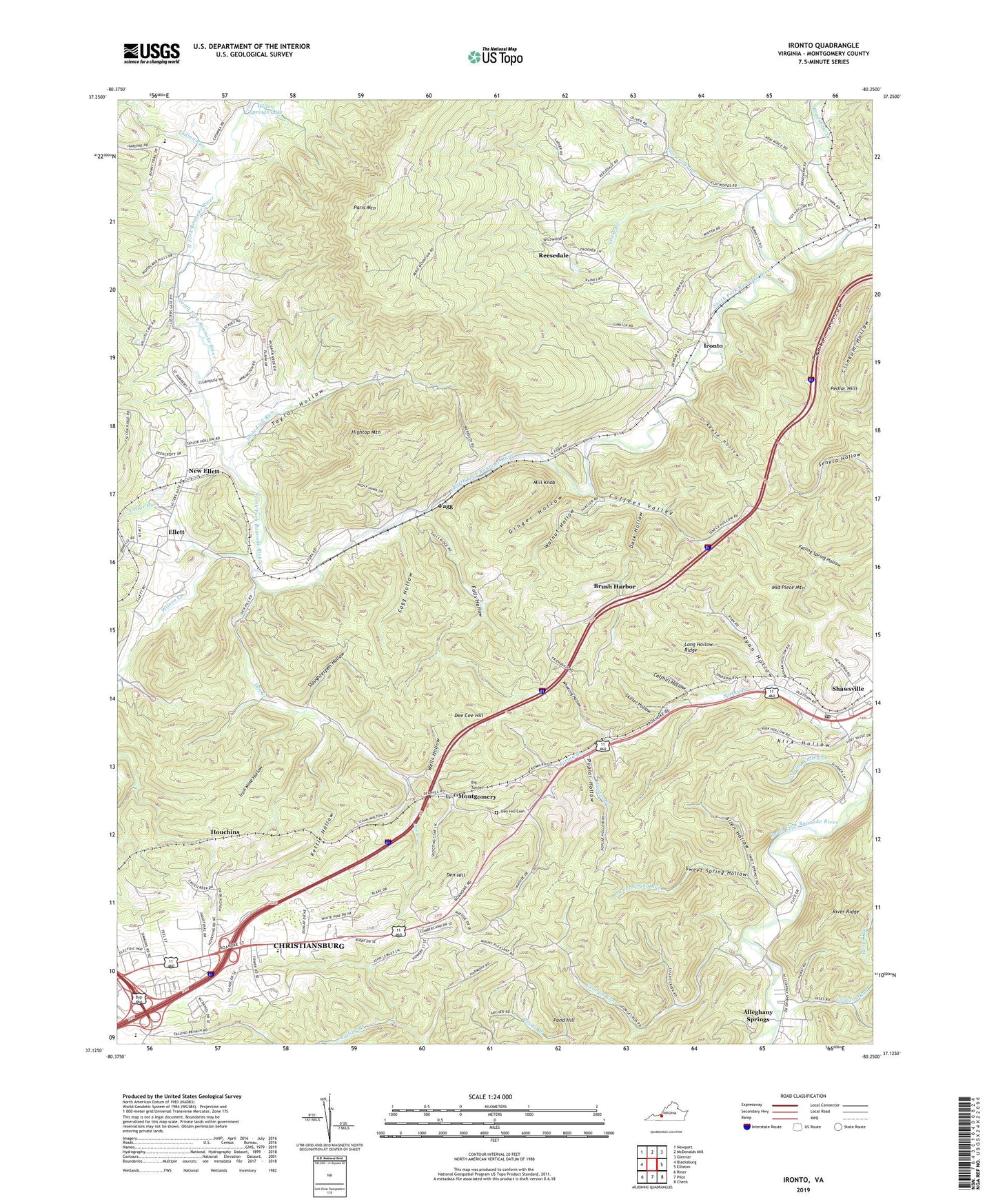
2022 topographic map quadrangle Ironto in the state of Virginia. Scale: 1:24000. Based on the newly updated USGS 7.5' US Topo map series, this map is in the following counties: Montgomery. The map contains contour data, water features, and other items you are used to seeing on USGS maps, but also has updated roads and other features. This is the next generation of topographic maps. Printed on high-quality waterproof paper with UV fade-resistant inks.
Quads adjacent to this one:
West: Blacksburg
Northwest: Newport
North: McDonalds Mill
Northeast: Glenvar
East: Elliston
Southeast: Check
South: Pilot
Southwest: Riner
This map covers the same area as the classic USGS quad with code o37080b3.
Contains the following named places: Alleghany Church, Alleghany School, Alleghany Springs, Allen Hollow, Big Tunnel, Blake Forest, Blakenship Farm, Bradshaw Creek, Brush Harbor, Calfhill Hollow, Calhoun Run, Cedar Run, Church Campgrounds, Coffees Valley, Community Christian Academy, Country Club Estates, Craig Branch, Cumberland Forest, Dark Hollow, Dee Cee Hill, Den Creek, Den Hill, Den Hill Cemetery, District C-01, East Ridge, Ellett, Elliott Creek, Fagg, Fagg Hollow, Falling Branch, Falling Branch Elementary School, Falling Waters Church, Falls Hollow, Flatwoods, Flatwoods Branch, Friendship School, Garber Chapel, Gateway Christian Academy, Georges Run, Ginger Hollow, Halls Church, Hightop Mountain, Houchins, Indian Run, Iron Mine Hollow, Ironto, Kettle Hollow, Kirk Hollow, Lavery's Sod Farm, Long Hollow Ridge, Lusters Gate, Middle Piece Mountain, Midway Church, Mill Knob, Montgomery, Montgomery White Sulphur Springs, Mount Calvary Church, Mount Pleasant Church, Mount Pleasant School, Mountain Top Estates, New Ellett, Paris Mountain, Pedlar Hills, Pond Hill, Poplar Branch, Poplar Hollow, Reese Hollow, Reesedale, Reesedale Church, Reesedale School, River Ridge, Riverside Church, Ryan Hollow, Shawsville, Shawsville Census Designated Place, Shawsville Historic District, Shawsville Post Office, Shawsville Volunteer Rescue Squad, Skillet Hollow, Slate Lick Run, Slaughterpen Hollow, Spring Valley Branch, Sweet Spring Hollow, Sweet Spring Run, Taylor Hollow, Trinity United Methodist Church, Walnut Hollow, Wanless Church, Wells Hollow, WFNR-AM (Blacksburg), WFNR-FM (Christiansburg), Wheeling Hollow, White Pine, Willow Springs Lake, Wilson Creek, ZIP Code: 24087