MyTopo
Forksville Virginia US Topo Map
Couldn't load pickup availability
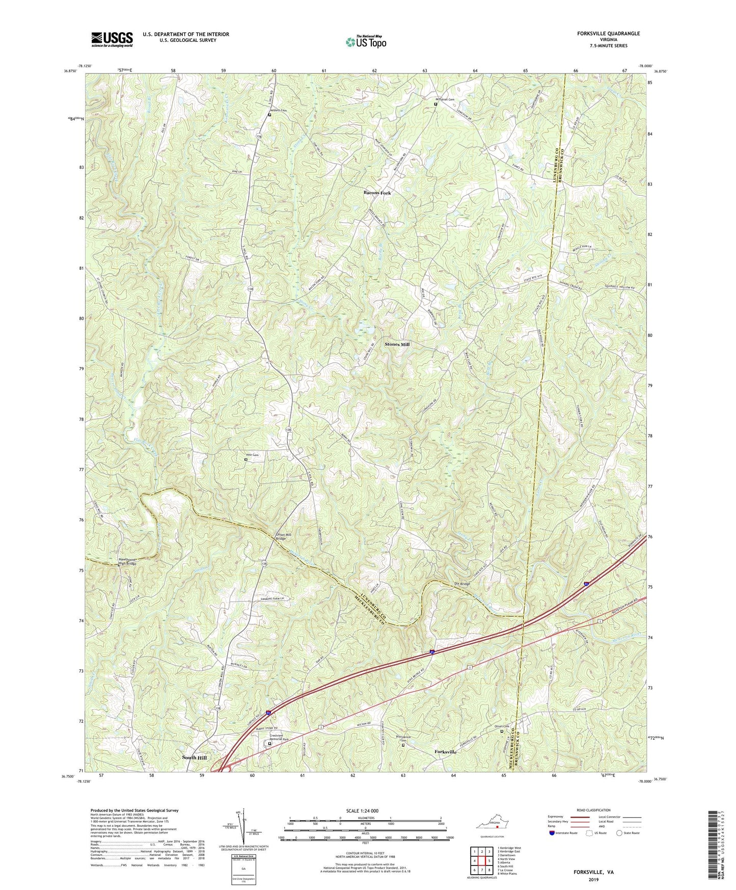
2019 topographic map quadrangle Forksville in the state of Virginia. Scale: 1:24000. Based on the newly updated USGS 7.5' US Topo map series, this map is in the following counties: Lunenburg, Mecklenburg, Brunswick. The map contains contour data, water features, and other items you are used to seeing on USGS maps, but also has updated roads and other features. This is the next generation of topographic maps. Printed on high-quality waterproof paper with UV fade-resistant inks.
Quads adjacent to this one:
West: North View
Northwest: Kenbridge West
North: Kenbridge East
Northeast: Danieltown
East: Alberta
Southeast: White Plains
South: La Crosse
Southwest: South Hill
Contains the following named places: Aaron Creek, Antioch Church, Bacons Fork, Beaver Creek District, Beaver Pond Creek, Bold Branch, Booker School, Broad Branch, Burnt Store, Crestview Memorial Park, Dix Bridge, Flat Rock Creek, Forksville, Friendship Church, Gills Corner, Hawthorne High Bridge, Hite Cemetery, Kettlesticks Creek, Lochleven, Lochleven Post Office, Lochleven School, Long Branch, McDaniel Cemetery, Neblett Cemetery, Oliver Church, Olivet Cemetery, Providence Cemetery, Providence Church, Reedy Branch, Smith Creek, Stones Mill, Stony Creek, Taylors Chapel, Union Church, Union Mill, Union Mill Bridge, Williams Church, Zion Union Church